UDOT PLANNED AVALANCHE CLOSURES!!

Forecast for the Provo Area Mountains

Mark Staples
Issued by Mark Staples on
Wednesday morning, January 23, 2019
Today wind drifting is the main issue. With increasing winds today plus more snow this afternoon, the avalanche danger is CONSIDERABLE at mid and upper elevations. Low elevations have a MODERATE danger. Avoid wind loaded slopes and you'll avoid most avalanches. With such a huge load of snow over the last week, the possibility remains for slides to break deeper in the snowpack. These avalanches are not likely and would be hard to trigger, but this possibility means it's worth giving the snowpack more time to stabilize.
Low
Moderate
Considerable
High
Extreme
Learn how to read the forecast here
Special Announcements
Are you new to the backcountry or looking to refresh your skills? The UAC has released a free 5-part avalanche skills eLearning series.
Weather and Snow
Temperatures this morning are hovering near 10 degrees F.
Winds at ridgetops this morning increased some and are averaging 15 mph gusting 25-35 from the WNW.
Today will have stronger winds and snowfall. Both should start around 11 a.m. but the strongest winds and heaviest snowfall should occur later in the afternoon. Winds at upper elevations will be gusting 40-60 mph from the W and NW. The Provo area mountains should receive 4-6 inches of snow by tomorrow morning.
It's been snowing a lot lately. While different areas have been favored at different times, most places in the last 7 days have received snowfall containing 4-5 inches of water.
Recent Avalanches
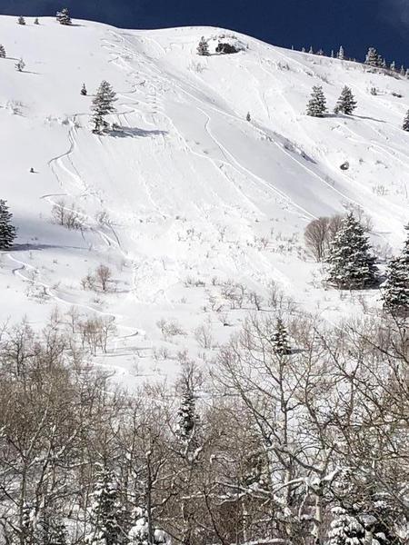
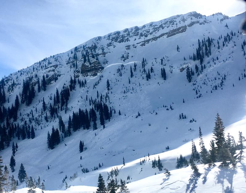
Following Monday's storm, there was a widespread natural avalanche cycle. Most avalanches broke within the new snow but some broke over wide areas. Yesterday a few slides occurred just within the new snow (ob1 and ob2). These were shallow sluffs running on a hard crust. Photo: T Halls.
One notable exception was a large avalanche that happened Monday night naturally at Snowbird on a wind loaded slope. Triggering one of these in the backcountry is unlikely but as one professional put it "I wouldn't trust anything big for a few days." Patience is always a good thing.
Ad
Avalanche Problem #1
Wind Drifted Snow
Type
Location
Likelihood
Size
Description
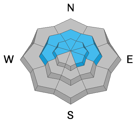
The number one issue today is wind-drifted snow. Wind loaded slopes will have both old and newly formed wind slabs. As winds increase today, the loading will keep these wind slabs sensitive. I think any avalanches breaking deeper in the snowpack are mostly likely to occur on these same slopes.
Winds today will be blowing from the W and NW, but I have indicated that this problem exists on all aspects at mid and upper elevations. Winds can blow and swirl in the mountains and the best way to identify wind loading is with your eyes, not with a compass or the above aspect/elevation diagram (aka the rose). Look for and avoid wind loaded slopes. I think you'll see the winds moving snow today. Otherwise, fresh wind deposits often look smooth and rounded.
Avalanche Problem #2
Persistent Weak Layer
Type
Location
Likelihood
Size
Description
There's good news and bad news. The good news is that any persistent weak layers of facets in the snowpack have gotten buried deep in the snowpack with recent storms. This means they are healing and we are building a strong snowpack. In many places the snowpack is already quite strong overall and no persistent weak layers exist. The bad news is that any existing layers have a lot of weight on them, thus a lot of stress.
What to do? First of all, be a little patient with the snowpack. Give it time to adjust to recent loading. This means things could be lining up for great conditions this weekend. Second, be a detective and look for areas with relatively thinner snow. This means its shallower than about a ski pole. These areas may be at lower elevations or rocky places at higher elevations. Try to avoid these locations and ride areas where you think the snow is the deepest.
General Announcements
This information does not apply to developed ski areas or highways where avalanche control is normally done. This forecast is from the U.S.D.A. Forest Service, which is solely responsible for its content. This forecast describes general avalanche conditions and local variations always occur.