Forecast for the Ogden Area Mountains

Nikki Champion
Issued by Nikki Champion on
Saturday morning, February 28, 2026

The avalanche danger is MODERATE on upper-elevation and mid-elevation slopes facing west through north to east. Avalanches may be large and destructive, breaking on a buried persistent weak layer 1 to 3+ feet deep and potentially hundreds of feet wide. These avalanches can be triggered remotely or from below.

As temperatures rise, wet snow avalanches may become possible, increasing danger to MODERATE on the remaining lower-elevation and sun-exposed slopes throughout the day. Avoid steep slopes during the warmest part of the day and watch for changing conditions.

Evaluate snow and terrain carefully.

Low
Moderate
Considerable
High
Extreme
Learn how to read the forecast here
Special Announcements

We are deeply saddened to report that one of the skiers involved in the Butler Basin accident on Saturday, February 21, has died from injuries sustained in the avalanche. Our deepest condolences go out to the victim’s family, friends, and everyone impacted by this tragic accident.

A new blog is posted Riding the Ski Lift With My Daughter. This piece was written to us by longtime friend and backcountry skier John Climaco.

Weather and Snow

This morning, skies are mostly clear, and overnight temperatures dropped below 30 °F at only a few weather stations. Winds continued to blow from the W at 10 to 15 mph, with gusts in the 20 to 30 mph range along the mid elevation ridges, and 15 to 25 mph with gusts into the 40s along the highest ridges.

Today, we’ll see partly sunny skies in the morning, followed by a chance of snow showers in the afternoon. Temperatures will rise into the mid 40s °F. Moderate to strong winds will continue from the W, especially at upper elevations, with sustained speeds of 15 to 25 mph and gusts into the 30 to 40 mph range through most of the day.

Outlook, a weak storm system will move in early Monday morning. Winds will start out of the southwest, then shift to the north or northwest by later Monday. Snow levels will begin pretty high, around 9000 feet, but will slowly drop to about 6500 feet by Tuesday as colder air moves in. This does not look like a super strong storm, but there is a bit of moisture with it. Could see up to 10 inches of new snow.

Recent Avalanches

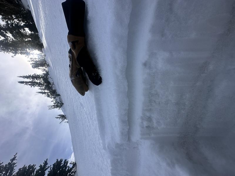
There were no reported avalanches from the Ogden backcountry yesterday, but on Wednesday, ski area avalanche teams reported large wet slab avalanches failing on PWL and gouging down near the ground.

Though the number of avalanches reported has slowed down, we can't forget that four people have been killed in separate avalanche accidents in the past ten days.

  • Wednesday 2/18 Ant Knolls, Wasatch Back Fatality — Snowmobiler. Final report HERE.
  • Thursday 2/19 Rock Garden, BCC (Brighton Backcountry) Fatality — 11-year-old skier. Preliminary report HERE.
  • Saturday 2/21 Butler Basin, BCC - Fatality — Backcountry skier. Preliminary report HERE.
  • Sunday 2/22 Caribou Basin, Wasatch Back Fatality — Snowbiker. Preliminary report HERE.

All of these accidents involved slab avalanches 2 to 3 feet thick and up to 500 feet wide, failing on weak faceted snow, our January Dry Layer (JDL). There’s another important point: in nearly all of these incidents, as well as many other close calls, the individual or party triggered the avalanche from below while in gentle terrain.

Avalanche Problem #1
Persistent Weak Layer
Type
Location
Likelihood
Size
Description

The DJL (Dry January Layer) is now buried 1 to 3 feet beneath the surface and has been responsible for four avalanche fatalities, several accidents, and more than 60 reported avalanches.

Over the past few days, fewer obvious signs of instability have appeared during backcountry travel and in snowpits, suggesting the snowpack is gradually gaining strength. In many areas, the Ogden mountains received rain all the way to the summits, creating many crust interfaces, and the facets appear to have absorbed most of the stress during both loading events, likely requiring another large load to see activity increase again. That said, we are only a few days past the last significant loading event, and uncertainty remains, especially given the poor snowpack structure and spatial variability across the range.

The most suspect areas are higher-elevation, thinner snowpack zones where the facets do not seem as wet and as many complex crust interfaces do not exist. Continue to pay attention, evaluate snow and terrain carefully, and travel conservatively in the backcountry.

Semi-supportable crust at the surface - N aspect - near 9000' from my field day yesterday near Snowbasin

Avalanche Problem #2
Wet Snow
Type
Location
Likelihood
Size
Description

Previous rain on snow and warm temperatures have created a saturated, unsupportable snowpack at mid and low elevations.

As daytime temperatures rise and the surface crust softens, wet snow avalanches may be triggered. Low- and mid-elevation north-facing aspects where persistent weak layers exist are the most concerning and should be avoided during the warmest part of the day.

Avalanche Problem #3
Wind Drifted Snow
Type
Location
Likelihood
Size
Description

Strong west winds, combined with dense snow from Wednesday, are creating thick, stiff slabs and large cornices along upper-elevation ridges. These slabs may be difficult to trigger, but could break above you. Look for signs of wind-drifted snow like round, pillow-shaped drifts.

General Announcements

This information does not apply to developed ski areas or highways where avalanche control is normally done. This forecast is from the U.S.D.A. Forest Service, which is solely responsible for its content. This forecast describes general avalanche conditions and local variations always occur.