There has been a lot of spatial variability across the Ogden zone, from the northern end of the range down to the Snowbasin and Ben Lomond region. Today we wanted to see how the rain and warm temperatures impacted the known weak snowpack structure, especially after the large loading event that rolled straight into this rain event.
We dug on a north facing aspect near 9000 feet off Allen Peak and found a total snow depth of 150 cm. Graupel was sitting on top of a supportable crust, roughly pencil hardness. In some places it was supportable to skis, while in others it was a bit thinner and easier to punch through.
Below that initial crust were a mix of crusts, graupel, decomposing fragments, clustered rounds, and broken precipitation particles, all resting on a thin melt freeze crust above the facets. Most of the layers above the facets were wet to moist, and the facets themselves were moist.
We saw propagation on the 17th tap down on a stout graupel layer, about 4 to 5 mm in size, at 110 cm. Overall, it feels like the snowpack absorbed a lot of shock during the loading event and then again during the rain event, and now seems somewhat stagnant. It would likely take a large load to punch through the crusts, step into the graupel layer, and then down into the facets.
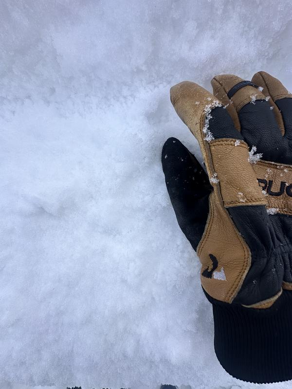
The semi-supportable crust at the surface - N aspect
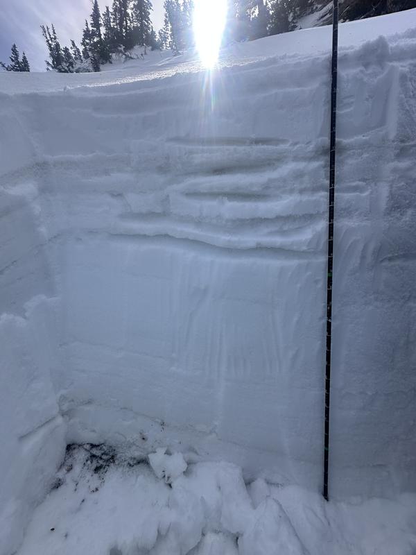
The many crust layers within the pit wall
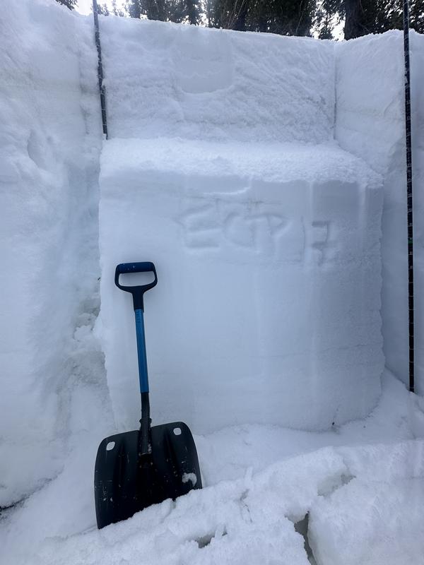
ECTP17 down on the large graupel above the facets
4-5mm graupel