UDOT PLANNED AVALANCHE CLOSURES!!

Forecast for the Ogden Area Mountains

Evelyn Lees
Issued by Evelyn Lees for
Thursday, November 22, 2018
The avalanche danger in the Ogden area mountains is LOW today, with the new snow mostly landing bare ground. However, with another one to two feet of snow in the forecast, the avalanche danger will increase the next few days. We we will do regular early morning updates through the weekend.
Low
Moderate
Considerable
High
Extreme
Learn how to read the forecast here
Special Announcements
Check out our BLOG with more info on our new web site and avalanche problems.
Ski resorts all have different uphill travel policies, so be sure to check the uphill policy of any ski resort before you plan on visiting. With no avalanche mitigation in place, closed ski areas are no different than the backcountry. If you are heading to a different region, make sure you check the local forecast - the avalanche danger is higher in the Provo and Salt Lake area mountains.
Weather and Snow
Skies are cloudy and there’ve been a few snow flurries early this morning. Temperatures are in the mid 30s to low 40s. The first serious wave of snowfall should start around noon, with 3 to 7” possible by evening. The southerly winds will be a significant player today – averaging 10 to 20 mph, with gusts in the 30s. Across the higher ridgelines, speeds will average closer to 35 mph, with gusts in the 50s.
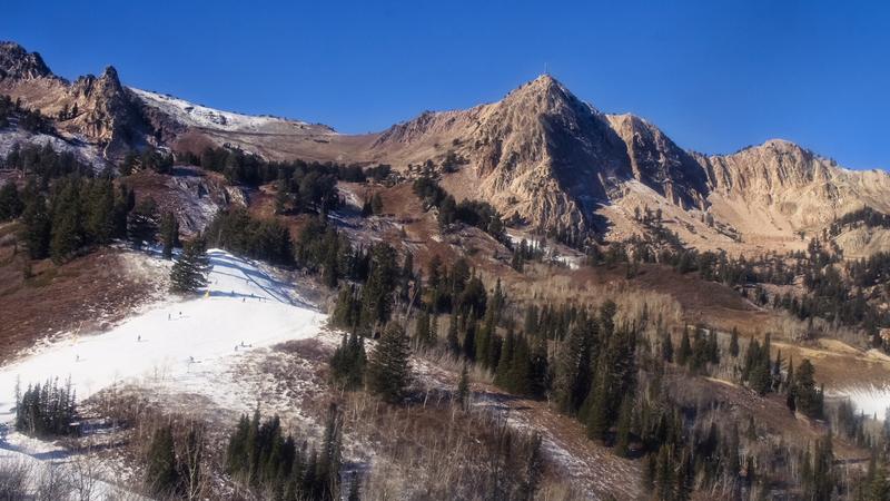
The Ogden area mountains are a whole different world from the Wasatch mountains to the south, and in a very good way. Most slopes are bare, with only patchy snow on upper elevation, northerly facing slopes. Below are photos from the Snowbasin and Powder Mountain web cams - other than the man made snow on the ski run, there is just a bit of snow on the upper elevation shady slopes.
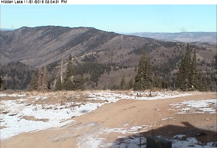
Another view from Powder Mountain.
Recent Avalanches
No avalanches have been reported.
Ad
Avalanche Problem #1
Normal Caution
Type
Location
Likelihood
Size
Description
Mostly it will be new snow on dirt, so there are few chances for recreation out side of the ski areas or perhaps on dirt roads or trails by Friday morning. However, if you do hike up to the highest peaks, small sluffs and avalanches could become possible late today or tomorrow morning on heavily wind drifted slopes, especially where there was a bit of old snow.
Below - Doug Weweer photo of "old snow" shallow crusts and facets on upper elevation northerly.
Additional Information
More snow is on the way! An additional 3 to 5” of snow is expected tonight, followed by 5 to 9" of warm heavy snow and strong gusty winds on Friday. A cold front will cross the area Friday night, with snowfall continuing into Saturday. Snow totals of two to three feet are expected by Sunday morning.
Join the UAC for the 2nd Annual Ogden Backcountry Bash at The Front Climbing Gym in Ogden.
Beer, pizza, silent auction, prizes, and climbing!
November 29
6:30 PM - 9:30 PM
The Front Climbing Club, 225 20th street, Ogden UT 84401