Forecast for the Moab Area Mountains

Issued by Eric Trenbeath on
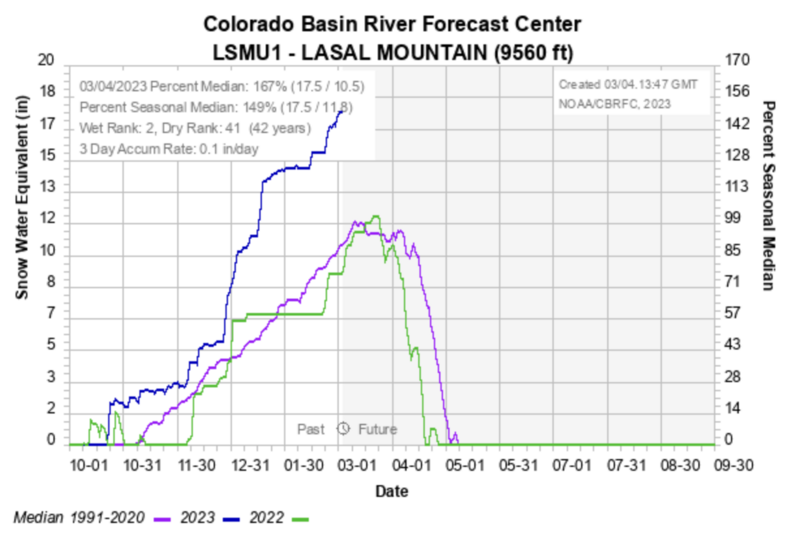
Sunday morning, March 5, 2023
Sunday morning, March 5, 2023
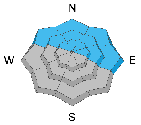
Areas of CONSIDERABLE avalanche danger exist on steep, northerly facing slopes above treeline that have recent deposits of wind drifted snow.
A MODERATE avalanche danger exists on northerly aspects at all elevations for human triggered avalanches 2'-4' deep failing on a buried persistent weak layer.
A MODERATE avalanche danger also exists for human triggered avalanches involving slabs of wind drifted snow on slopes near treeline and above that face W-N-SE
Most other south facing terrain has generally LOW danger.
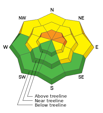
Low
Moderate
Considerable
High
Extreme
Learn how to read the forecast here