Forecast for the Moab Area Mountains

Eric Trenbeath
Issued by Eric Trenbeath for
Saturday, March 4, 2023
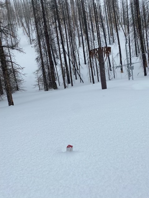
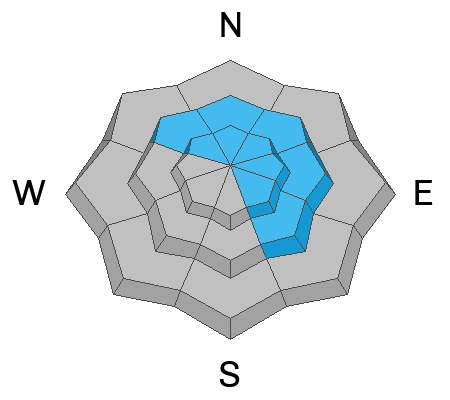
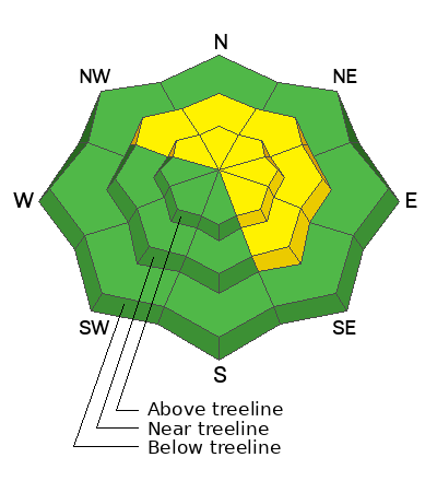
The avalanche danger is MODERATE. Human triggered avalanches are POSSIBLE in areas of wind drifted snow that exist near and above treeline on slopes that face NW-N-NE-E-SE. The greatest danger is predominantly found above treeline where drifts can be found up to 2 feet deep.
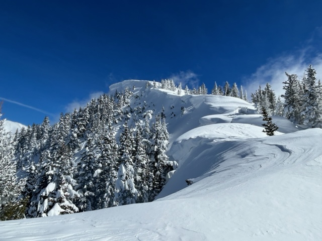
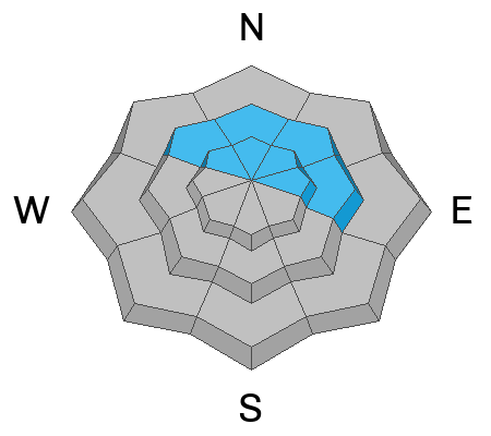
A layer of weak faceted snow exists on some slopes near treeline and above that face NW-N-NE-E. It is still POSSIBLE to trigger an avalanche breaking down to this weak layer, but the likelihood is decreasing.
Low
Moderate
Considerable
High
Extreme
Learn how to read the forecast here
Special Announcements
Geyser Pass Road: The road is plowed over a snowpacked surface.
Grooming: Brian and Zach rolled out all trails yesterday. Matt will be up today to fine tune and set classic track.
To help you safely enjoy the backcountry, the UAC team is constantly evaluating and implementing new programs and technologies. Donate to the Spring Campaign to help our team implement innovative tools and better provide you with the information you rely on.
Weather and Snow
6:00 a.m. Snow and Weather Data
24 Hour Snow 0" 72 Hour Snow 11" Season Total Snow 229" Base Depth at Gold Basin 85"
Winds on Pre Laurel Peak SW 15-25 Temp 18F

Weather
Look for increasing clouds and wind as a low pressure trough moving through the Pacific Northwest begins to slide southeastward. The bulk of the energy stays north but we'll see a slight chance for snow showers, SW winds in the 25-35 mph range with gusts in the 40's, and high temps in the mid 20's. SW winds will continue to increase overnight with very windy conditions on tap for tomorrow. Gusts as high as 70 mph are possible. By Monday, the system moves on bringing mostly sunny skies but continued breezy conditions. The pattern remains active through the model run, but snow for our area remains out of reach through the mid term.

General Conditions
Backcountry travelers yesterday reported good turning and riding conditions from the mid week storm. Go up and get some today before tomorrow's winds have their way with things. Your primary avalanche concern is triggering a slab of wind drifted snow that formed earlier this week on northerly aspects. In some cases, slabs may be sitting on top of weaker layers buried deeper in the snowpack. Avalanches failing on a buried weak layer are becoming increasingly unlikely but it's a good idea to dig down and see what you find before committing to steep, northerly facing terrain.
The manual snowstake in Gold Basin is in need of an extension! This is only the second time I have seen this with the last during the 2018-19 season.

Snowpack and Weather Data
Gold Basin Storm Stake (10,000')
Gold Basin SNOTEL site (10,000')
SNOTEL site near Geyser Pass Winter Trailhead (9600')
Wind Station on Pre-Laurel Peak (11,400')
NWS forecast for the La Sal Mountains.
Recent Avalanches
A few, relatively small natural avalanches involving recent and wind drifted snow have been observed since Wednesday's storm event. Brian Murdock reported seeing some older activity on Norieaga's face yesterday.
See the La Sal avalanche database here.
Ad
Avalanche Problem #1
Wind Drifted Snow
Type
Location
Likelihood
Size
Description
Your primary avalanche concern today is wind drifted snow that exists near treeline and above on slopes that face NW-N-NE-E-SE. Old hard slabs from strong southerly winds earlier in the week still remain in alpine terrain. Older, hard wind slabs can be very stubborn. and may not release until you get well out on them. Hard drifts often produce hollow drum-like sounds when you walk on them.
In addition to these lingering hard slabs, fresh slabs formed on Wednesday during the recent storm. Freshly formed wind slabs can be quite sensitive and are more easily triggered. You can recognize them by their smooth, round appearance. Drifted snow is stiffer and more compact than non drifted snow. You will often see clues like cracking in the snow surface when you step onto a recent wind drift.
Large cornices above North facing terrain. These are obvious clues that this slope has seen significant wind loading.
Avalanche Problem #2
Persistent Weak Layer
Type
Location
Likelihood
Size
Description
On some northerly aspects, a weak layer of faceted snow exists about two feet down in the snowpack. This layer was buried on Valentine's Day, and we have not seen much activity associated with it. It is becoming less likely to trigger an avalanche on this layer, but the fact that it still exists warrants caution. The distribution of this layer is spotty. If you are thinking about skiing steep North facing terrain you need to get out your shovel and look for the faceted layer. If you get propagation with an Extended Column Test, I would back off to a lower angle slope or a different aspect.
Additional Information
SNOTEL data from the LSMU1 plot near the Geyser Pass Trailhead is near off the chart at 167% of average.
General Announcements
This forecast is from the U.S.D.A. Forest Service, which is solely responsible for its content. This forecast describes general avalanche conditions and local variations always occur. This forecast will be updated by 7:30 tomorrow morning.