Forecast for the Moab Area Mountains

Mark Staples
Issued by Mark Staples for
Sunday, March 17, 2019
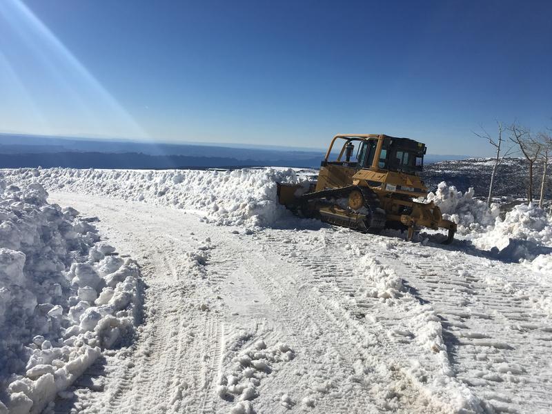
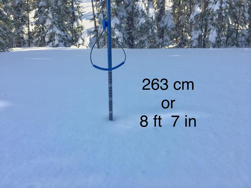
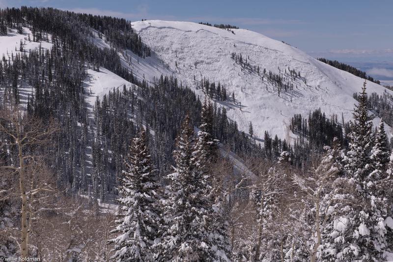
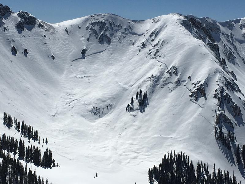
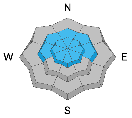
Today the avalanche danger is CONSIDERABLE at mid and upper elevations. Avalanches can break near the ground 6-12 feet deep or in slabs of wind drifted snow 3-4 feet deep. The danger is MODERATE at low elevations where wet avalanches are possible.

Triggering an avalanche is getting a little harder to do with each day after the Tuesday/Wednesday storm. These are still dangerous avalanche conditions that require cautious routefinding and conservative decision-making.
Low
Moderate
Considerable
High
Extreme
Learn how to read the forecast here
Special Announcements
The road to Geyser Pass Trailhead will be open today (Sunday). Grand County and Forest Service crews have worked two full days plowing the road. Much of the upper section is a narrow single lane. There are a few turnouts and wider sections. Be prepared to back up in order to pass oncoming traffic.
The road will close on Monday to allow crews to push more snow and widen the road.
Weather and Snow
This morning under clear skies, temperatures dropped into the teens F. High temperatures yesterday were around 40 degrees F.
Winds at upper elevations have been dead calm and should remain calm today.
Temperatures should quickly warm again this morning and reach the lower 40s F under clear sunny skies.
The snow on many slopes other than shaded north facing ones got damp yesterday and should have an ice crust on them this morning, but it will likely melt quickly.
The recent storm lasted from Tuesday morning until Wednesday evening (37 hours). It delivered 32 inches of snow with 3.6 inches of snow water equivalent. Winds during the storm blew from the south, west and north. The strongest winds blew from the west.
Total snow depth in Gold Basin at 10,000 feet is 8 feet 7 inches.

New snow totals in Gold Basin (10,000')
Snotel totals at the Geyser Pass Trailhead (9600')
National Weather Service point forecast.
Recent Avalanches
Following the storm on Tuesday/Wednesday there were many avalanches. Some broke within the new snow. However, many broke 1/4 to 1/2 mile wide at the ground. See the full list of avalanches we have cataloged so far HERE.
Below is a photo of a slope called Noriega's Face (photo W. Holdman)
Below is a photo of the Talking Mountain Cirque
Another slide in Gold Basin
Ad
Avalanche Problem #1
Persistent Weak Layer
Type
Location
Likelihood
Size
Description
Recent avalanches tell us all we need to know about this problem. They will be massive and deadly. They can break near the ground or in the middle of the snowpack on a pesistent weak layer of sugary facets. I don't expect any more to occur naturally unless strong winds occur but they are not in the forecast.
Triggering one of these large avalanches gets a little harder to do each day. The trouble is that it is hard to know what that likelihood is. What we do know is that any avalanche we trigger on a buried persistent weak layer will be huge and will be deadly.
Evaluating avalanches that break deep in the snowpack is one of the most difficult avalanche problems to assess. Ski Patrols armed with explosives and intimate knowledge of specific slopes struggle with this avalanche problem. Time and patience is the only answer.
Avalanche Problem #2
Wind Drifted Snow
Type
Location
Likelihood
Size
Description
The most likely places to trigger an avalanche in the new snow are slopes that have deposits of wind drifted snow. The clear cold weather last weekend (just before the storm) may have weakened the snow surface a small amount. On Friday in the Abajo mountains, I found evidence of this (video). It wasn't too concerning but is something to watch for as it could keep wind slabs unstable a little longer than normal.
Avalanche Problem #3
Wet Snow
Type
Location
Likelihood
Size
Description
Watch for warming of the new snow today at low elevations. This morning is starting very cold but should warm rapidly as the strong March sun rises. The new snow has been through a couple of days of warming and re-freezing making wet avalanches a little less likely.
You should see roller balls and pinwheels of snow rolling downhill. As this activity increases, the danger for loose wet avalanches increases. The simple strategy is just avoid being under steep slopes as the snow gets wet. You should see lots of clues.
Additional Information
Check out this clip of local Moab sledders playing it safe and making sure their beacons are on at the Geyser Pass Trailhead.
General Announcements
Your information can save lives. If you see anything we should know about, please help us out by submitting snow and avalanche observations HERE. You can also call me at 801-641-6307, or send me an email: [email protected].
Support the UAC through your daily shopping. When you shop at Smith's, or online at REI, Backcountry.com, Patagonia, NRS, Amazon, eBay by clicking on these links, they donate a portion of your purchase to the UAC. If you sell on eBay, you can have your See our Affiliate Page for more details on how you can support the UAC when you shop
This forecast is from the U.S.D.A. Forest Service, which is solely responsible for its content. This forecast describes general avalanche conditions and local variations always occur.