UDOT PLANNED AVALANCHE CLOSURES!!

Forecast for the Moab Area Mountains

Mark Staples
Issued by Mark Staples for
Saturday, March 16, 2019
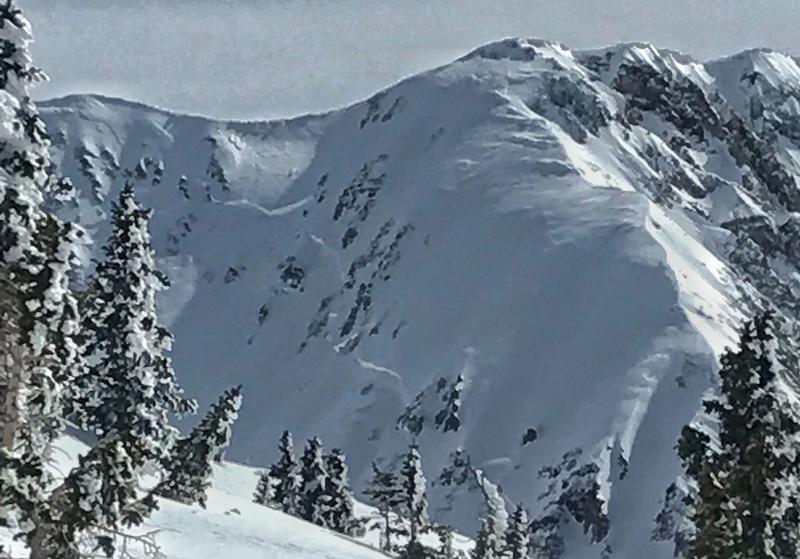
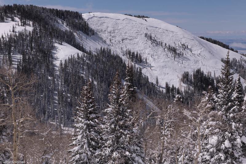
Today the avalanche danger is CONSIDERABLE at all elevations. Avalanches can break near the ground 6-12 feet deep or in slabs of wind drifted snow 3-4 feet deep. At low elevations some wet avalanches are possible on southerly facing and west facing slopes.

These are still dangerous avalanche conditions that require cautious routefinding and conservative decision-making which warrants a CONSIDERABLE danger rating.
Low
Moderate
Considerable
High
Extreme
Learn how to read the forecast here
Special Announcements
The road to Geyser Pass remains closed as crews plow snow. A Forest Service bull dozer worked yesterday to push snow banks out of the way to give Grand County room to plow the snow and open the road. Unfortunately it is a slow process. The road will likely remain closed through the weekend for vehicle traffic. Photo below from Z. Lowe
Weather and Snow
This morning under clear skies, temperatures dropped into the low teens F following high temperatures yesterday in the mid 30s F. At 11,000 feet air temperatures were in the high 20s.
Winds at upper elevations have been dead calm but increased this morning and were blowing easterly 15 mph gusting to 20 mph on Abajo Peak.
Today clear skies and strong sunshine will allow temperatures to rise into the 30s F again and maybe a bit higher than yesterday. Winds are not expected to blow much more than 5-10 mph.
The recent storm lasted from Tuesday morning until Wednesday evening (37 hours). It delivered 32 inches of snow with 3.6 inches of snow water equivalent. Winds during the storm blew from the south, west and north. The strongest winds blew from the west.

New snow totals in Gold Basin (10,000')
Snotel totals at the Geyser Pass Trailhead (9600')
National Weather Service point forecast.
Recent Avalanches
We are collecting more photos of recent avalanches. Some broke within the new snow (Haystack) but many paths avalanched at the ground over areas 1/4 to 1/2 mile wide. Below is photo (B. Murdock) from Talking Mountain Cirque. Other notable avalanches occurred on Exxon's Folley, Noriega's Face, and the West Face of Tuk.
The photo (W. Holdman) below is of Noriega's Face, a north facing slope just above 10,000 feet.
Ad
Avalanche Problem #1
Persistent Weak Layer
Type
Location
Likelihood
Size
Description
Recent avalanches tell us all we need to know about this problem. They will be massive and deadly. They can break near the ground or in the middle of the snowpack on a pesistent weak layer of sugary facets. I don't expect any more to occur naturally unless strong winds occur but they are not in the forecast.
Triggering one of these large avalanches gets a little harder to do each day. The trouble is that it is hard to know what that likelihood is. What we do know is that any avalanche we trigger on a buried persistent weak layer will be huge and will be deadly.
Evaluating avalanches that break deep in the snowpack is one of the most difficult avalanche problems to assess. Ski Patrols armed with explosives and intimate knowledge of specific slopes struggle with this avalanche problem. Time and patience is the only answer.
Avalanche Problem #2
Wind Drifted Snow
Type
Location
Likelihood
Size
Description
The new snow from this week's storm has likely settled a lot and bonded well to the old snow surface. The most likely places to trigger an avalanche in the new snow are slopes that have deposits of wind drifted snow. The clear cold weather last weekend (just before the storm) may have weakened the snow surface a small amount. Yesterday in the Abajo mountains, I found evidence of this (video). It wasn't too concerning but is something to watch for as it could keep slabs of wind drifted snow unstable a little longer than normal.
Avalanche Problem #3
Wet Snow
Type
Location
Likelihood
Size
Description
Watch for warming of the new snow today at low elevations. This morning is starting very cold but should warm rapidly as the strong March sun rises. You should see roller balls and pinwheels of snow rolling downhill. As this activity increases, the danger for loose wet avalanches increases. The simple strategy is just avoid being under steep slopes as the snow gets wet. You should see lots of clues.
Additional Information
Check out this clip of local Moab sledders playing it safe and making sure their beacons are on at the Geyser Pass Trailhead.
General Announcements
Your information can save lives. If you see anything we should know about, please help us out by submitting snow and avalanche observations HERE. You can also call me at 801-641-6307, or send me an email: [email protected].
Support the UAC through your daily shopping. When you shop at Smith's, or online at REI, Backcountry.com, Patagonia, NRS, Amazon, eBay by clicking on these links, they donate a portion of your purchase to the UAC. If you sell on eBay, you can have your See our Affiliate Page for more details on how you can support the UAC when you shop
This forecast is from the U.S.D.A. Forest Service, which is solely responsible for its content. This forecast describes general avalanche conditions and local variations always occur.