Forecast for the Moab Area Mountains

Mark Staples
Issued by Mark Staples for
Thursday, March 14, 2019
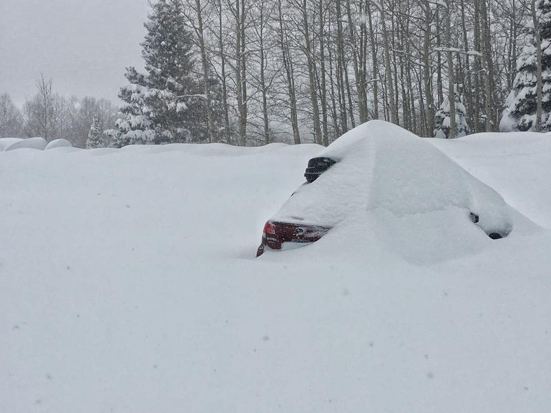
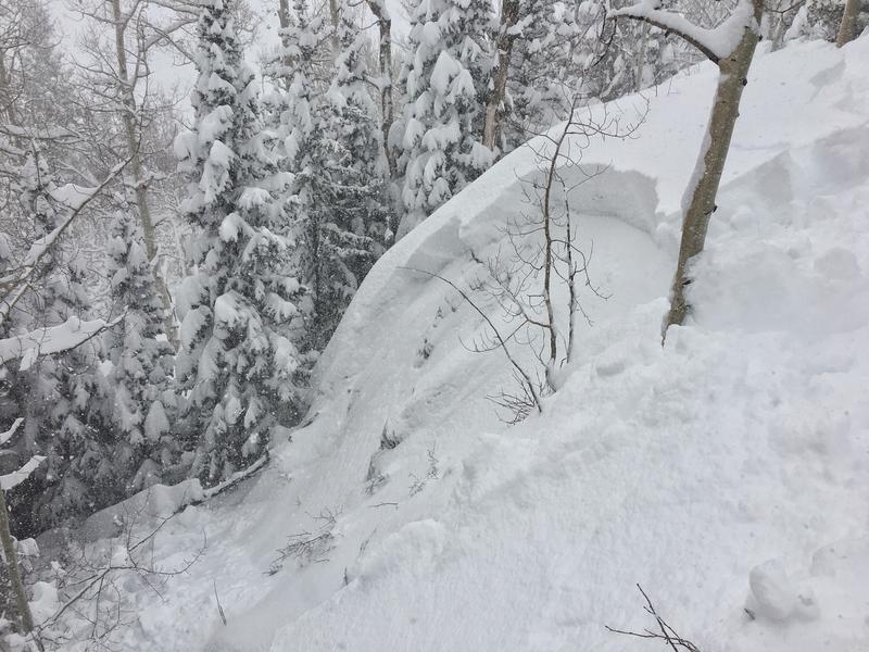
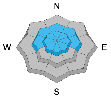
Today's travel advice is to avoid avalanche terrain. For this reason the avalanche danger at upper elevations is rated HIGH. Avalanches will break in the new snow or will break deeper in the snowpack on buried weak layers. Mid and lower elevations have dangerous avalanche conditions as well, and the danger is rated CONSIDERABLE.
Low
Moderate
Considerable
High
Extreme
Learn how to read the forecast here
Special Announcements
Grand County will be plowing the road to Geyser Pass Trailhead this morning! The road will be closed while plowing is in progress. There is a lot of snow, and it could take them much of the day.
Weather and Snow
Since Tuesday morning a total of 32 inches of snow has fallen containing 3.6 inches of water.
Temperatures this morning dropped to 10 degrees F in Gold Basin and are in the low teens at the Geyser Pass TH. At upper elevations they are in the single digits.
Winds blew from the west yesterday and shifted to the north overnight. Pre-Laurel Peak is probably heavily rimed again and not reporting. Winds are likely blowing about 10 mph and gusting 15-20 mph. Yesterday afternoon below the Geyser Pass TH they were drifting minor amounts of snow across the road.
Today will have partly sunny skies. Cold north winds will keep temperatures from rising much. Winds may gust up to 25 mph and possibly calm by late this afternoon.
Photo below is from Geyser Pass TH yesterday afternoon.

New snow totals in Gold Basin (10,000')
Snotel totals at the Geyser Pass Trailhead (9600')
National Weather Service point forecast.
Recent Avalanches
Yesterday, Dave Garcia was able to find a small steep slope and trigger slab avalanche in the new snow (photo below).
With such a rapid, heavy load of new snow, I suspect there were many natural avalanches breaking in the new snow especially on slopes with wind drifted snow. There is a good chance that other avalanches broke much deeper in the snowpack. The last major avalanche (Horse Creek) occurred last Thursday or Friday following a week of snowfall containing 3 inches of water and strong southwest winds. That avalanche broke 6-12 feet deep and over 2,500 feet wide. Yesterday's storm delivered 3.6 inches of water in 37 hours.
Ad
Avalanche Problem #1
New Snow
Type
Location
Likelihood
Size
Description
The most likely avalanches today will involve the new snow which is nearly 3 feet deep. The avalanche shown above is a good example, but it was small because it was a small terrain feature. Bigger terrain will produce bigger avalanches. The new snow will be especially sensitive on any slope with wind drifted snow but these slopes may be hard to identify as winds have changed direction through the storm. Winds were initially blowing from the southwest. The strongest winds blew from the west during the storm. Overnight they slowly shifted to the north.
Avalanche Problem #2
Persistent Weak Layer
Type
Location
Likelihood
Size
Description
With such a rapid heavy load of new snow, buried persistent weak layers have a lot of stress on them. These layers can produce massive avalanches. Over time, they can strengthen but for today these layers are at their breaking point. On many northerly facing slopes, they exist near the ground. Southerly facing slopes at upper elevations have a buried persistent weak layer in the middle of the snowpack (see video below from last weekend).
These avalanches can be a little tough to trigger because the weak layers are now buried 6-12 feet deep. Triggering an avalanche in the new snow is one way to trigger a much deeper avalanche.
Personally I would be nervous even being under steep slopes in the runout zones. Such large avalanches reach speeds of 80 mph and travel long distances.
Avoiding avalanche terrain is the best option.
Additional Information
Check out this clip of local Moab sledders playing it safe and making sure their beacons are on at the Geyser Pass Trailhead.
General Announcements
Your information can save lives. If you see anything we should know about, please help us out by submitting snow and avalanche observations HERE. You can also call me at 801-641-630, or send me an email: [email protected].
Support the UAC through your daily shopping. When you shop at Smith's, or online at REI, Backcountry.com, Patagonia, NRS, Amazon, eBay by clicking on these links, they donate a portion of your purchase to the UAC. If you sell on eBay, you can have your See our Affiliate Page for more details on how you can support the UAC when you shop
This forecast is from the U.S.D.A. Forest Service, which is solely responsible for its content. This forecast describes general avalanche conditions and local variations always occur.