Forecast for the Logan Area Mountains

Toby Weed
Issued by Toby Weed for
Wednesday, March 1, 2023
There is HIGH avalanche danger in the backcountry. Dangerous conditions exist on drifted slopes at all elevations, but avalanches are more likely up high in windy terrain and on slopes facing west, north, and east.

People are likely to trigger dangerous avalanches today, so it's best to stay off and out from under drifted slopes steeper than 30°. Avoid travel in avalanche terrain, and stay clear of avalanche runouts, since long running natural avalanches are possible.
Low
Moderate
Considerable
High
Extreme
Learn how to read the forecast here
Special Announcements
Come out and ride for a cause! Utah Snowmobile Association's 6th annual RALLY IN THE VALLEY is being held March 4th at the cabins at Bear River Lodge. Bring family and friends to join in the fun! All of the proceeds from RALLY IN THE VALLEY go directly to supporting the sport in our state.
Weather and Snow
The new snow is rapidly settling and stability is improving quickly, as it does this time of year, but conditions are probably still rather unstable on many slopes today. The snow was just too deep yesterday, and that kept most of us out of trouble. Huge loads of new snow and drifted snow are now overloading slopes, some with poor snow structure and buried persistent weak layers..
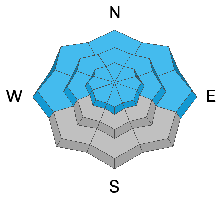
I plan to avoid avalanche terrain today, which means I'll stay off and out from under backcountry slopes at all elevations steeper than 30°.

The 8400' Tony Grove Snotel reports over 40 inches of new snow, with 4.4" SWE from the incredible storm so far. It's 14° F this morning, and there is 137 inches of total snow. The wind is blowing from the south, 25 to 30 mph, apparently moderating after and gusting well into the 60s overnight at the 9700' CSI Logan Peak weather station.
Here is the NWS point forecast for high elevations in the Central Bear River Range:
Today: Snow likely, mainly before 2pm. The snow could be heavy at times. Mostly cloudy, with a high near 23. Wind chill values as low as -5. South wind 11 to 15 mph becoming east in the afternoon. Chance of precipitation is 60%. Total daytime snow accumulation of 3 to 5 inches possible.
Tonight: Mostly cloudy, with a low around 3. Wind chill values as low as -8. North northeast wind around 11 mph.
Thursday: Partly sunny, with a high near 20. Wind chill values as low as -12. North wind 10 to 14 mph becoming west northwest in the morning.

Unsettled weather will continue through the weekend and clouds, cold temperatures will help preserve the powder.
Recent Avalanches
  • Skiers remotely triggered a large avalanche in the Beaver Mountain Backcountry yesterday. The 2' deep and 600' wide avalanche off the south ridge of Beaver Mountain is on an east facing slope at 8000', and it was triggered by a skier hundreds of feet away. report is HERE
  • Tuesday, I could see evidence of widespread long running natural avalanches in the Wellsvilles, with most paths having slid. Bench slammers! Some ran full length of their paths, way overrunning debris from previous events..
  • A natural avalanche Monday morning ran ~1250 vrt' to Green Canyon bottom less than 100' from access road to popular trailhead at about 5000' in elevation.
  • Monday, widespread booming collapses and remotely triggered cornice falls were reported from Blind Hollow.

  • For a list of avalanches in the Logan Zone go HERE
    Find a list of all recent observations & avalanches from across Utah HERE.
Ad
Avalanche Problem #1
Wind Drifted Snow
Type
Location
Likelihood
Size
Description
This morning winds are blowing from the south, and they've been way more than strong enough to drift the heavy powder from yesterday. Avalanches of wind drifted storm snow, 2 to 4 feet thick, are likely on drifted slopes at all elevations, but will be larger and even more likely for people to trigger on upper elevation slopes facing west, north, and east.
  • Avoid corniced slopes and stiffer drifts on steep slopes near ridges and in and around terrain features like cliff bands, sub-ridges, mid-slope break-overs, and gully walls.
  • Wind slabs consist of stiffer drifted snow. Today, deep avalanches of drifted storm snow are likely.
  • Some wind slab avalanches could fail on a sugary persistent weak layer, and some might be triggered remotely.
  • Stay well clear of the freshly swollen cornices, which are likely to break further back than you might expect and could trigger wind slab avalanches below.
  • Natural avalanches are possible, especially during periods of intense drifting.
Avalanche Problem #2
Persistent Weak Layer
Type
Location
Likelihood
Size
Description
The PWL problem is widely scattered across terrain, especially at mid and upper elevations, where thin layers of sugary snow or other weak snow grains exist in pockets, but on most aspects. At lower elevations in the Logan Zone layers of sugary faceted snow are more widespread and more prevalent on northerly facing slopes. The snow is particularly weak in protected terrain, and poor snow structure and areas with unstable old snow can be found now on lots of lower elevation slopes.
  • Avalanches failing on a persistent weak layer are possible at all elevations but are notably also possible down lower, below about 7000' elevation.
  • Avalanches could be triggered remotely or from a distance.
Avalanche Problem #3
New Snow
Type
Location
Likelihood
Size
Description
Around four feet of snow fell already with this storm and another several inches of accumulation is possible in the Bear River Range today. As heavy snow continues to stack up on steep slopes it will be pretty unstable, but when accumulations slow down stability will increase.
  • People are likely to trigger soft slab and loose avalanches of storm snow on slopes steeper than 30°.
  • Natural avalanches are most likely during periods of particularly heavy snowfall and/or drifting.
Additional Information
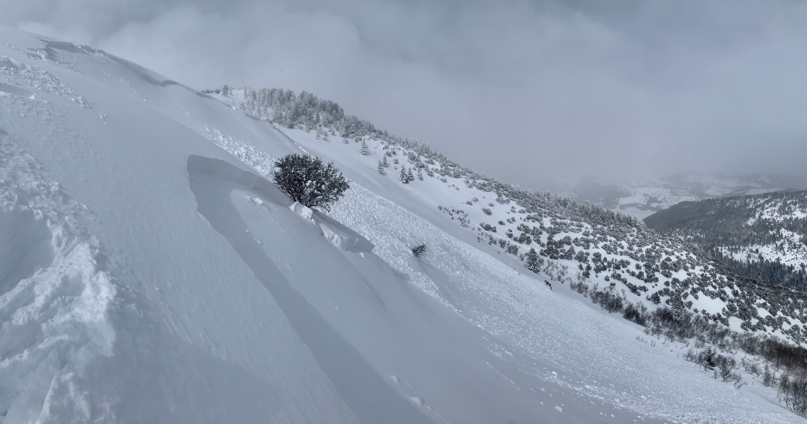
This large avalanche that occurred on Tuesday in the Beaver Mountain Backcountry was remotely triggered by skiers from hundreds of feet away.
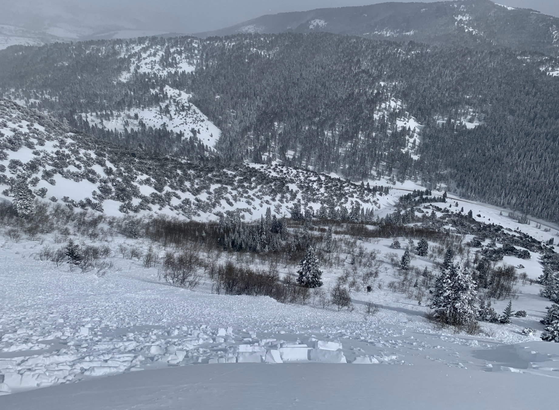
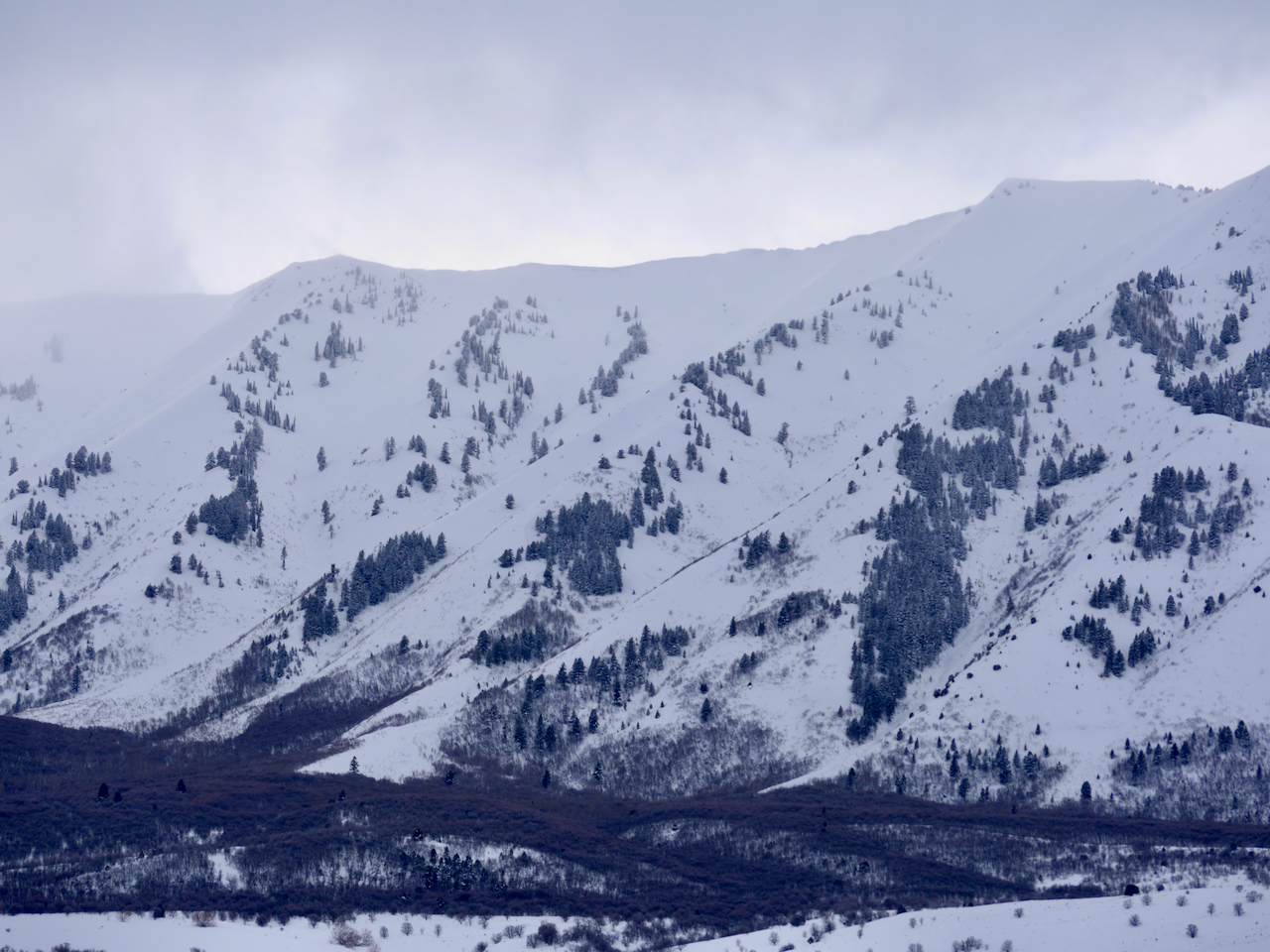
Numerous long running natural avalanches occurred in the Maple Bench Area of the Mount Naomi Wilderness above Mendon.
General Announcements
  • Please submit your observations from the backcountry HERE.
  • For a list of avalanche classes from the Utah Avalanche Center go HERE
  • For information on where you can ride your sled or snowbike, check out this map of the winter travel plan for the Logan and Ogden Ranger Districts HERE, and a close up of the Tony Grove and Franklin Basin Areas HERE.
This forecast is from the U.S.D.A. Forest Service, which is solely responsible for its content. This forecast describes general avalanche conditions and local variations always occur.