UDOT PLANNED AVALANCHE CLOSURES!!

Forecast for the Logan Area Mountains

Toby Weed
Issued by Toby Weed for
Thursday, March 2, 2023
There is CONSIDERABLE avalanche danger on drifted upper and mid elevation slopes in the backcountry. Elevated conditions exist on drifted slopes at all elevations, but avalanches are more likely up high in windy terrain and on slopes facing west, north, and east, where people are still likely to trigger avalanches. Loose wet avalanches entraining moist fresh snow may become likely in sunny terrain in the middle of the day.

Make conservative decisions and evaluate snow and terrain carefully.
Low
Moderate
Considerable
High
Extreme
Learn how to read the forecast here
Special Announcements
To help you safely enjoy the backcountry, the UAC team is constantly evaluating and implementing new programs and technologies. Donate to the Spring Campaign to help our team implement innovative tools and better provide you with the information you rely on.
Weather and Snow
The new snow is rapidly settling and stability is improving quickly, as it does this time of year. Even so, it's probably a good idea to give the recent big load of new snow a bit more time before committing to steep slopes The deep snow was still difficult to travel in yesterday, and that might have kept most of us out of trouble. Huge loads of drifted new snow snow from this week's storm are now overloading slopes, some with poor snow structure and buried persistent weak layers.. While we'll probably find much better stability today, it'll be even better tomorrow.

The 8400' Tony Grove Snotel reports close to four feet of new snow, with 4.5" SWE from this week's incredible storm. It's 8° F this morning, and there is 129 inches of total snow. The wind diminished significantly yesterday and it is blowing from the northwest, 15 to 20 mph at the 9700' CSI Logan Peak weather station.
Here is the NWS point forecast for high elevations in the Central Bear River Range:
Today: Partly sunny, with a high near 19. Wind chill values as low as -6. West northwest wind 8 to 15 mph.
Tonight: Snow likely, mainly after 2am. Mostly cloudy, with a temperature falling to near 11 by 8pm, then rising to around 18 during the remainder of the night. Wind chill values as low as -3. West wind 11 to 15 mph. Chance of precipitation is 60%. New snow accumulation of 1 to 2 inches possible.
Friday: Snow. Temperature rising to near 19 by 11am, then falling to around 12 during the remainder of the day. Wind chill values as low as -5. Blustery, with a west northwest wind 15 to 23 mph. Chance of precipitation is 100%. New snow accumulation of 2 to 4 inches possible.

Unsettled weather will continue and more snow will accumulate this weekend, with another 7 to 15 inches possible at upper elevations Saturday and Saturday night.
Recent Avalanches
  • Skiers remotely triggered a large avalanche in the Beaver Mountain Backcountry Tuesday. The 2' deep and 600' wide avalanche off the south ridge of Beaver Mountain is on an east facing slope at 8000', and it was triggered by a skier hundreds of feet away. report is HERE

  • Tuesday, I could see evidence of widespread long running natural avalanches in the Wellsvilles, with most paths having slid. Bench crashers! Some ran full length of their paths, way overrunning debris from previous events..
  • A natural avalanche Monday morning ran ~1250 vrt' to Green Canyon bottom less than 100' from access road to popular trailhead at about 5000' in elevation.

  • For a list of avalanches in the Logan Zone go HERE
    Find a list of all recent observations & avalanches from across Utah HERE.
Ad
Avalanche Problem #1
Wind Drifted Snow
Type
Location
Likelihood
Size
Description
This morning diminished winds are blowing from the northwest. Avalanches of wind drifted storm snow, 1 to 4 feet thick, are possible on drifted slopes at all elevations, but will be larger and even more likely for people to trigger on upper and mid elevation slopes facing west, north, and east.
  • Avoid corniced slopes and stiffer drifts on steep slopes near ridges and in and around terrain features like cliff bands, sub-ridges, mid-slope break-overs, and gully walls.
  • Wind slabs consist of stiffer drifted snow.
  • Some wind slab avalanches could fail on a sugary persistent weak layer, and some might be triggered remotely.
  • Stay well clear of the freshly swollen cornices, which are likely to break further back than you might expect and could trigger avalanches on slopes below.
Avalanche Problem #2
Persistent Weak Layer
Type
Location
Likelihood
Size
Description
The PWL problem is widely scattered across terrain, especially at mid and upper elevations, where thin layers of sugary snow or other weak snow grains exist in pockets, but on most aspects. At lower elevations in the Logan Zone layers of sugary faceted snow are more widespread and more prevalent on northerly facing slopes. The snow is particularly weak in protected terrain, and poor snow structure and areas with unstable old snow can still be found now on lots of lower elevation slopes.
  • Avalanches failing on a persistent weak layer are possible at all elevations but are notably also possible down lower, below about 7000' elevation.
  • Avalanches could be triggered remotely or from a distance.
Avalanche Problem #3
Wet Snow
Type
Location
Likelihood
Size
Description
Strong March sun will moisten the fresh snow on sunny slopes and loose wet avalanches will become possible on steep sunny slopes in the middle of the day. Natural avalanches could be triggered by snowballs rolling off trees or cliff bands. Loose wet avalanches on sustained slopes could entrain significant piles of fresh snow today.
Additional Information
This large avalanche that occurred on Tuesday in the Beaver Mountain Backcountry was remotely triggered by skiers from hundreds of feet away.
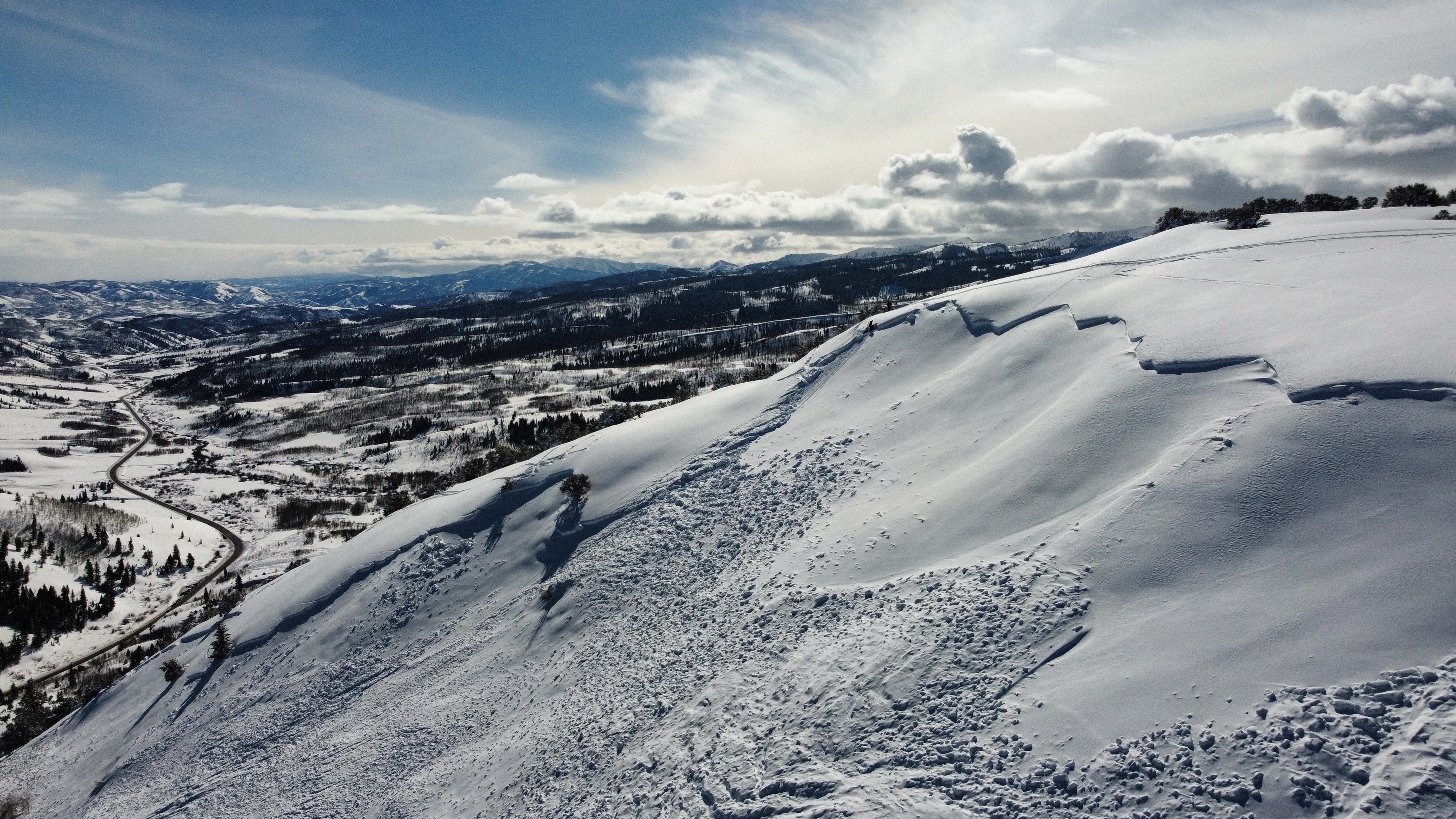
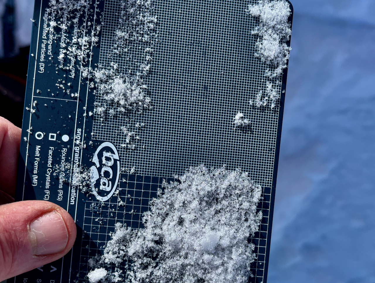
We found very small grains of sugary faceted snow above a crust that was the avalanche bed surface.
General Announcements
  • Please submit your observations from the backcountry HERE.
  • For a list of avalanche classes from the Utah Avalanche Center go HERE
  • For information on where you can ride your sled or snowbike, check out this map of the winter travel plan for the Logan and Ogden Ranger Districts HERE, and a close up of the Tony Grove and Franklin Basin Areas HERE.
This forecast is from the U.S.D.A. Forest Service, which is solely responsible for its content. This forecast describes general avalanche conditions and local variations always occur.