Forecast for the Logan Area Mountains

Toby Weed
Issued by Toby Weed for
Saturday, February 17, 2024
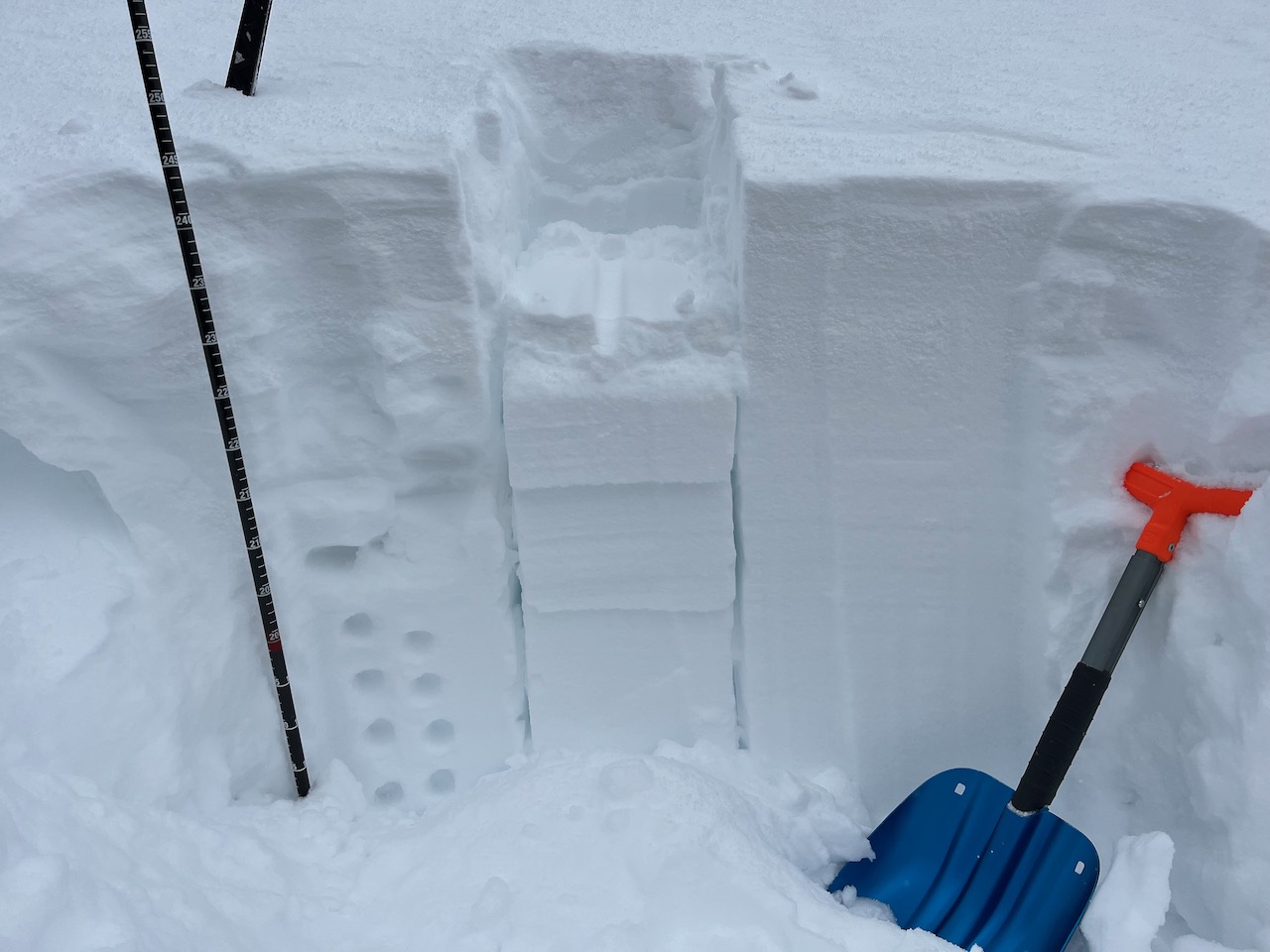
Today, people will find elevated avalanche conditions with human-triggered avalanches possible on many slopes steeper than 30°. Areas with CONSIDERABLE danger exist in drifted upper elevation terrain, where people are more likely to trigger avalanches of wind-drifted snow up to 2 feet deep, and natural avalanches are possible. Rapid solar warming will cause heightened wet avalanche conditions in sunny terrain at all elevations, with loose avalanches entraining heavy wet snow possible.

Careful snowpack evaluation, cautious route-finding, and conservative decision-making are essential for safe backcountry travel.
Low
Moderate
Considerable
High
Extreme
Learn how to read the forecast here
Special Announcements
We are seeking a passionate individual to join us as Executive Director of the nonprofit Utah Avalanche Center. Click here for more information.
Want to learn more about how to stay safe from avalanches while riding in the backcountry? Join us Feb 23-24 for an Introduction to Avalanche class. Information and registration here.
Weather and Snow
Yesterday, observers noted very heavy new snow and obvious signs of instability like cracking and collapsing. Human-triggered soft slab avalanches up to around 2 feet deep are likely on drifted upper-elevation slopes. Expect the heavy new snow to quickly become wet and sloppy when warmed by the sun. Natural soft slab and wet loose avalanches are possible and are most likely to occur in sunny terrain due to rapid solar warming.

The Tony Grove Snotel at 8400' reports 21" of new snow in the last couple of days, with 3.1" SWE. It's 12° F at the site, and there is 95" of total snow. The wind is blowing from the east-southeast this morning, 10 to 15 mph , at the 9700' CSI Logan Peak weather station. At 9500' on Paris Peak, winds from the south-southeast are blowing around 10 mph, and it's 9° F.
Today will be sunny in the mountains, with 8500' high temperatures around 28° F and 5 to 10 mph winds blowing from the southeast.
Snow is expected to resume late tonight with 1 to 3 inches of accumulation possible and 9 to 13 mph winds from the south-southwest. Snow will be heavy at times on Sunday in the mountains, with 4 to 8 inches of accumulation possible, 15 to 21 mph winds from the west-southwest, and high temperatures around 31° F.
Recent Avalanches
A skier triggered a couple of small soft slab avalanches, 10 inches deep and about 50 feet wide in the Garden City Bowls Thursday on an east-facing slope at around 8600 feet in elevation. Numerous small natural wind slab, soft slab, and loose avalanches were observed across the zone on both Thursday and Friday.
Check out local observations and avalanches HERE.

Ad
Avalanche Problem #1
Wind Drifted Snow
Type
Location
Likelihood
Size
Description
Drifting by winds from the west in the last couple of days created stiff wind slabs in exposed upper-elevation terrain. In some areas, people are likely to trigger avalanches of wind-drifted snow up to 2 feet deep on drifted slopes steeper than 30°. Avalanches may fail on a thin layer of small-grained, sugary, or faceted snow that was on the snow surface on Wednesday. This is a persistent weak layer, but it appears to be gaining strength pretty quickly.
  • Watch for and avoid fresh wind slabs on the lee side of major ridges, on corniced slopes, and in and around terrain features like cliff bands, sub-ridges, gully walls, and mid-slope rollovers.
  • Stay well away from and out from under overhanging cornices, which may break further back than expected.
  • Obvious signs of instability include cracking and collapsing, but these red flags may not be present when avalanches occur.
Avalanche Problem #2
Wet Snow
Type
Location
Likelihood
Size
Description
Loose avalanches of moist or wet snow will become more likely at all elevations on steep slopes during the day as the heavy new snow is rapidly warmed by the sun. Loose wet avalanches could entrain large heavy piles of soggy new snow
  • Natural avalanches on sunny slopes are most likely during the middle of the day. People should avoid being on sunny avalanche paths and stay off and out from under steep slopes with saturated surface snow.
  • Avoid being under steep lower-elevation slopes with wet or moist new snow. This would include places like those nice fishing holes under steep slopes in the Logan River and Blacksmith Fork.
Additional Information
We found a layer of sugary snow at the interface of Wednesday's snow surface and Thursday's new snow.
There are a couple of weak layers in the new snow that has accumulated in the past couple days.
General Announcements
-Listen to your very own Logan Zone avalanche forecasters on the UAC Podcast HERE.
-Read Toby's recent blog about wind, drifting, and avalanches HERE.
-Sign up for forecast region-specific text message alerts. You will receive messages about changing avalanche conditions, watches, and warnings...HERE.
-For all questions on forecasts, education, Know Before You Go, events, online purchases, or fundraising, call 801-365-5522.
-To report an avalanche or submit an observation from the backcountry, go HERE.
-Come practice companion rescue at the Franklin Basin TH Beacon Training Park. It's free and open to everyone. For easy user instructions, go HERE.
-We will update this forecast by 7:30 AM tomorrow.
This forecast is from the U.S.D.A. Forest Service, which is solely responsible for its content. This forecast describes general avalanche conditions, and local variations always occur.