Forecast for the Logan Area Mountains

Toby Weed
Issued by Toby Weed for
Tuesday, January 8, 2019
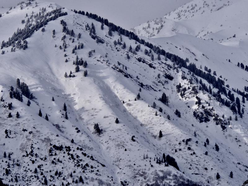
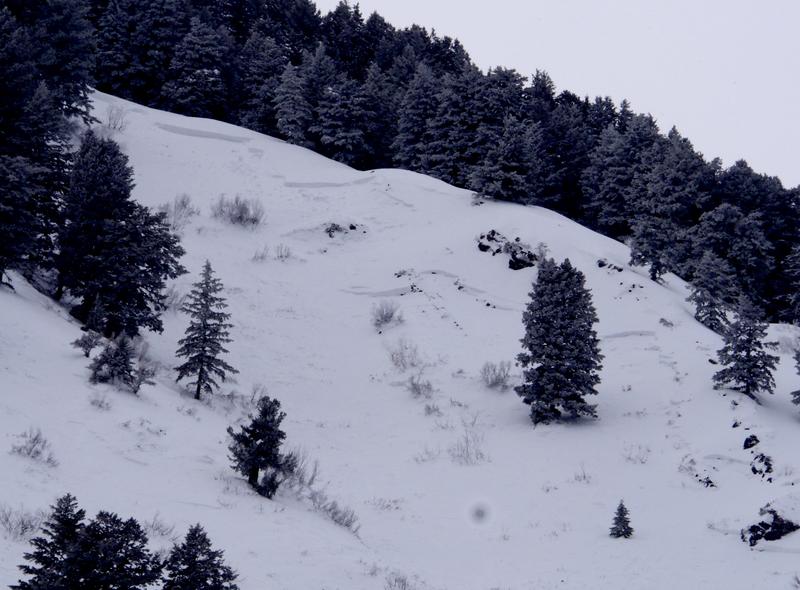
HIGH: Dangerous human triggered avalanches are likely and naturals possible today in the backcountry on steep slopes at all elevations. Very dangerous avalanche conditions exist on drifted upper and mid elevation slopes, and you could trigger avalanches on a persistent weak layer remotely or from a distance. Avalanches at lower elevations could impact unsuspecting people who are usually not at risk.
  • Continue to avoid travel in backcountry avalanche terrain.
  • Stay off and out from under steep slopes and obvious or historic avalanche runouts.
Low
Moderate
Considerable
High
Extreme
Learn how to read the forecast here
Avalanche Warning
THE FOREST SERVICE UTAH AVALANCHE CENTER IN SALT LAKE CITY HAS CONTINUED A BACKCOUNTRY AVALANCHE WARNING.
* TIMING...THROUGH 6 AM MST WEDNESDAY.
* AFFECTED AREA...FOR THE BEAR RIVER RANGE, PROVO AREA MOUNTAINS AND UINTA MOUNTAINS OF NORTHERN UTAH.
* AVALANCHE DANGER...HIGH.
* REASON/IMPACTS...VERY DANGEROUS AVALANCHE CONDITIONS EXIST. HEAVY SNOW COMBINED WITH WIND HAS CREATED WIDESPREAD AREAS OF UNSTABLE SNOW. BOTH HUMAN TRIGGERED AND NATURAL AVALANCHES ARE LIKELY.
STAY OFF OF AND OUT FROM UNDERNEATH SLOPES STEEPER THAN 30 DEGREES. BACKCOUNTRY TRAVELERS SHOULD CONSULT WWW.UTAHAVALANCHECENTER.ORG OR CALL 1-888-999-4019 FOR MORE DETAILED INFORMATION.
THIS WARNING DOES NOT APPLY TO SKI AREAS WHERE AVALANCHE HAZARD REDUCTION MEASURES ARE PERFORMED.
Weather and Snow
Heavy snow and drifting from strong southwest and west winds overloaded widespread weak snow, and large dangerous avalanches remain likely in the mountains today. The Tony Grove Snotel at 8400' picked up about 17" with 1.9" of SWE from the Sunday/Monday storm. It's 25º F and there's 53" of total snow containing 95% of average SWE. I'm reading 20º F at the 9700' CSI Logan Peak weather station, and west-southwest winds are currently averaging about 23 mph.
Evidence of a natural avalanche cycle in the Wellsville Range became apparent with clearing yesterday, 1/7/19.
High pressure will dominate midweek, with a weak weather system possible during the latter portion of the week. Today will be mostly sunny, with a high near 32º F at 8500'. Calm wind becoming east around 5 mph in the afternoon.
Recent Avalanches
There was a fairly extensive natural avalanche cycle in the Wellsville Range overnight Sunday or early Monday morning. You can see evidence of this from Cache Valley, with an obvious pile of debris spilling onto Maple Bench from a long running avalanche in Gibson Canyon off Mendon Peak. (~2500 vrt') . I found almost two feet of inverted heavy new snow at 5800' in the large meadow below Mitton Peak at the mouth of Rattlesnake Canyon yesterday afternoon. We triggered several large audible collapses or whumpfs slogging across low angled terrain. Numerous natural avalanches were apparent in the area.

Last Friday afternoon, when the danger was much lower, 3 lucky riders triggered a large hard slab avalanche on a south facing slope at about 9000' in elevation near Providence Peak. Luckily nobody got caught in the 4' to 6' deep and 300' wide avalanche consisting of wind drifted snow and failing on a sugary or faceted persistent weak layer. See Report HERE
Ad
Avalanche Problem #1
Wind Drifted Snow
Type
Location
Likelihood
Size
Description
Very dangerous avalanche conditions exist on drifted slopes after sustained strong south and west winds found plenty of fresh snow to drift into avalanche starting zones. Drifts have built up on widespread weak surface snow and buried sugary or faceted weak layers, and dangerous avalanche conditions exist at all elevations.
  • Watch for and avoid drifted snow on the lee sides of major ridges and in and around terrain features like cliff bands, scoops, gullies, stringers, and sub-ridges.
  • Avoid steep slopes that have a smooth, rounded appearance, or that sound hollow like a drum.
  • Softer, fresh wind slabs may be triggered remotely or from a distance today, while harder wind slabs have a nasty tendency to let you get well out on them before releasing.
  • Cracking or collapsing in the snow are red flags indicating instability.
Avalanche Problem #2
Persistent Weak Layer
Type
Location
Likelihood
Size
Description
The shallow snow on the ground in many areas has become loose, sugary, and faceted in the past couple weeks, and last week's very cold temperatures didn't help. Slabs of stiffer snow formed on top of faceted snow, and if you trigger an avalanche today it will fail on a buried persistent weak layer. We've found particularly weak snow at mid and lower elevations in the backcountry, and anywhere where the total snow is fairly shallow, and soft slab avalanches stepping down to sugary persistent weak layers are possible even in sheltered terrain. At upper elevations and in deeper areas, weak sugary snow exists just under the preexisting surface. Feathery surface hoar was also widespread across the zone. You could trigger avalanches remotely, from a distance, or below. This instability is likely to last for a while, and the snow on many slope will not stabilize very quickly.
Additional Information
I will update this forecast Wednesday morning.
General Announcements
The Beaver Mountain Backside is the backcountry, and it is avalanche terrain. If you cross the ski area boundary, you and your partners should carry and practice with avalanche rescue equipment. As always in the backcountry, practice safe backcountry travel protocols.
The new UAC IOS mobile app is now available on the app store. Check out the new "My Weather" feature. HERE
Check out the new free online avalanche course series developed by the Utah Avalanche Center. This is a great way to refresh your skills or prepare you for a Backcountry 101 or Level 1 class. HERE
Now is a great time to practice companion rescue techniques with your backcountry partners. Here is our practice video.
If you would like to get the daily advisory by email you subscribe HERE.
Support the UAC through your daily shopping. When you shop at Smith's, or online at REI, Backcountry.com, Patagonia, NRS, Amazon, eBay by clicking on these links, they donate a portion of your purchase to the UAC. If you sell on eBay, you can have your See our Affiliate Page for more details on how you can support the UAC when you shop
Remember your information can save lives. If you see anything we should know about, please help us out by submitting snow and avalanche observations. HERE You can call us at 801-524-5304, email by clicking HERE, or include #utavy in your Instagram.
This forecast is from the U.S.D.A. Forest Service, which is solely responsible for its content. The forecast describes general avalanche conditions and local variations always occur.