Photo: Brad R. Allen WCSAR
On February 22, 2026, a group of seven snowbikers met at the Guardsman Pass trailhead in Big Cottonwood Canyon with a plan to spend the afternoon riding in the area. A majority of the riding group had extensive backcountry experience both on snow machines and skis. Many members also had formal avalanche training. Each member of the riding group carried an avalanche transceiver, probe, shovel, and an avalanche airbag. The group was aware of the current backcountry conditions and that the avalanche danger was rated CONSIDERABLE. They regularly consult avalanche forecasts before heading out. They knew the Caribou Basin area well and planned to stay on low-angle slopes and avoid avalanche terrain.
At the trailhead, members of the party asked each other whether they had their avalanche transceivers, but they did not perform a transceiver check to ensure everyone was transmitting before the group left on their ride.
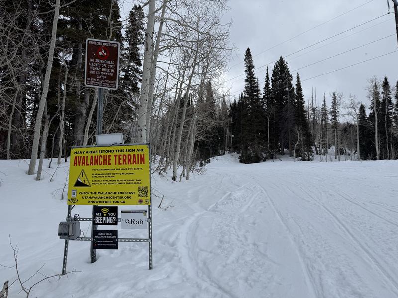 The Guardsman Pass trailhead is equipped with a sign alerting of Avalanche Terrain in the area and a verification system to test your transceiver is transmitting a signal.
While riding, the group observed numerous avalanches. During the day, at least one rider got stuck in the deep snow, and while other members of the group helped him to get unstuck, they noted how loose and sugary the underlying layers were below the upper snowpack. They knew that this weak layer was responsible for all the recent avalanches in the area they had observed, and they confirmed their decision to stay off steep terrain.
Near the end of the day, the group took a break from riding and regrouped. They noted that the day was “euphoric”, the weather was nice, and the fresh powder was phenomenal. They decided they would have one more session around the basin before riding back to the trailhead. They noted that the area they were riding in had a slope that had not avalanched during the storm. The group dispersed and enjoyed more fresh snow. When they regrouped, they noticed that one person was missing. They backtracked to find the rider and spotted a fresh avalanche that had overrun the area they were previously riding in. It is estimated that roughly 10 minutes had passed since they last saw the missing rider. They immediately called 911 to request assistance and began a transceiver search of the debris. The debris pile was very large, and they did not pick up a transceiver signal. This became alarming as they combed the debris, and still did not pick up a transceiver signal. After several minutes of searching, someone spotted the rider's snowbike in the debris, which confirmed their fears that he had been caught. Members of the group began spot-probing the area near the bike. The group continued searching for a transceiver signal but never found one.
Wasatch County Search and Rescue and AirMed responded to the accident site. When they arrived, it was getting dark, and they determined that avalanche mitigation would be needed to ensure rescuer safety during the search of the debris. The rescue effort was halted for the night. The following morning, Wasatch County Search and Rescue, Wasatch Backcountry Rescue, Brighton Ski Patrol, and the Department of Public Safety resumed rescue efforts. Avalanche mitigation was performed to reduce avalanche exposure for rescue workers. The victim was located by an avalanche dog. He was buried roughly 2 feet below the snow surface.
The victim was wearing an avalanche transceiver, but it was not turned on. He was wearing an avalanche airbag, with the trigger armed, but the airbag had not been deployed.
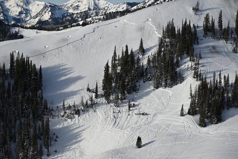
Caribou Basin is a high-elevation drainage that runs east to west. It is located between Snake Creek and Lavina Creek, west of Midway, UT. The narrow basin has short, steep, north-facing slopes that are prone to frequent avalanching during the winter months. The avalanche occurred on a northeast-facing slope at 9600 feet. The starting zone is a predominantly planar 36-degree slope with a distinct, very steep convexity mid-slope where the slope angle increases to more than 40 degrees. Looking down the slope, the left side has a band of old-growth trees, and the right side has a near-vertical rock band with a 15-25-foot-tall cliff. The runout is free of vegetation but has a notable bench and terrain feature on the looker's left side below the trees that deflects debris to the right into low-angle terrain. On the south-facing side of the ridge is a low-angle slope with sparse trees and sagebrush. This creates a high-volume fetch area of snow for wind to transport and deposit on the leeward side of the ridge.
This area is categorized as ‘Challenging’ using the Avalanche Terrain Exposure Scale. Challenging terrain is defined by ‘exposure to well-defined avalanche paths, starting zones, terrain traps, or overhead hazard. Options exist to reduce or eliminate exposure with careful routefinding.’
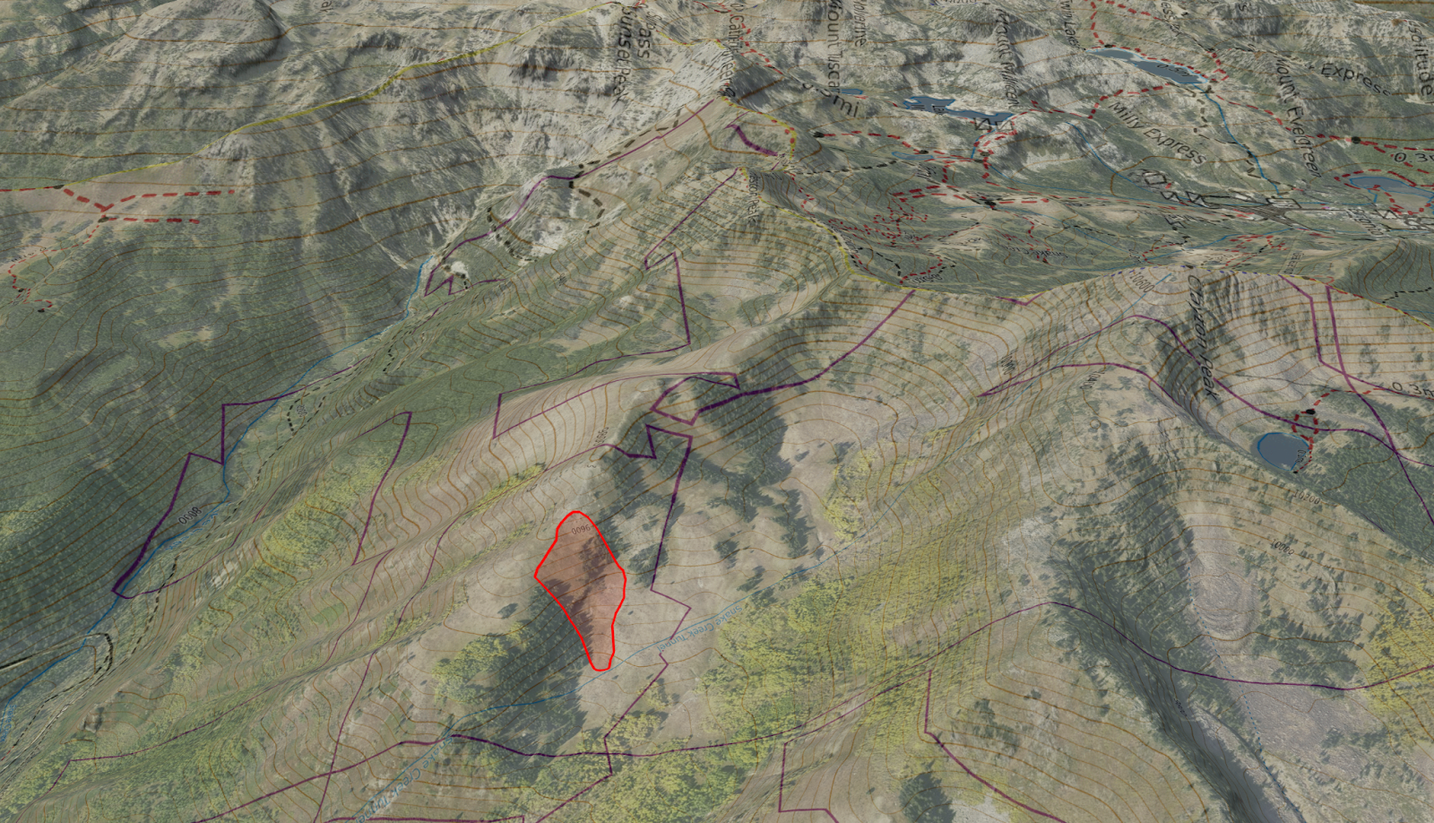 The avalanche occurred on the far eastern extent of ‘Rochester Ridge’.
 Caribou Basin has steep slopes and wide, low-angle meadows. The red polygon marks the avalanche and its debris.
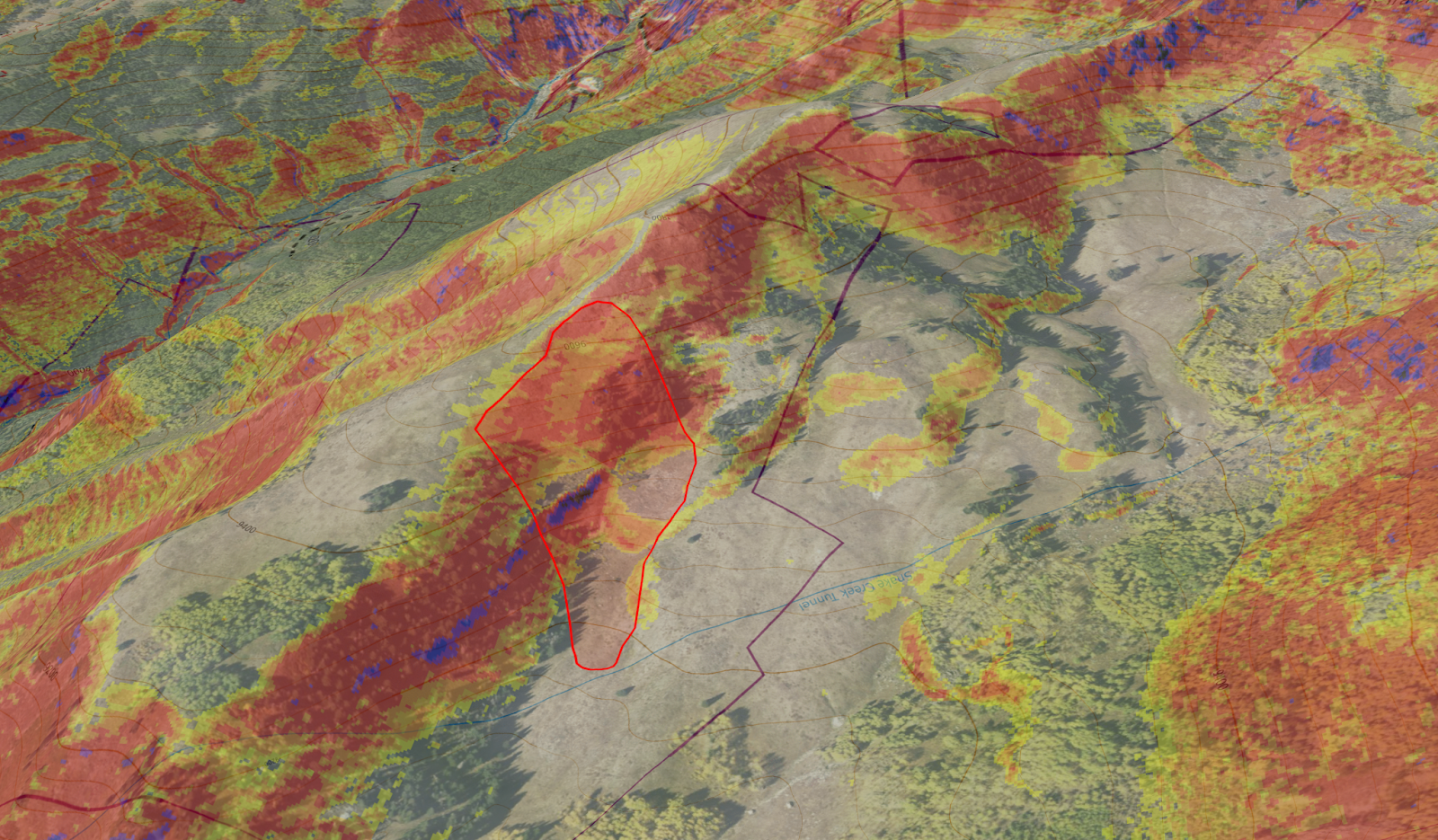
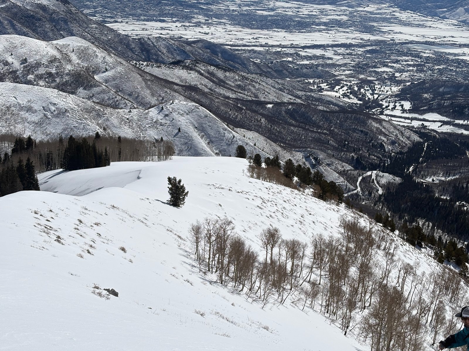 The south-facing side of the ridge from where the avalanche occurred is a large fetch area where snow was stripped and deposited on the lee side of the ridge.
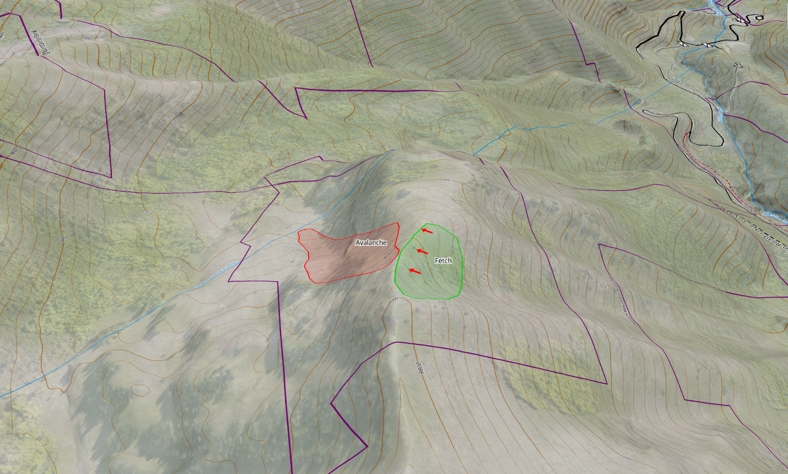
The green polygon represents the large fetch area where wind stripped snow from the south-facing slope and drifted it into the northeast-facing starting zone.
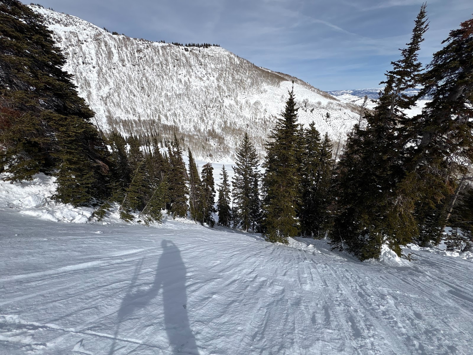
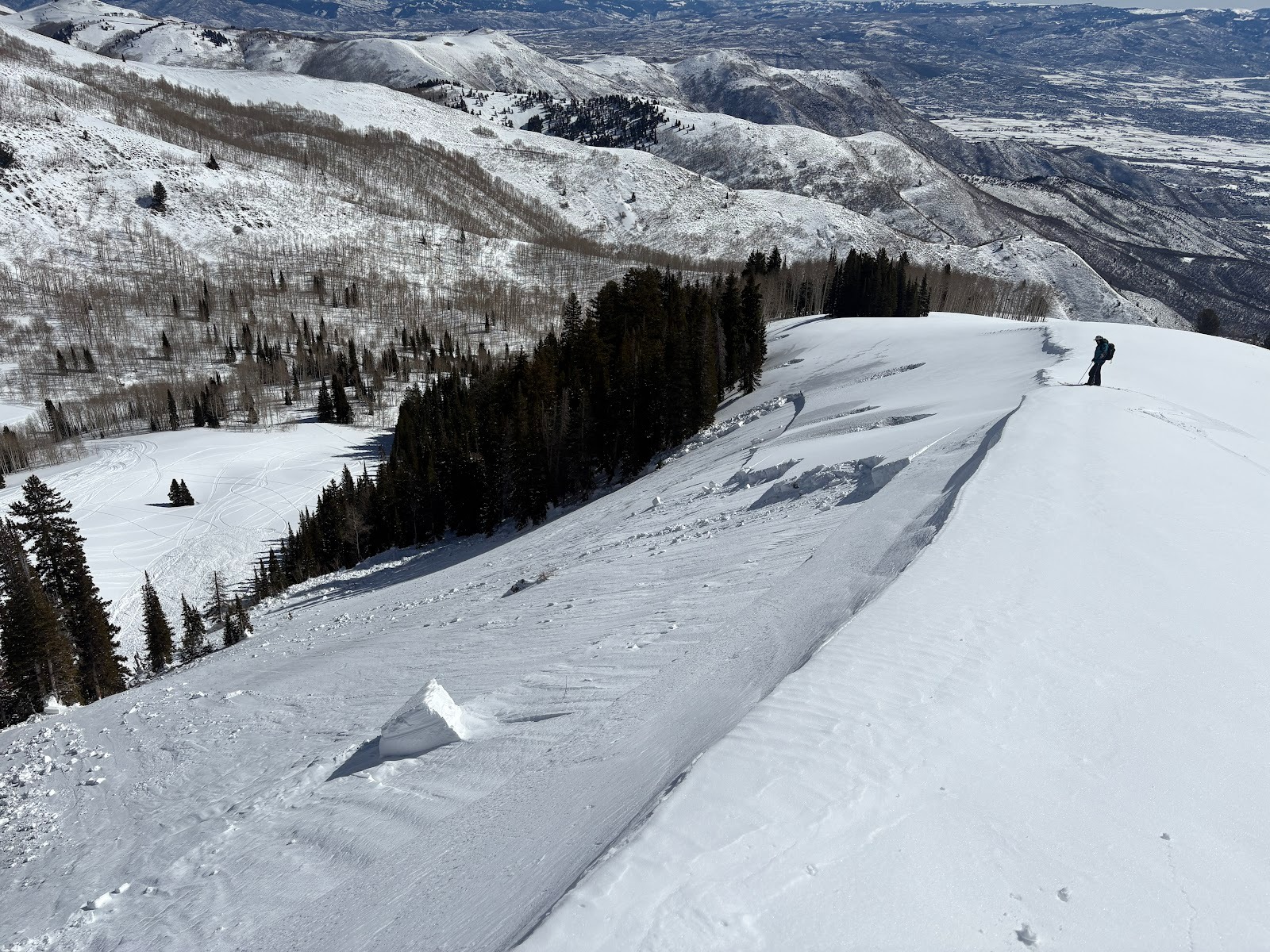 Looking down the slope. The starting zone is a large, planar slope with no vegetation.
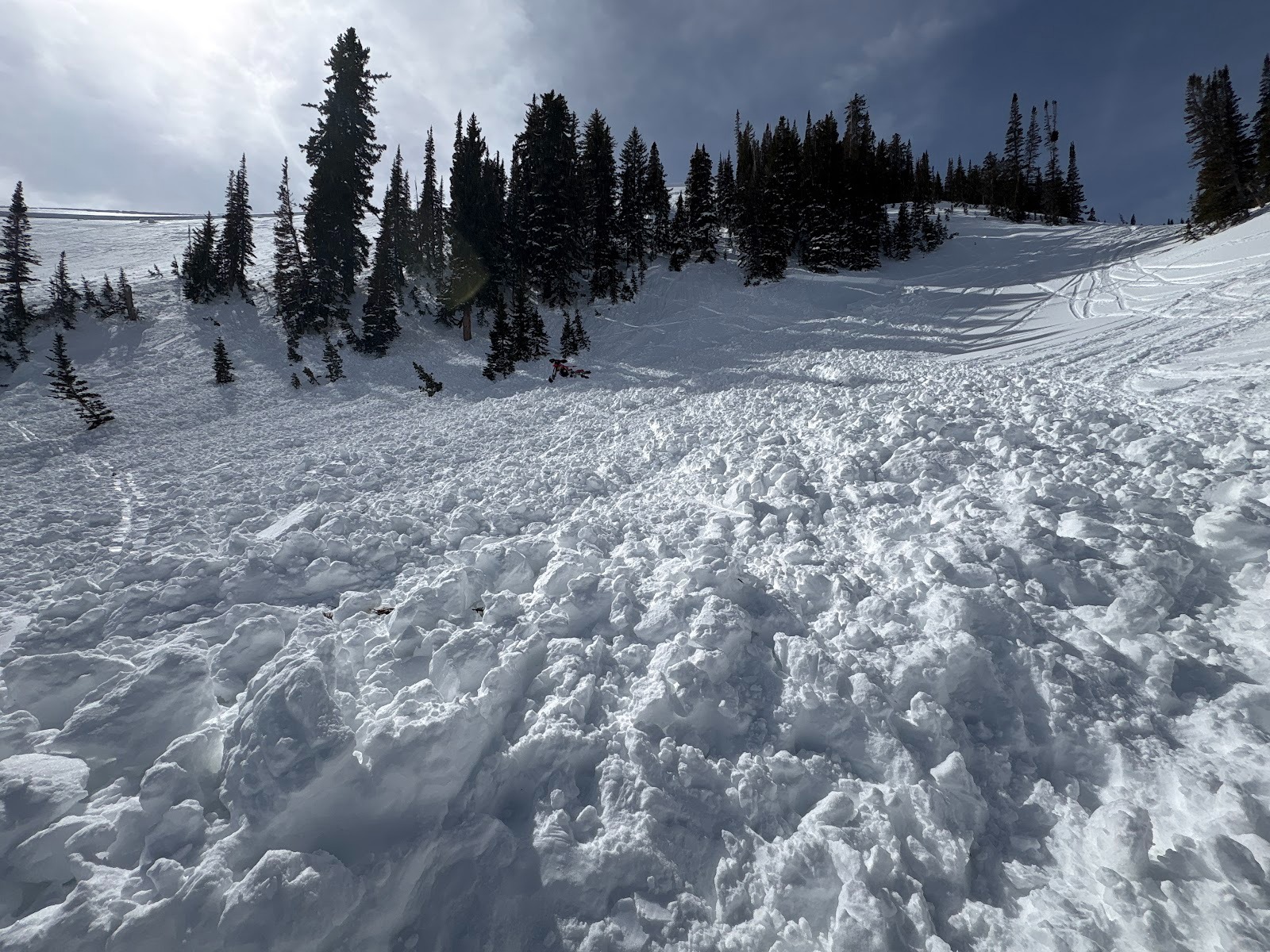
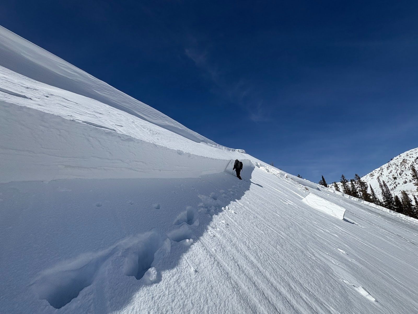 The crown measured 2-3 feet thick and roughly 475 feet wide.
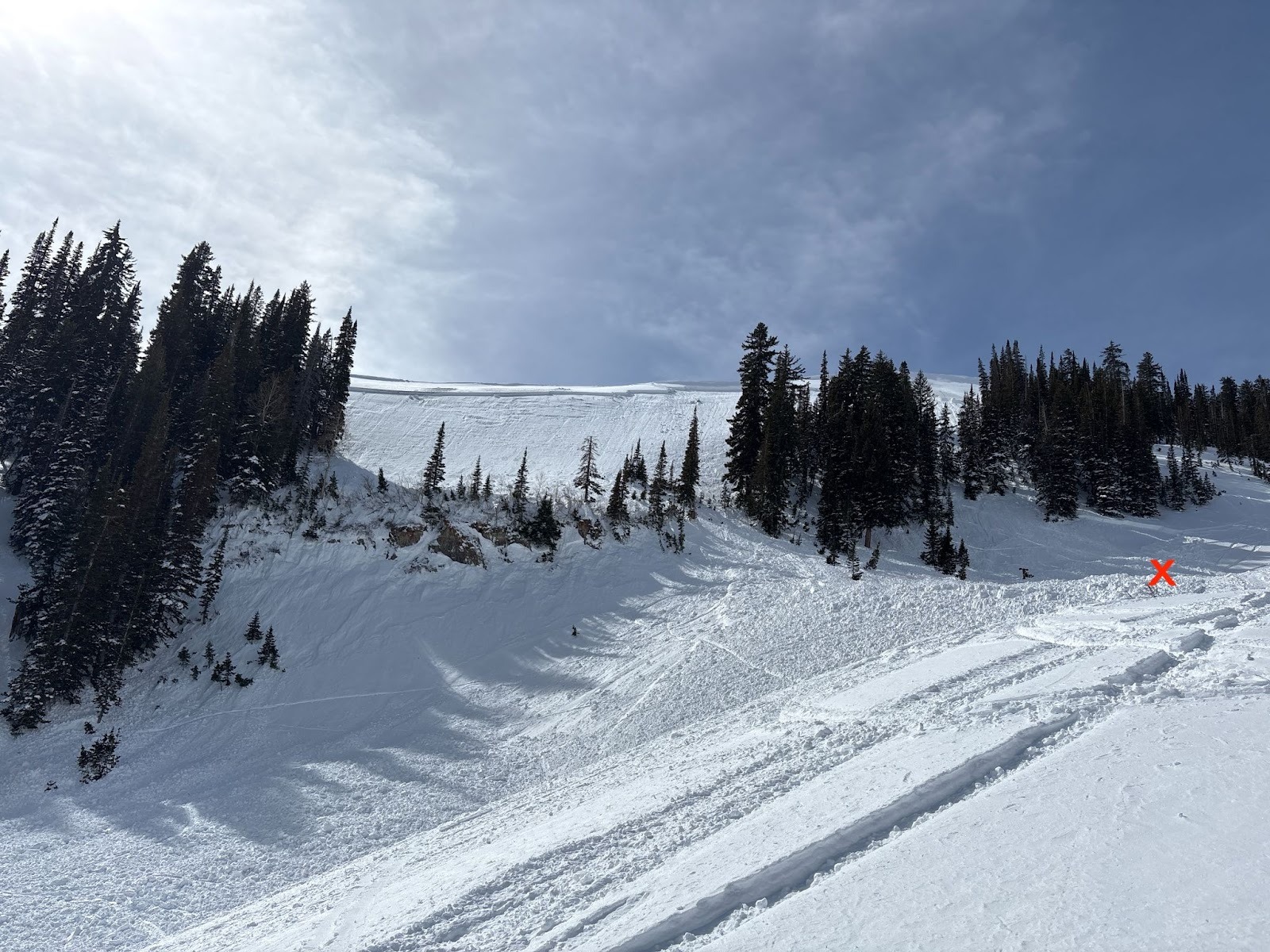 Looking up the slope. The victim was buried below the stand of trees on the right, where the slope benches. The red ‘X’ indicates the approximate burial location.
 The victim was buried beneath this stand of trees. His track suggests that he rode into this area, triggered the avalanche, and was carried through the trees.
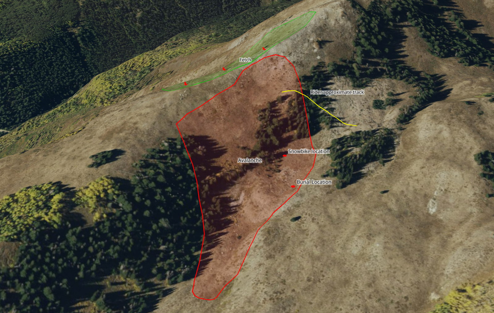 Diagram of burial location and approximate line of the victim’s track into the starting zone.
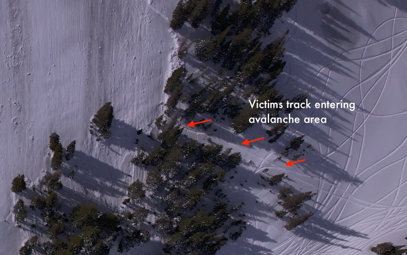
Based on the burial locations of the victim and the snowbike, along with photos of the tracks provided by the party, it appears the victim climbed through the trees into the start zone. There, he likely triggered the avalanche, was carried down through the trees, and was fully buried.
 The victim was buried approximately 100 feet downhill from his snowbike.
After a stormy start to January, a strong ridge of high pressure moved into the Western United States. This prolonged period of clear weather allowed the snow surface to transform into a layer of weak, sugary, faceted snow. The Utah Avalanche Center had documented this layer across all forecast zones throughout the state. In mid-February, a series of powerful storms was forecast to impact the state. The Utah Avalanche Center began messaging in anticipation of changing avalanche conditions and the potential for dangerous backcountry conditions. On February 16, the Utah Avalanche Center issued an Avalanche Watch, alerting the public to potentially dangerous avalanche conditions developing in the backcountry in the near future. On February 18, an Avalanche Warning was issued, urging people to avoid avalanche terrain.
From January 9 to January 28, the Brighton SNOTEL site, located 2.2 miles to the northwest of the accident site, did not record any precipitation. On January 29, a very small storm brought 1 inch of snow and 0.4 inches of Snow Water Equivalent (SWE). This did not change overall avalanche conditions. The dry pattern persisted until February 10, when a series of small storms brought 7 inches of snow and 1 inch of SWE. This storm provided a glimpse of how weak the old surface snow had become, with numerous human and remotely-triggered avalanches reported.
The first in a series of storms entered the area on February 17. The bulk of the storm moved in on February 18 and lasted through February 20. During this period, the Brighton SNOTEL site recorded 2.1 inches of SWE. By February 20, the site had recorded 3 inches of SWE. Nearby, Brighton Ski Patrol maintains a manual snow study site and recorded 42 inches of snow and 3.58 inches of snow water equivalent during the storm event. The storm began to clear out on February 20, and a weekend with clear weather was forecast.
The wind data is from Alta-Mt. Baldy at 11,066 ft. The wind site is located 4.5 miles WSW from the accident site. During the storm event, periods of moderate, strong, and extreme wind were recorded predominantly from the south and west. This contributed to the overall thickness and hardness of the avalanche.
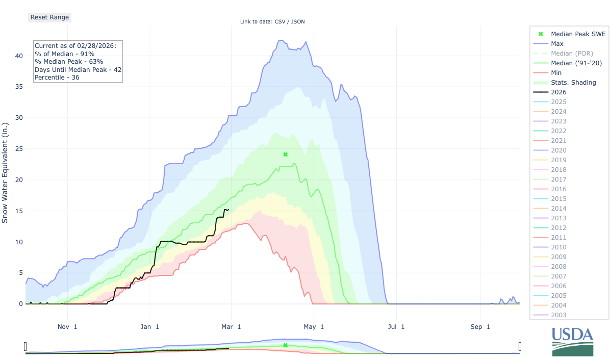
This total SWE graph from the Brighton SNOTEL site shows the prolonged period of no accumulated precipitation followed by the series of storms where 3 inches of SWE accumulated during the event.
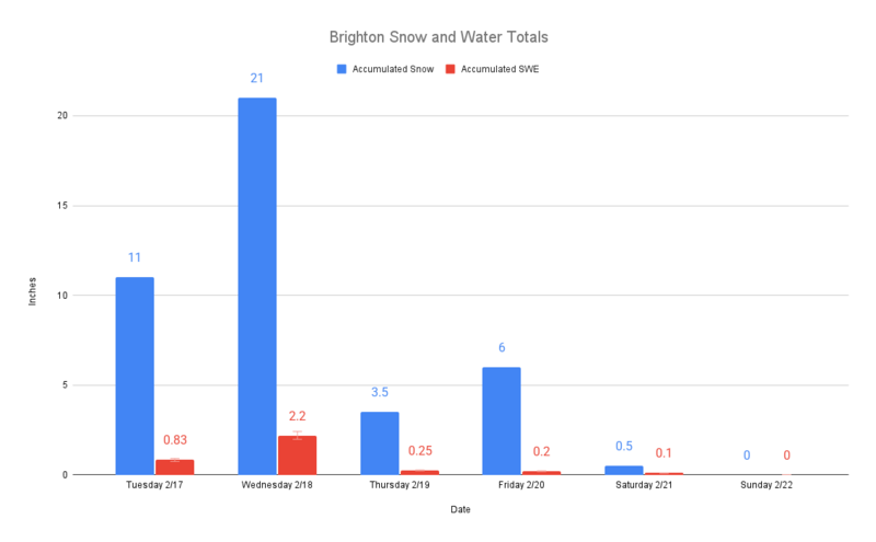
Recordings from Brighton Ski Patrol. 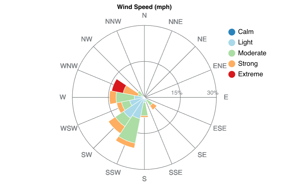
Wind data is from Alta-Mt. Baldy from February 17 to February 22, 2026.
The storm cycle was significant. Using the Brighton SNOTEL site to compare with the Historical Storm Distribution of Snow Water Equivalent from 1985-2026, the one- and three-day SWE accumulations place this storm period in the 99th percentile. The 7 and 10-day SWE accumulations place this storm period in the 95th percentile.
-
1- Day SWE: Feb18-19 1.9 inches- 99th percentile
-
3- Day SWE: Feb 17-20 2.8 inches - 99th percentile
-
7- Day SWE: Feb 15-22 3.0 inches - 95th percentile
-
10- Day SWE: Feb 12-22 3.1 inches - 95th percentile
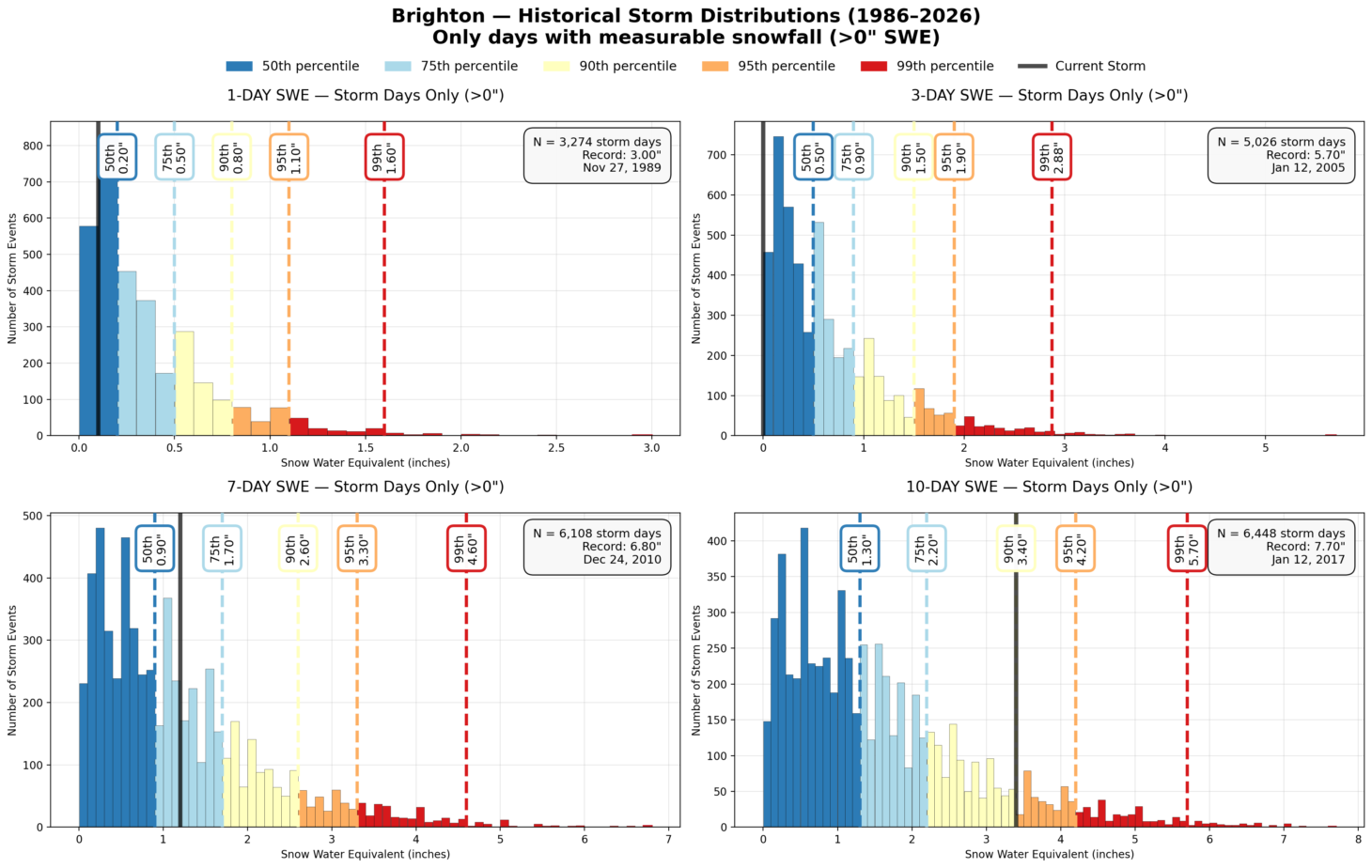
SNOTEL Storm Tracker is an Avalanche Forecasting Tool to view historical storm distributions.
The avalanche occurred on a northeast-facing slope at 9640 feet. The crown measured 2-3 feet thick and more than 475 feet wide. The slab consisted of several hard layers of recent storm snow and wind-drifted snow from the mid-February storm cycle. The avalanche failed on a layer of depth hoar that developed during a prolonged period of clear weather in January. The bed surface was a slick ice crust that formed during a widespread rain-on-snow event on December 24. The avalanche danger for that area was rated CONSIDERABLE that day, with a Special Avalanche Bulletin warning that “With improving weather moving in for the weekend, avalanche accidents are likely in the backcountry.”
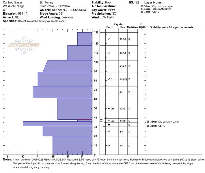
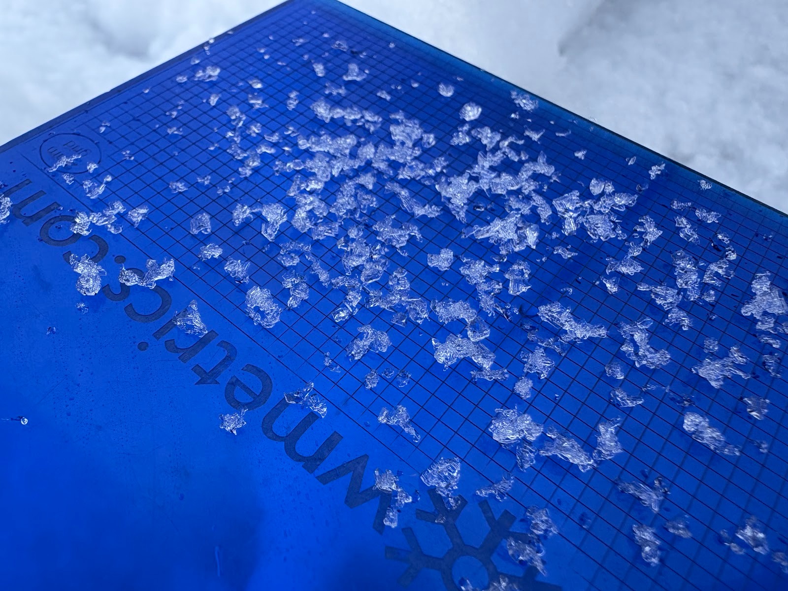 The avalanche failed on a layer of depth hoar.
Key takeaways from this event:
- Before leaving the trailhead for the day, it is important to ensure that everyone in the group is wearing an avalanche transceiver, that they have turned it on, have adequate battery life to perform a search, and know how to use it. In this accident, the party ensured everyone had the equipment, but did not check that each transceiver was transmitting a signal before leaving the trailhead.
- It is common when recreating on snow machines for groups to split up and ride in their own area before regrouping. When a group is riding near or in avalanche terrain, group members should maintain visual contact even when spread out. This ensures that if someone is caught, you can begin the search exactly where you last saw the person in the avalanche.
At the Utah Avalanche Center, we strive to learn from every avalanche incident and share insights to help others avoid similar accidents. We have all experienced close calls and understand how easily mistakes can happen. Our goal with this report is to provide a valuable learning opportunity, and we all aim to learn from accidents like this, without in any way pointing fingers at victims. Thank you to Wasatch County Search and Rescue, Wasatch Backcountry Rescue, Brighton Ski Patrol, AirMed, the Department of Public Safety, and the Wasatch County Sheriff's Office for providing closure to this individual's family and friends.
Our heartfelt condolences go out to the victim's family, friends, and all those in the community affected by his loss.


