| During the month of April, Mark Miller will donate $75 to the charity of your choice (5 to chose from, including the Utah Avalanche Center!) Mark Miller Subaru has raised over $300k in the previous 6 Do Good Feel Good events. More Info here |  |
| During the month of April, Mark Miller will donate $75 to the charity of your choice (5 to chose from, including the Utah Avalanche Center!) Mark Miller Subaru has raised over $300k in the previous 6 Do Good Feel Good events. More Info here | |
| Advisory: Uintas Area Mountains | Issued by Craig Gordon for Monday - April 6, 2015 - 6:16am |
|---|
 |
special announcement We've wrapped up forecasting for the winter and next week at this time, I'll have my toes in white sand and blue Caribbean water. However, I couldn't leave without thanking a truly awesome cast of characters. Partnerships are huge to the western Uinta advisory program and both the Heber-Kamas and Evanston Ranger Districts are instrumental in supplying field partners and in-kind support. First and foremost is the incredible information we get from Ted Scroggin. He has a lot on his plate, but still finds the time to get on the snow and submit snow and weather observations that help the accuracy of this program which ultimately save lives. Ted knows the Uinta's like no other and we are truly grateful to have such a high caliber forecaster on our team... he is truly the glue that holds this program together. Also, I would be remiss if I didn't thank Trent Meisenheimer, Cody Hughes, Tyler St. Jeor and Andy VanHouten who devoted a ton of energy to our sled specific avy awareness classes. Also, John Garofalo's weekly snowpit profiles are simply amazing and Michael Janulaitis info was top-notch this year! In addition, many thanks to the Park City Powder Cats (PCPC), not only for all the snow and avalanche information and for the great professional dialog during times of heightened avalanche danger, but also for your very generous donations to the UAC. The Powdercats host our sled specific avalanche classes and this year donated two days of cat skiing with proceeds going to the avalanche center. Many thanks to Ron Baldis, Johnny Adolphson, Jason Boyer and the amazing PCPC crew... what a first class operation! Also, hi-end, state-of-the-art sleds make all the difference, allowing us to visit more terrain and issue more accurate advisories. We couldn't do this with out the great support from Tri-City Performance and Polaris along with Weller's Recreation and BRP/Ski-doo.Adolphson, and Jason Boyer Click here for a short viddy shout-out giving huge thanks to all of our great partners for helping to make this program so successful! In addition, the National Weather Service helped us maintain a total of six weather stations. Many thanks to Al Martinelli, Greg Wallace, and Larry Dunn for making this happen. And finally, thanks to all of you who helped support this program by attending our annual fundraisers and classes and by submitting snow and avalanches observations.
|
 |
current conditions Archived avalanche advisories from the 2014-15 season are found here. Click here for recent trip reports. Click here for real-time temperatures, snowfall, and winds.
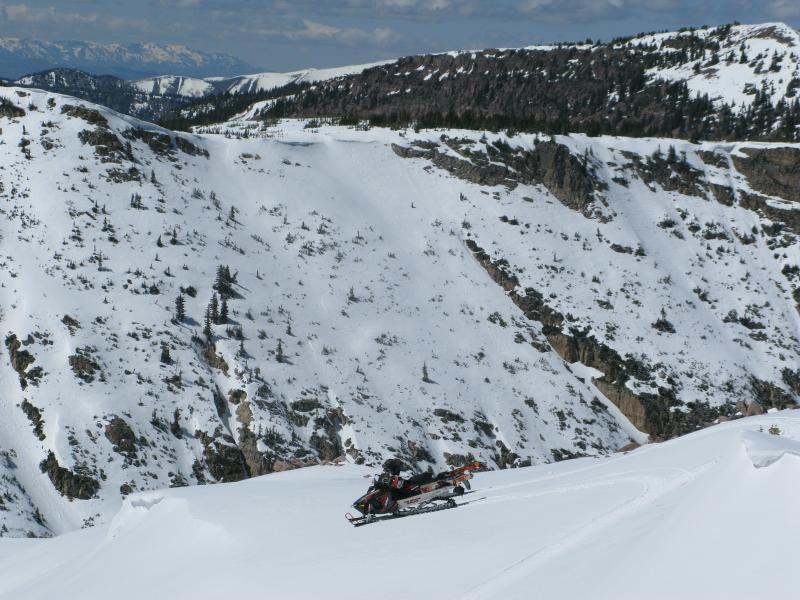
Not a bad payoff. A couple bucks worth of gas...
... allows us to maintain our weather stations
... provides million dollar views
... and delivers us to tattoo-worthy snow.
|
 |
recent activity Archived avalanche activity is found here |
| type | aspect/elevation | characteristics |
|---|


|

|
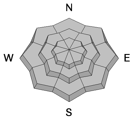
LIKELIHOOD
 LIKELY
UNLIKELY
SIZE
 LARGE
SMALL
TREND
 INCREASING DANGER
SAME
DECREASING DANGER
|
|
description
In general you can count on several types of avalanche conditions in the spring. Whenever we get a storm the avalanche danger will rise, as the new snow might not bond well to the existing hard, slick crust it falls on. As always, recent avalanche activity as well as cracking and collapsing of the snowpack are dead giveaways the snow is unstable. Even if these clues don’t present themselves, be sure to do some tests on smaller slopes that are similar in aspect, elevation and slope angle to what you want to ride on. Choose test slopes that have minimal consequences, especially after a significant snowfall. A well placed slope cut will give you a good feel for the stability of the slope. If there is much wind associated with the storm or if there is snow available for transport before it gets cooked into place, expect to find potentially unstable wind slabs on leeward slopes.
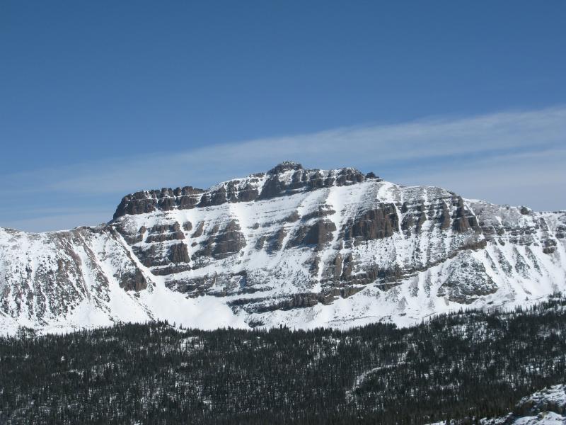
I shot this picture on Friday April 3rd, of Upper Weber Canyon whilst perched high in the saddle between Bald Mountain and Reids Peak. The lack of snow for the beginning of April is unprecedented.
|
| type | aspect/elevation | characteristics |
|---|

|
|
LIKELIHOOD
LIKELY
UNLIKELY
SIZE
LARGE
SMALL
TREND
INCREASING DANGER
SAME
DECREASING DANGER
|
|
description
Wet slides and sluffs are pretty easy to manage. As the day wares on and the snow heats up, like clockwork, wet avalanches will become more widespread on steep, sunny slopes. If you're feeling like an ant under a magnifying glass... so is the snow. During the heat of the day, steer clear of terrain traps like gullies and road cuts, where even a small slide can pile up cement-like debris very deeply. |
| general announcements Remember your information can save lives. If you see anything we should know about, please participate in the creation of our own community avalanche advisory by submitting snow and avalanche conditions. You can call me directly at 801-231-2170, email [email protected], or email by clicking HERE This is a great time of year to schedule a free avalanche awareness presentation for your group or club. You can contact me at 801-231-2170 or email [email protected] Donate to your favorite non-profit –The Utah Avalanche Center. The UAC depends on contributions from users like you to support our work. Benefit the Utah Avalanche Center when you buy or sell on ebay - set the Utah Avalanche Center as a favorite non-profit in your ebay account here and click on ebay gives when you buy or sell. You can choose to have your seller fees donated to the UAC, which doesn't cost you a penny. Utah Avalanche Center mobile app - Get your advisory on your iPhone along with great navigation and rescue tools. The information in this advisory is from the US Forest Service which is solely responsible for its content. This advisory describes general avalanche conditions and local variations always occur. See y'all back here when the snow starts flying! |


_0.jpg)