| During the month of April, Mark Miller will donate $75 to the charity of your choice (5 to chose from, including the Utah Avalanche Center!) Mark Miller Subaru has raised over $300k in the previous 6 Do Good Feel Good events. More Info here |  |
| During the month of April, Mark Miller will donate $75 to the charity of your choice (5 to chose from, including the Utah Avalanche Center!) Mark Miller Subaru has raised over $300k in the previous 6 Do Good Feel Good events. More Info here | |
| Advisory: Uintas Area Mountains | Issued by Craig Gordon for Sunday - January 11, 2015 - 5:41am |
|---|

|
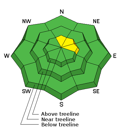
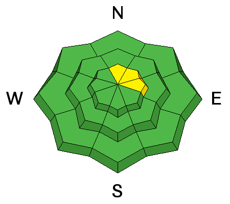
bottom line Today you'll find pockets MODERATE avalanche danger on steep, rocky, upper elevation slopes facing the north half of the compass and human triggered avalanches are possible. While not widespread and making up a small portion of the terrain available to ride in, once triggered, avalanches still have potential to break to the ground, especially on slopes facing North, Northeast, and East. All other terrain offers a LOW avalanche danger.
|
 |
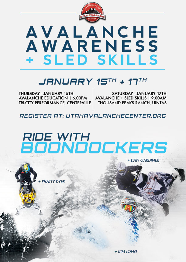
special announcement We still have a slots open. For more info and to register click HERE.
We just released an exciting, new avy safety video designed specifically for snowmobilers - Knowledge is Powder. https://vimeo.com/113677686 NEW THIS YEAR: You can now receive advisories by email for each region in the state. Go here for details. |
 |
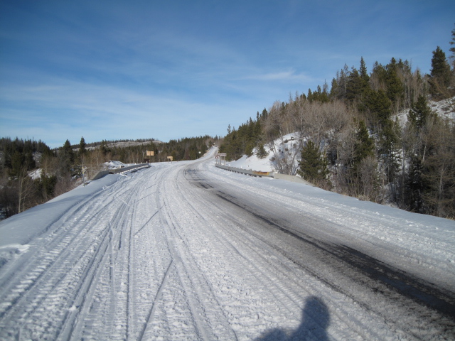
current conditions It's mostly cloudy and kinda gloomy, but there's light snow falling, and a weak storm drifted through the region early this morning, depositing 2" of medium density snow. Temperatures are in the mid 20's, winds are light and variable except for on the highest peaks where they're blowing out of the west at speeds of 15-20 mph. Riding and turning conditions are a bit hit or miss, but if you hunt around, you'll still find patches of soft snow in upper elevation wind sheltered terrain.
Trailheads got baked this week and lower elevation terrain took a hard hit. Click here for real-time temperatures, snowfall, and winds.
|
 |
recent activity No recent avalanche activity to report |
| type | aspect/elevation | characteristics |
|---|

|
|
LIKELIHOOD
 LIKELY
UNLIKELY
SIZE
 LARGE
SMALL
TREND
 INCREASING DANGER
SAME
DECREASING DANGER
|
|
description
In a chronological sense, the snowpack is in it's early teenage years, and this delicate medium we love to ride on in the winter has gone through a plethora of changes in the past few weeks. It's been battered by strong east winds, then west winds, and finally a big warm up with near record high temperatures this week. Wow... tough neighborhood to grow up in! In general though, the snowpack is relaxed, wornout, and a bit tired, sorta like me this time of year. But of course, you wanna know is it still possible to trigger an avalanche. Well I'll tell ya.... while the vast majority of our terrain has a Low avalanche danger, I still think you could trigger a pocket that breaks to the ground. Steep, rocky, upper elevation slopes facing the north half of the compass are the most likely suspects. Still wanna ride radical terrain, but don't want to deal with an unpredictable avalanche dragon? Well it's easy. Simply swing around to slopes facing the south half of the compass or get into terrain you know avalanched during the Solstice storm.
JG does such an awesome job with his pit profiles. The most likely place for an avalanche to fail is in the midpack, near what is labeled decomposing crusts. That's the interface between the old early season snow and the big winter Solstice storm.
Cody Hughes displays a dangerous setup for future avalanches once winter returns.... surface hoar on top of a heat crust... no es bueno.
|
 |
weather Snow showers taper off this morning and I don't think we'll see much more accumulation. West winds blow in the 20's along the high ridges and temperatures climb just a few degrees during the day, maxing out in the upper 20's. Overnight lows dip into the low 20's and snow begins to develop early Monday morning. Monday's storm is looking a little more promising with the potential for 6"-8" of snow by the time it exits the region early Tuesday. High pressure builds for the rest of the week and the models indicate a change in the pattern for late in the weekend, |
| general announcements Remember your information can save lives. If you see anything we should know about, please participate in the creation of our own community avalanche advisory by submitting snow and avalanche conditions. You can call me directly at 801-231-2170, email [email protected], or email by clicking HERE This is a great time of year to schedule a free avalanche awareness presentation for your group or club. You can contact me at 801-231-2170 or email [email protected] Donate to your favorite non-profit –The Utah Avalanche Center. The UAC depends on contributions from users like you to support our work. Benefit the Utah Avalanche Center when you buy or sell on ebay - set the Utah Avalanche Center as a favorite non-profit in your ebay account here and click on ebay gives when you buy or sell. You can choose to have your seller fees donated to the UAC, which doesn't cost you a penny. Utah Avalanche Center mobile app - Get your advisory on your iPhone along with great navigation and rescue tools. The information in this advisory is from the US Forest Service which is solely responsible for its content. This advisory describes general avalanche conditions and local variations always occur. I will update this advisory by 7:00 AM Wednesday Jan. 14, 2015. |


_0.jpg)