| During the month of April, Mark Miller will donate $75 to the charity of your choice (5 to chose from, including the Utah Avalanche Center!) Mark Miller Subaru has raised over $300k in the previous 6 Do Good Feel Good events. More Info here |  |
| During the month of April, Mark Miller will donate $75 to the charity of your choice (5 to chose from, including the Utah Avalanche Center!) Mark Miller Subaru has raised over $300k in the previous 6 Do Good Feel Good events. More Info here | |
| Advisory: Uintas Area Mountains | Issued by Craig Gordon for Sunday - November 30, 2014 - 5:48am |
|---|

|
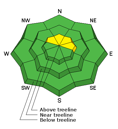
bottom line While not widespread, pockets of MODERATE avalanche danger exist on steep, upper elevation slopes facing the north half of the compass and human triggered avalanches are possible. Remember- triggering even a small slide will expose stumps and rocks, instantly ruing your day and quite possibly your season. Out of the wind zone the avalanche danger is generally LOW.
|
 |
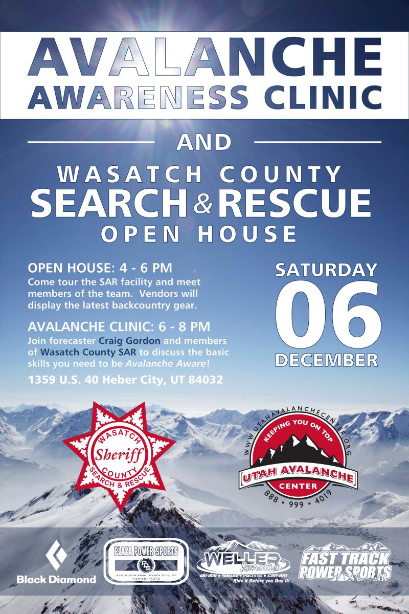
special announcement Please join us next Saturday Dec. 6th in Heber-
NEW THIS YEAR: You can now receive advisories by email for each region in the state. Go here for details.
|
 |
current conditions A weak cold front slid through the region overnight, leaving a dusting of snow and dropping temperatures into the mid and upper 20's. Southwest winds calmed down around 8:00 last night and are now blowing 15-25 mph along the ridges. With only two feet of total snow on the ground it's still pretty thin out there and you gotta think light if you're getting off an established trail or road. Our Uinta weather station network is up and running. Current winds, snowfall, and temperatures can be found here.
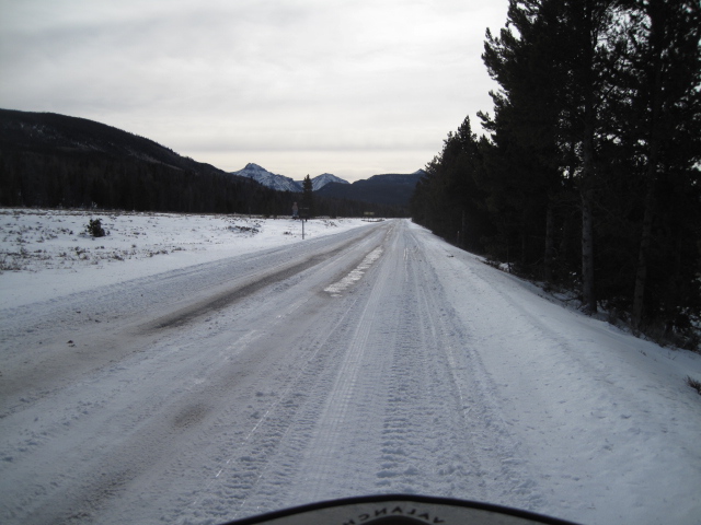
Lower elevation terrain has taken a hard hit this week
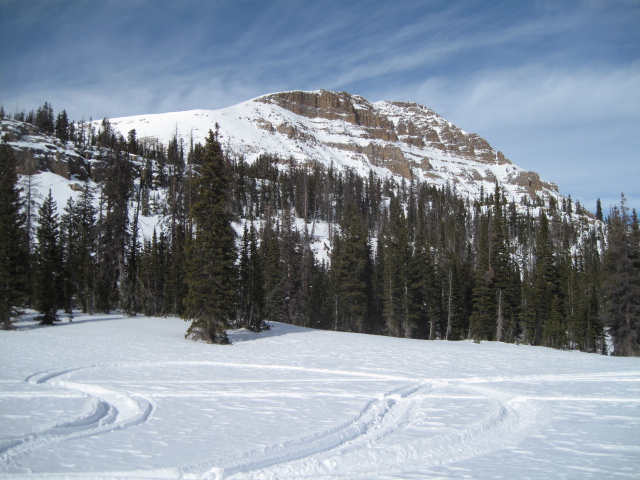
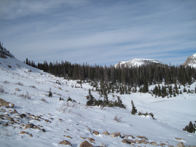
Upper elevation terrain is white from far...
but far from white.
|
 |
recent activity No recent avalanche activity to report. |
| type | aspect/elevation | characteristics |
|---|

|
|
LIKELIHOOD
 LIKELY
UNLIKELY
SIZE
 LARGE
SMALL
TREND
 INCREASING DANGER
SAME
DECREASING DANGER
|
|
description
It's been pretty quiet on the eastern front and for good reason.... the snowpack is rather well behaved. The warm temperatures this week have been a big help, allowing the snowpack to settle and gain strength. Sure, in the short term the trailheads are melting out and getting around is a pain in the neck, but in the long term the warmth is allowing the weak early snow to gain a bit of strength. The Uinta's are thin and rocky and the snowpack lacks continuity... it's what we call "pockety" and it's not all that connected. What that means is you'd really have to go out of your way to trigger an avalanche this weekend. Remember though, triggering even a small slide will immediately ruin your day if you go for a body beating ride through rocks and stumps. The most likely terrain to trigger a slide is gonna be steep, shady, upper elevation terrain facing the north half of the compass.
|
 |
weather A weak cold front brings occasional light snow to the range with a couple inches possible before tapering off late tonight. High temperatures climb into the low to mid 30's and southwest winds remain pretty reasonable... in the 15-25 mph range. Partly cloudy skies and warm for Monday. Moisture increases across the region again Tuesday night through Wednesday bringing another round of snow. |
| general announcements Remember your information can save lives. If you see anything we should know about, please participate in the creation of our own community avalanche advisory by submitting snow and avalanche conditions. You can call me directly at 801-231-2170, email [email protected], or email by clicking HERE This is a great time of year to schedule a free avalanche awareness presentation for your group or club. You can contact me at 801-231-2170 or email [email protected] Donate to your favorite non-profit –The Utah Avalanche Center. The UAC depends on contributions from users like you to support our work. Benefit the Utah Avalanche Center when you buy or sell on ebay - set the Utah Avalanche Center as a favorite non-profit in your ebay account here and click on ebay gives when you buy or sell. You can choose to have your seller fees donated to the UAC, which doesn't cost you a penny. Utah Avalanche Center mobile app - Get your advisory on your iPhone along with great navigation and rescue tools. The information in this advisory is from the US Forest Service which is solely responsible for its content. This advisory describes general avalanche conditions and local variations always occur. I will update this advisory by 7:00 AM Wednesday Dec. 3, 2014. |


_0.jpg)