| Please join us at the 23rd annual Black Diamond Fall Fundraiser Party Thursday Sept 15. Tickets are on sale now here, at the Black Diamond store & at REI. Special bonus raffle for online ticket purchasers! |
| Please join us at the 23rd annual Black Diamond Fall Fundraiser Party Thursday Sept 15. Tickets are on sale now here, at the Black Diamond store & at REI. Special bonus raffle for online ticket purchasers! |
| Advisory: Skyline Area Mountains | Issued by Brett Kobernik for Friday - December 18, 2015 - 6:52am |
|---|


|
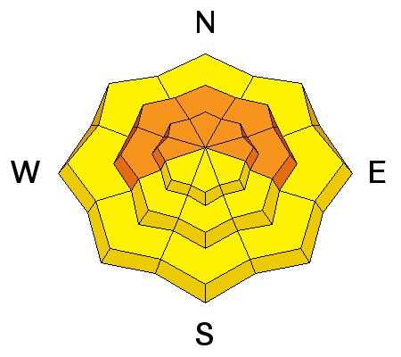
bottom line Weak old snow from November with a large amount of new snow added on top of it along with recent stronger winds has created a CONSIDERABLE avalanche danger in the mid and upper elevation terrain. The old weak snow will continue to make the avalanche conditions quite dangerous through the weekend. Human triggered avalanches are likely. Continue to avoid the steeper terrain in the mid and upper elevation terrain that faces west, north and east.
|
 |
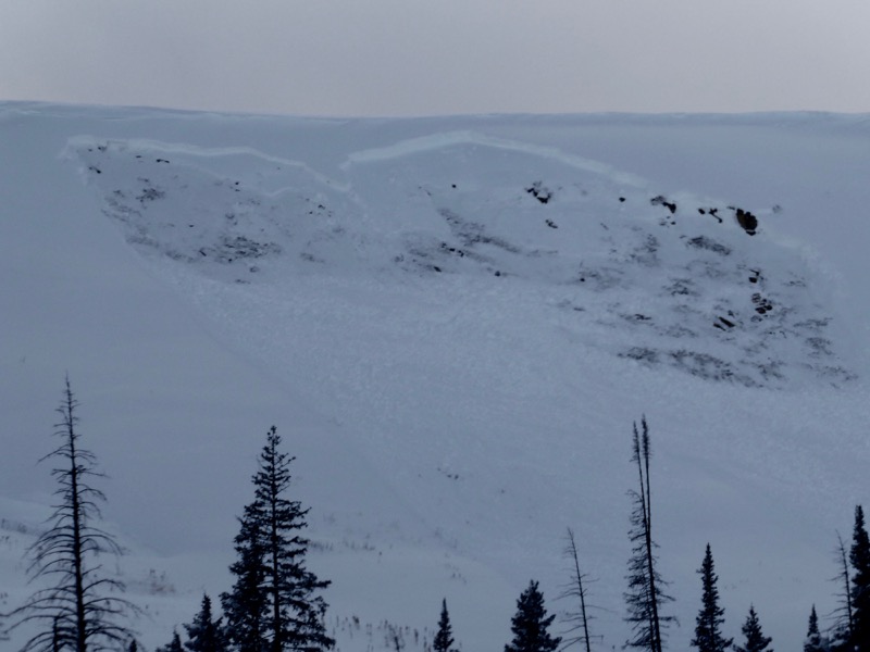
recent activity I observed a number of avalanches on Thursday that released naturally early in the morning from a bump in wind speeds and a few inches of new snow. These all broke on weak snow near the ground that fell in November.
|
| type | aspect/elevation | characteristics |
|---|

|
|
LIKELIHOOD
 LIKELY
UNLIKELY
SIZE
 LARGE
SMALL
TREND
 INCREASING DANGER
SAME
DECREASING DANGER
|
|
description
The weak snow near the ground will continue to be unstable producing sketchy avalanche conditions through the weekend and perhaps next week as well. |
 |
weather |
| general announcements We will publish full detailed advisories Saturday and Sunday mornings by 7am. We will also be publishing basic avalanche danger ratings & info during the week. If you are getting out into the mountains, we love to hear from you! You can SUBMIT OBSERVATIONS ONLINE or EMAIL US If you would like to have avalanche advisories emailed to you, SIGN UP HERE We can provide basic avalanche awareness presentations for your school, group or club. To enquire, CLICK HERE |