
| During the month of April, Mark Miller will donate $75 to the charity of your choice (5 to chose from, including the Utah Avalanche Center!) Mark Miller Subaru has raised over $300k in the previous 6 Do Good Feel Good events. More Info here |  |
| During the month of April, Mark Miller will donate $75 to the charity of your choice (5 to chose from, including the Utah Avalanche Center!) Mark Miller Subaru has raised over $300k in the previous 6 Do Good Feel Good events. More Info here | |
| Advisory: Salt Lake Area Mountains | Issued by Brett Kobernik for Tuesday - January 20, 2015 - 6:48am |
|---|


|
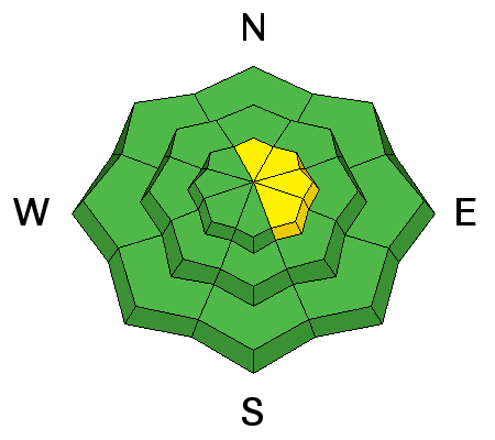
bottom line The overall avalanche danger is LOW in most terrain. There is still a "pockety" MODERATE avalanche danger for recent deposits of wind drifted snow mainly along the lee sides of the mid and upper elevation ridges. Consider consequences of even a small avalanche.
|
 |
special announcement AvaTech-SheJumps Happy Hour |
 |
current conditions Skies are starting to break up this morning and temperatures have dropped into the upper teens. Wind speeds last night were a bit stronger with gusts to near 60 along the highest peaks and moderate speeds along the mid elevation ridges from the west or northwest. The winds have been slowing since about midnight. Snow surface conditions vary greatly and include wind effected snow and melt freeze crusts. There is also some dense settled soft snow in the mid elevation sheltered terrain. |
 |
recent activity There was one small wind slab triggered by a skier on Monday near Murdock Peak. It was 14" deep and around 25' wide. It exposed some rocks after it released indicating that it was a shallow location which probably harbored some faceted snow. |
| type | aspect/elevation | characteristics |
|---|

|
|
LIKELIHOOD
 LIKELY
UNLIKELY
SIZE
 LARGE
SMALL
TREND
 INCREASING DANGER
SAME
DECREASING DANGER
|
|
description
The small avalanche off Murdock demonstrates the type of avalanche problem you'll want to keep in mind for today. With continued moderate wind speeds, we continue to see some drifting of the surface snow which forms these slabs. They may crack out on faceted snow in shallow locations. You may also find these in areas that have a deeper more stable snowpack with just a weak interface between the new wind slab and the previous snow surface. The probability for finding one of these is fairly low. The consequences of these pockets aren't all that great either unless you were to get surprised in exposed terrain above rocks, cliffs or trees. When evaluating your terrain today, continue to anticipate what may happen if you trigger a small pocket and it "bosses you around" a bit. |
 |
weather Skies will continue to clear out and we'll see ridgetop high temperatures in the low 20s. Westerly winds should continue to slow during the day. The high pressure ridge that we've been seeing all winter continues to affect our area well into next week. We'll have a couple of days of cooler weather then a warming trend into next week. It doesn't look like any significant storms for at least a week or so. |
| general announcements Remember your information can save lives. If you see anything we should know about, please participate in the creation of our own community avalanche advisory by submitting snow and avalanche conditions. You can also call us at 801-524-5304, email by clicking HERE, or include #utavy in your tweet or Instagram. If you trigger an avalanche in the backcountry - especially if you are adjacent to a ski area – please call the following teams to alert them to the slide and whether anyone is missing or not. Rescue teams can be exposed to significant hazard when responding to avalanches, and do not want to do so when unneeded. Thanks. Salt Lake and Park City – Alta Central (801-742-2033), Canyons Resort Dispatch (435-615-3322) Snowbasin Resort Dispatch (801-620-1017), Powder Mountain Dispatch (801-745-3772 x 123). Sundance Dispatch (801-223-4150) EMAIL ADVISORY If you would like to get the daily advisory by email you will need to subscribe here. DAWN PATROL Hotline updated daily by 5-530am - 888-999-4019 option 8. Twitter Updates for your mobile phone - DETAILS UDOT canyon closures: LINK TO UDOT, or on Twitter, follow @UDOTavy, @CanyonAlerts or @AltaCentral Utah Avalanche Center mobile app - Get your advisory on your iPhone along with great navigation and rescue tools. Wasatch Powderbird Guides Blog/Itinerary for the Day. Lost or Found something in the backcountry? - http://nolofo.com/ Discount lift tickets are now available at Backcountry.com. Thanks to Ski Utah and the Utah Resorts. All proceeds go towards paying for Utah Avalanche Center avalanche and mountain weather advisories. To those skinning uphill at resorts: it is your responsibility to know the resort policy on uphill travel. You can see the uphill travel policy for each resort here. IMPORTANT: Before skinning or hiking at a resort under new snow conditions, check in with Ski Patrol. Resorts can restrict or cut off access if incompatible with control and grooming operations. Benefit the Utah Avalanche Center when you shop from Backcountry.com or REI: Click this link for Backcountry.com or this link to REI, shop, and they will donate a percent of your purchase price to the UAC. Both offer free shipping (with some conditions) so this costs you nothing! Benefit the Utah Avalanche Center when you buy or sell on ebay - set the Utah Avalanche Center as a favorite non-profit in your ebay account here and click on ebay gives when you buy or sell. You can choose to have your seller fees donated to the UAC, which doesn't cost you a penny. This information does not apply to developed ski areas or highways where avalanche control is normally done. This advisory is from the U.S.D.A. Forest Service, which is solely responsible for its content. This advisory describes general avalanche conditions and local variations always exist. |


