
| During the month of April, Mark Miller will donate $75 to the charity of your choice (5 to chose from, including the Utah Avalanche Center!) Mark Miller Subaru has raised over $300k in the previous 6 Do Good Feel Good events. More Info here |  |
| During the month of April, Mark Miller will donate $75 to the charity of your choice (5 to chose from, including the Utah Avalanche Center!) Mark Miller Subaru has raised over $300k in the previous 6 Do Good Feel Good events. More Info here | |
| Advisory: Salt Lake Area Mountains | Issued by Bruce Tremper for Monday - April 28, 2014 - 6:36am |
|---|

|
bottom line Carefully watch your slope angles today. Stay off of, and out from underneath, slopes approaching 35 degrees or steeper. Especially avoid slopes with recent wind deposits.
|
 |
special announcement We have gone to intermittent avalanche advisory updates for the rest of April. With the expected weekend storm, we will likely update sometime during the weekend, probably Saturday night or Sunday morning. We are not publishing danger ratings because we don't have very good information this time of year. Plus spring avalanche conditions depend directly on the weather, which is inherently very unpredictable in spring. We are still publishing observations so keep them coming if you are getting out in the backcountry! |
 |
current conditions It ain't over till it's over. UDOT at Alta reported another foot overnight and Alta Lifts reported 10 inches, both of about 10% water equivalent with a storm total of about 2 feet. It's 13 degrees at 11,000' with a stiff wind from the west and northwest. It's 18 degrees at 9.500'. It should remain mostly cloudy today with slow clearing. Remember, you can always check current conditions for yourself at the National Weather Service Snow Page.
|
 |
recent activity Two skier triggered avalanches yesterday: Three people were caught when they triggered a slab as they ascended the Hypodermic Needle in Hogum Fork. I'm assuming it was a wind slab and fairly high on the slope, perhaps 10,500'. Everyone is OK but they may have lost some equipment. Another ski party triggered a wind slab on a ski cut on the steep, south facing side of Little Superior around 10,500'. No one caught. Overnight, the automated, infrasonic avalanche sensors in Little Cottonwood Canyon indicated several natural avalanches on the steep, south facing slopes that did not reach the highway. |
| type | aspect/elevation | characteristics |
|---|

|
|
LIKELIHOOD
 LIKELY
UNLIKELY
SIZE
 LARGE
SMALL
TREND
 INCREASING DANGER
SAME
DECREASING DANGER
|
|
description
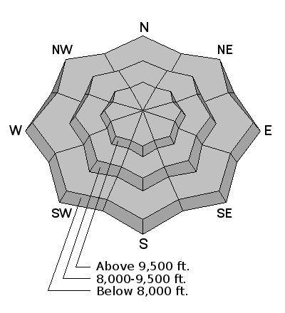
Note: the danger rose is all grey because we are not publishing danger ratings this time of year. These late spring storms often take people by surprise. Winter is winter no matter when you find it. With copious new snow and lots of strong wind from the west and northwest, you can expect to find continued, dangerous slabs within the new snow especially on steep slopes with recent wind deposits. Today is not the day to mess with the steep slopes, especially steep slopes with high consequences. Remember the closed ski areas are not doing any avalanche control so you need to treat them like backcountry. We don't have enough information this time of year to issue danger ratings but the UDOT forecasters think it's Considerable (orange) danger for today.
|
 |
weather The forecast is for another 3 inches of snow today with continued strong wind from the west and northwest 30 mph, gusting to 40. 8,000' temperatures should rise to the mid 20's today and be around 10 degrees on the ridges. Skies should remain mostly cloudy with slow clearing through the day. For the rest of the week, we will have mostly sunny skies with a slow warming trend. Be sure to monitor the latest weather conditions before heading out. Here are a few of my favorite sources: Cottonwood Canyons Forecast from the National Weather Service |
| general announcements Remember your information can save lives. If you see anything we should know about, please participate in the creation of our own community avalanche advisory by submitting snow and avalanche conditions. You can also call us at 801-524-5304 or 800-662-4140, email by clicking HERE, or include #utavy in your tweet or Instagram. If you trigger an avalanche in the backcountry - especially if you are adjacent to a ski area – please call the following teams to alert them to the slide and whether anyone is missing or not. Rescue teams can be exposed to significant hazard when responding to avalanches, and do not want to do so when unneeded. Thanks. Salt Lake and Park City – Alta Central (801-742-2033), Canyons Resort Dispatch (435-615-3322) EMAIL ADVISORY We have switched to a new SLC email advisory system. If you would like to get the daily advisory by email, or if you have been getting the advisory by email since the beginning of the season and wish to continue, you will need to subscribe here. Twitter Updates for your mobile phone - DETAILS UDOT canyon closures: LINK TO UDOT Utah Avalanche Center mobile app - Get your advisory on your iPhone along with great navigation and rescue tools.uned. Lost or Found something in the backcountry? - http://nolofo.com/ To those skinning uphill at resorts: it is your responsibility to know the resort policy on uphill travel. Some allow uphill travel and have guidelines, some don't. Contact the Ski Patrol at each resort for details. IMPORTANT: Before skinning at a resort under new snow conditions, check in with Ski Patrol. Resorts can restrict or cut off access if incompatible with control and grooming operations. Benefit the Utah Avalanche Center when you shop from Backcountry.com or REI: Click this link for Backcountry.com or this link to REI, shop, and they will donate a percent of your purchase price to the UAC. Both offer free shipping (with some conditions) so this costs you nothing! Benefit the Utah Avalanche Center when you buy or sell on ebay - set the Utah Avalanche Center as a favorite non-profit in your ebay account here and click on ebay gives when you buy or sell. You can choose to have your seller fees donated to the UAC, which doesn't cost you a penny. This information does not apply to developed ski areas or highways where avalanche control is normally done. This advisory is from the U.S.D.A. Forest Service, which is solely responsible for its content. This advisory describes general avalanche conditions and local variations always exist. |


