
| During the month of April, Mark Miller will donate $75 to the charity of your choice (5 to chose from, including the Utah Avalanche Center!) Mark Miller Subaru has raised over $300k in the previous 6 Do Good Feel Good events. More Info here |  |
| During the month of April, Mark Miller will donate $75 to the charity of your choice (5 to chose from, including the Utah Avalanche Center!) Mark Miller Subaru has raised over $300k in the previous 6 Do Good Feel Good events. More Info here | |
| Advisory: Salt Lake Area Mountains | Issued by Bruce Tremper for Friday - April 25, 2014 - 1:58pm |
|---|

|
bottom line We have not issued any danger ratings because of little information and very changeable conditions. Watch for instabilities within the new snow by jumping on small, test slopes, digging down with your hands and using a good slope cut before committing to steep slopes.
|
 |
special announcement We have gone to intermittent avalanche advisory updates for the rest of April. With the expected weekend storm, we will likely update sometime during the weekend, probably Saturday night or Sunday morning. We are not publishing danger ratings because we don't have very good information this time of year. Plus spring avalanche conditions depend directly on the weather, which is inherently very unpredictable in spring. We are still publishing observations so keep them coming if you are getting out in the backcountry! |
 |
current conditions Today, we have typical, spring, pre-storm conditions with increasing clouds, increasing southwest ridge top wind and warm temperatures. It's up to the mid 40's at 9,000' with wind blowing 30, gusting to 50 on the high peaks and about half that on most ridge tops. The snow surface is mostly wet and stable. Remember, you can always check current conditions for yourself at the National Weather Service Snow Page.
|
 |
recent activity There's been no significant, recent activity. |
| type | aspect/elevation | characteristics |
|---|

|

|
LIKELIHOOD
 LIKELY
UNLIKELY
SIZE
 LARGE
SMALL
TREND
 INCREASING DANGER
SAME
DECREASING DANGER
|
|
description
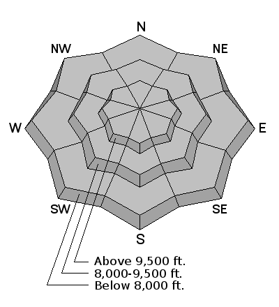
Note: the danger rose is all grey because we are not publishing danger ratings this time of year. We're expecting about 10 inches of new snow late Friday night through Saturday and perhaps a couple more inches on Sunday. With a mostly stable pre-existing snowpack, most of the problems will remain within the new snow. Which is good, because any problems will be near the surface and easy to detect for experienced users. In spring, avalanche conditions depend directly on weather conditions, which are inherently very unpredictable this time of year. So you'll need to assess these often changing and tricky weather and snow conditions as they develop. As you travel, jump on small test slopes to see how well the new snow has bonded to the layers underneath and put in a good slope cut before you commit to steeper terrain. You will also likely find some wind-deposited snow (wind slabs) in the wind exposed terrain. So as always, be cautious of steep slopes with recent wind deposits, which usually look smooth and rounded and often feel "slabby" (stronger snow on top of weaker snow).
|
 |
weather It will feel like winter this weekend. We're expecting about 10 inches of new snow starting late tonight and mostly on Saturday with perhaps a couple more inches on Sunday. The wind should blow 30, gusting to 50 in the wind exposed terrain from the southwest today and tonight and they should drop when the cold front arrives on Saturday. But usually these spring storms can be wild with instability showers and as the front arrives. It's not uncommon to see lots of graupel, gusty wind and possibly lightning. Temperatures should cool off on Saturday, dropping into the 20's and into the teens on Sunday. Be sure to monitor the latest weather conditions before heading out. Here are a few of my favorite sources: Cottonwood Canyons Forecast from the National Weather Service |
| general announcements Remember your information can save lives. If you see anything we should know about, please participate in the creation of our own community avalanche advisory by submitting snow and avalanche conditions. You can also call us at 801-524-5304 or 800-662-4140, email by clicking HERE, or include #utavy in your tweet or Instagram. If you trigger an avalanche in the backcountry - especially if you are adjacent to a ski area – please call the following teams to alert them to the slide and whether anyone is missing or not. Rescue teams can be exposed to significant hazard when responding to avalanches, and do not want to do so when unneeded. Thanks. Salt Lake and Park City – Alta Central (801-742-2033), Canyons Resort Dispatch (435-615-3322) EMAIL ADVISORY We have switched to a new SLC email advisory system. If you would like to get the daily advisory by email, or if you have been getting the advisory by email since the beginning of the season and wish to continue, you will need to subscribe here. Twitter Updates for your mobile phone - DETAILS UDOT canyon closures: LINK TO UDOT Utah Avalanche Center mobile app - Get your advisory on your iPhone along with great navigation and rescue tools.uned. Lost or Found something in the backcountry? - http://nolofo.com/ To those skinning uphill at resorts: it is your responsibility to know the resort policy on uphill travel. Some allow uphill travel and have guidelines, some don't. Contact the Ski Patrol at each resort for details. IMPORTANT: Before skinning at a resort under new snow conditions, check in with Ski Patrol. Resorts can restrict or cut off access if incompatible with control and grooming operations. Benefit the Utah Avalanche Center when you shop from Backcountry.com or REI: Click this link for Backcountry.com or this link to REI, shop, and they will donate a percent of your purchase price to the UAC. Both offer free shipping (with some conditions) so this costs you nothing! Benefit the Utah Avalanche Center when you buy or sell on ebay - set the Utah Avalanche Center as a favorite non-profit in your ebay account here and click on ebay gives when you buy or sell. You can choose to have your seller fees donated to the UAC, which doesn't cost you a penny. This information does not apply to developed ski areas or highways where avalanche control is normally done. This advisory is from the U.S.D.A. Forest Service, which is solely responsible for its content. This advisory describes general avalanche conditions and local variations always exist. |


