| During the month of April, Mark Miller will donate $75 to the charity of your choice (5 to chose from, including the Utah Avalanche Center!) Mark Miller Subaru has raised over $300k in the previous 6 Do Good Feel Good events. More Info here |  |
| During the month of April, Mark Miller will donate $75 to the charity of your choice (5 to chose from, including the Utah Avalanche Center!) Mark Miller Subaru has raised over $300k in the previous 6 Do Good Feel Good events. More Info here | |
| Advisory: Salt Lake Area Mountains | Issued by Brett Kobernik for Thursday - February 27, 2014 - 6:29am |
|---|

|
bottom line The overall avalanche danger is MODERATE today. Watch for instabilities within the new snow as well as wind drifting of the new snow. Anticipate wind loaded slopes on northwest through southeast facing slopes along the ridges. Keep in mind that the avalanche danger rises rapidly during periods of heavy snowfall.
|
 |
special announcement Join us March 8th and 9th at Brighton Resort for the first annual VertFest and 11th annual PowderKeg. There will be gear demos, a series of backcountry skills clinics, free beacon clinics, a party featuring the band Salem from Boulder, CO and a great gear raffle. The VertFest is a benefit for the Utah Avalanche Center. Click Here to find out more and to sign up for the backcountry clinics. |
 |
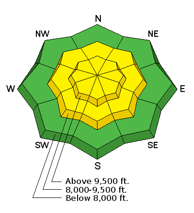
current conditions Warm temperatures made the snow damp on all aspects up to around 9500 feet on Wednesday with some southerly and lower elevation slopes becoming saturated and punchy all the way through the pack. Overnight temperatures stayed mild with upper elevations in the mid to upper 20s and mid elevations around freezing or higher. Southerly winds are increasing in speed. A few light snow showers have been noted this morning already. |
 |
recent activity There were a few wet loose avalanches on steep southerly slopes Wednesday. Mid day cloud cover shut down continued heating just about the time things were getting fairly loose. |
| type | aspect/elevation | characteristics |
|---|

|
|
LIKELIHOOD
 LIKELY
UNLIKELY
SIZE
 LARGE
SMALL
TREND
 INCREASING DANGER
SAME
DECREASING DANGER
|
|
description
We shift gears as storms roll through over the next few days and we need to start thinking about how the new snow will impact the avalanche conditions.
|
| type | aspect/elevation | characteristics |
|---|

|
|
LIKELIHOOD
LIKELY
UNLIKELY
SIZE
 LARGE
SMALL
TREND
INCREASING DANGER
SAME
DECREASING DANGER
|
|
description
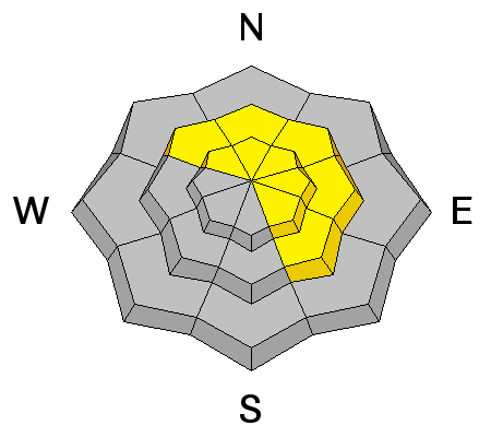
Increasing winds will drift snow today so you will want to watch for any fresh drifts that form especially along the lee sides of the ridges. Watch for cracking as you travel indicating wind slabs are forming. Cutting test slopes and small cornice drops are appropriate for getting an idea of how sensitive these become. These fresh drifts will hardly be enough to effect the danger for snowmobilers today. |
 |
weather Snow showers are expected this morning and will pick up mid day into tonight. Ridgetop temperatures will drop into the 20s as the day goes on. Snow levels will start out around 7000 feet. Winds will be moderate to strong increasing more as the day goes on from the southwest. Snow will continue into tonight with 4 to 8 inches total expected. We'll see a break Friday then another system moves through this weekend which should bring more snow than today's storm. |
| general announcements
Remember your information can save lives. If you see anything we should know about, please participate in the creation of our own community avalanche advisory by submitting snow and avalanche conditions. You can also call us at 801-524-5304 or 800-662-4140, email by clicking HERE, or include #utavy in your tweet or Instagram. If you trigger an avalanche in the backcountry - especially if you are adjacent to a ski area – please call the following teams to alert them to the slide and whether anyone is missing or not. Rescue teams can be exposed to significant hazard when responding to avalanches, and do not want to do so when unneeded. Thanks. Salt Lake and Park City – Alta Central (801-742-2033), Canyons Resort Dispatch (435-615-3322) Snowbasin Resort Dispatch (801-620-1017), Powder Mountain Dispatch (801-745-3772 x 123). Sundance Dispatch (801-223-4150) EMAIL ADVISORY We have switched to a new SLC email advisory system. If you would like to get the daily advisory by email, or if you have been getting the advisory by email since the beginning of the season and wish to continue, you will need to subscribe here. DAWN PATROL Hotline updated daily by 5-530am - 888-999-4019 option 8. Twitter Updates for your mobile phone - DETAILS UDOT canyon closures: LINK TO UDOT Utah Avalanche Center mobile app - Get your advisory on your iPhone along with great navigation and rescue tools.uned. Wasatch Powderbird Guides Blog/Itinerary for the Day. Lost or Found something in the backcountry? - http://nolofo.com/ Discount lift tickets are now available at Backcountry.com - Thanks to Ski Utah and the Utah Resorts. All proceeds go towards paying for Utah Avalanche Center avalanche and mountain weather advisories. To those skinning uphill at resorts: it is your responsibility to know the resort policy on uphill travel. Some allow uphill travel and have guidelines, some don't. Contact the Ski Patrol at each resort for details. IMPORTANT: Before skinning at a resort under new snow conditions, check in with Ski Patrol. Resorts can restrict or cut off access if incompatible with control and grooming operations. Benefit the Utah Avalanche Center when you shop from Backcountry.com or REI: Click this link for Backcountry.com or this link to REI, shop, and they will donate a percent of your purchase price to the UAC. Both offer free shipping (with some conditions) so this costs you nothing! Benefit the Utah Avalanche Center when you buy or sell on ebay - set the Utah Avalanche Center as a favorite non-profit in your ebay account here and click on ebay gives when you buy or sell. You can choose to have your seller fees donated to the UAC, which doesn't cost you a penny. This information does not apply to developed ski areas or highways where avalanche control is normally done. This advisory is from the U.S.D.A. Forest Service, which is solely responsible for its content. This advisory describes general avalanche conditions and local variations always exist. |