

Avalanche Advisory
| Advisory: Salt Lake Area Mountains | Issued by Drew Hardesty for April 7, 2013 - 6:03am |
|---|


Above 9,500 ft.
8,000-9,500 ft.
Below 8,000 ft.
|
bottom line We have a mostly Low avalanche danger in the mountains today. Watch for developing shallow and isolated wind slab along the highest ridgelines. Other problem areas include the mid-elevation east to north to westerly aspects where you may punch through or auger deeply into wet unconsolidated grains. Wet avalanche activity may be more pronounced in the Park City, Ogden and Provo where they've had a poor refreeze for the last 5 days...
|


 |
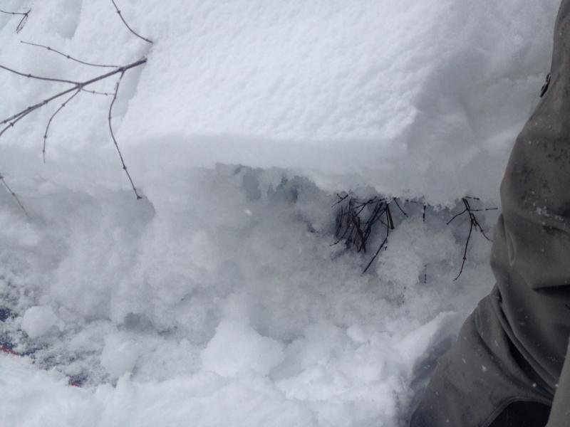
current conditions We're still in this alliterative warm, wet, westerly flow and we'll have yet another impulse of moisture moving through today that will be more pronounced north of I-80, particularly near the Logan area mountains. Skies are overcast, temps are in the mid to upper 20s and winds are light except for 20-25mph speeds along the 11,000' ridgelines. If you lowered your expectations, riding conditions were not half bad yesterday up high in 1-2" of damp and dense above a supportable 2" thick melt freeze crust. Those smarter than me started high and stayed high for these conditions. Instead, I exited out a southerly facing drainage and found that the supportable crust became less friendly and I'd "trapdoor" to the ground through the "isothermal" damp to wet grains below. But not before becoming soaked by the rain/snow mix at 7500'. Would've made a Pacific Northwest'r feel right at home. Photo below after trapdoor-ing on the exit.
|
 |
recent activity None. |
Avalanche Problem 1over the next 24 hours
| type | aspect/elevation | characteristics |
|---|
 |
Above 9,500 ft.
8,000-9,500 ft.
Below 8,000 ft.
|
|
|
description
It's mostly Low danger. Call it much more and it takes the teeth out of Moderate. Still; there will be a few things to look out for today -
|

 |
weather Today's westerlies should continue to favor the Logan area mountains with snow while the central Wasatch sees a skiff to 2". I expect a rain/snow line to remain at 7000' or so. Winds will increase to 20-25mph along the high peaks; temps will be in the mid 20s to low 30s. Tomorrow's cold winter storm has the Uintas written all over it. The storm approaches from the northwest but tragically closes off on itself, favoring, in this case anyway, the north slope of the Uintas and other areas favored by a north to easterly flow. They'll likely see 1-2' with 30-40mph winds through later Tuesday while the rest of us scrape by with perhaps an optimistic 6-10". With the winds as well. Another quick hitter arrives on Thursday.
|
| general annoucements Go to http://www.backcountry.com/utah-avalanche-center to get EVEN MORE DISCOUNTED tickets from our partners at Beaver Mountain and Sundance. All proceeds benefit the Utah Avalanche Center. If you trigger an avalanche in the backcountry - especially if you are adjacent to a ski area – please call the following teams to alert them to the slide and whether anyone is missing or not. Rescue teams can be exposed to significant hazard when responding to avalanches, and do not want to do so when unneeded. Thanks. Salt Lake and Park City – Alta Central (801-742-2033), Canyons Resort Dispatch (435-615-3322) Ogden – Snowbasin Patrol Dispatch (801-620-1017) Powder Mountain Ski Patrol Dispatch (801-745-3772 ex 123) Provo – Sundance Patrol Dispatch (801-223-4150) Dawn Patrol Forecast Hotline, updated by 05:30: 888-999-4019 option 8. Twitter Updates for your mobile phone - DETAILS Daily observations are frequently posted by 10 pm each evening. Subscribe to the daily avalanche advisory e-mail click HERE. UDOT canyon closures UDOT at (801) 975-4838 Wasatch Powderbird Guides does daily updates about where they'll be operating on this blog http://powderbird.blogspot.com/ . Remember your information can save lives. If you see anything we should know about, please participate in the creation of our own community avalanche advisory by submitting snow and avalanche conditions. You can also call us at 801-524-5304 or 800-662-4140, email by clicking HERE, or include #utavy in your tweet. Donate to your favorite non-profit –The Friends of the Utah Avalanche Center. The UAC depends on contributions from users like you to support our work. For a print version of this advisory click HERE. This advisory is produced by the U.S. Forest Service, which is solely responsible for its content. It describes only general avalanche conditions and local variations always exist. Specific terrain and route finding decisions should always be based on skills learned in a field-based avalanche class. |