

Avalanche Advisory
| Advisory: Salt Lake Area Mountains | Issued by Drew Hardesty for March 31, 2013 - 6:44am |
|---|


Above 9,500 ft.
8,000-9,500 ft.
Below 8,000 ft.
|
bottom line A mostly Low danger this morning will rise to MODERATE with daytime heating. Human triggered slides will again become likely during the heat of the day. Cornices and runouts beneath yawning glide cracks should be avoided. Again, the Bottom line is to get off of and out from underneath steeper slopes by the time they've become wet, unconsolidated and unstable (and not limited to the sunny aspects). The danger may be more pronounced in the Park City, Ogden, and Provo area mountains as they've suffered warmer temps over the last three days...
|


 |
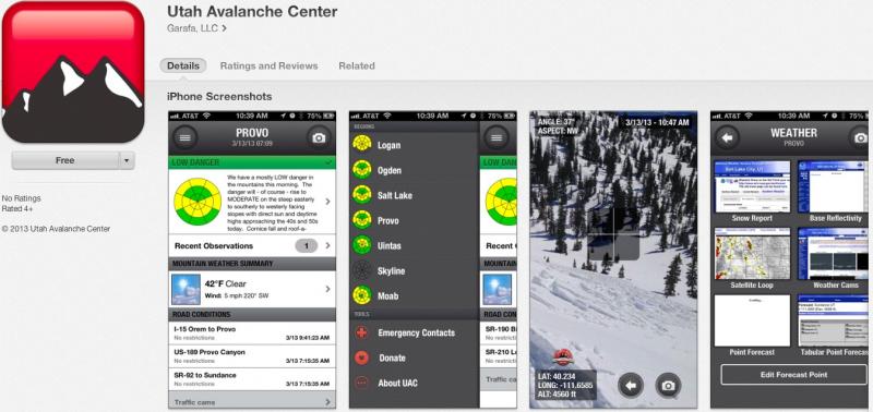
special announcement iPhone & iPad users: With help from Backcountry.com & Garafa, LLC, we now have a free mobile app that combines the best of the UAC advisories, observations, and weather summaries with National Weather Service products & UDOT road updates. This puts the tools you need for planning your day and your run in one handy mobile package. Check it out, tell your friends, and let us know what you think. http://utahavalanchecenter.org/apps
|
 |
current conditions I suppose I oughtta keep the links up below for another day. Skies are clear, winds are light, and with overnight lows in the upper 20s to mid 30s, we'll have a rock-solid lock-up of supportable crust. Indeed the corn harvest is on with a few turns in cold snow up high on the straight north. Crusts are likely to soften by -say- 930 to 10 on east...and you can milk it as the sun swings around to favor south then west. Well it's a sign of spring when there are more cars at the Gate Buttress for rock climbing in Little Cottonwood Canyon than at the backcountry trailheads. It's also a sign of spring when there are tons of surveys and blog entries from us at the UAC -
We plan to have another survey up soon regarding avalanche info signage along the roads. Just a couple quick questions...and your feedback is needed.
|
 |
recent activity No significant activity reported yesterday except for some larger rollerballs and a few wet sluffs on steep slopes as they heated up. More glide cracks are appearing as well...and cornices continue to drip and sag. |
Avalanche Problem 1over the next 8 hours
| type | aspect/elevation | characteristics |
|---|
 |

Above 9,500 ft.
8,000-9,500 ft.
Below 8,000 ft.
|
|
|
description
Clear skies and cooler overnight temps should help diminish the wet potential today. In any event, here's a couple things to stack the odds in your favor. Yellow flags -
Bottom line is to get off of and out from underneath steeper sunny slopes by the time they've become wet, unconsolidated and unstable. Avoid being in or above steep walled gullies or other terrain traps that funnel snow into deeper piles of wet cement. |

Avalanche Problem 2over the next 24 hours
| type | aspect/elevation | characteristics |
|---|
 |
Above 9,500 ft.
8,000-9,500 ft.
Below 8,000 ft.
|
|
|
description
Glide avalanches and cornice failure become increasingly likely in the spring. Notorious glide avalanche terrain includes Stairs Gulch, Broads Fork and Mill B South of Big Cottonwood Canyon and have resulted in a double fatality in - I believe - spring of '99 in Stairs Gulch and a significant accident and broken leg earlier this year (in Broads Fork). Check out Glide Avalanches in our Encyclopedia and watch the avalanche rip-out. |

 |
weather Should be clear to partly cloudy today with less potential for convective showers. Temperatures should rise from freezing this morning to the mid 50s at the 8000 foot level and around 40 along the ridges again. Winds will be light from the west to northwest. A weak cutoff Low affects the area tomorrow through Tuesday that may produce 3-7" of snow and a rain/snow line to 7-7500'. High pressure rebuilds for mid week with a couple more weak systems for Friday and over the weekend.
|
| general annoucements Go to http://www.backcountry.com/utah-avalanche-center to get EVEN MORE DISCOUNTED tickets from our partners at Beaver Mountain and Sundance. All proceeds benefit the Utah Avalanche Center. If you trigger an avalanche in the backcountry - especially if you are adjacent to a ski area – please call the following teams to alert them to the slide and whether anyone is missing or not. Rescue teams can be exposed to significant hazard when responding to avalanches, and do not want to do so when unneeded. Thanks. Salt Lake and Park City – Alta Central (801-742-2033), Canyons Resort Dispatch (435-615-3322) Ogden – Snowbasin Patrol Dispatch (801-620-1017) Powder Mountain Ski Patrol Dispatch (801-745-3772 ex 123) Provo – Sundance Patrol Dispatch (801-223-4150) Dawn Patrol Forecast Hotline, updated by 05:30: 888-999-4019 option 8. Twitter Updates for your mobile phone - DETAILS Daily observations are frequently posted by 10 pm each evening. Subscribe to the daily avalanche advisory e-mail click HERE. UDOT canyon closures UDOT at (801) 975-4838 Wasatch Powderbird Guides does daily updates about where they'll be operating on this blog http://powderbird.blogspot.com/ . Remember your information can save lives. If you see anything we should know about, please participate in the creation of our own community avalanche advisory by submitting snow and avalanche conditions. You can also call us at 801-524-5304 or 800-662-4140, email by clicking HERE, or include #utavy in your tweet. Donate to your favorite non-profit –The Friends of the Utah Avalanche Center. The UAC depends on contributions from users like you to support our work. For a print version of this advisory click HERE. This advisory is produced by the U.S. Forest Service, which is solely responsible for its content. It describes only general avalanche conditions and local variations always exist. Specific terrain and route finding decisions should always be based on skills learned in a field-based avalanche class. |