Home
utahavalanchecenter.org
Keeping you on top!

Sponsor Ads

  • About
    • Submit Avalanche Observations
    • Contact
    • Who we are
    • Staff
    • FUAC
    • How we generate an advisory
    • Log in
  • Advisories
    • Logan
    • Ogden
    • Salt Lake
    • Provo
    • Uintas
    • Skyline
    • Moab
    • Tomorrow's Danger Rating
    • Podcasts
    • Archives
  • Education
    • Classes/Workshops
    • Know Before You Go
    • Tutorials
    • Beacon Practice
    • Avalanche Stats
    • FAQ
    • Encyclopedia
  • Detailed Info
    • Submit Backcountry Observations
    • All the Good Stuff
      • All Regions
      • Logan
      • Ogden
      • Salt Lake
      • Provo
      • Uintas
      • Skyline
      • Moab
    • Avalanches
      • All Regions
      • Logan
      • Ogden
      • Salt Lake
      • Provo
      • Skyline
      • Uintas
      • Moab
      • Detailed List
    • Accidents
    • Video
    • Photos
      • Avalanches
    • Maps
      • Selected Routes
      • Place Names Map
    • Archives
  • Blog
  • Weather
    • Mtn Weather Forecasts
      • Logan
      • Moab
      • Salt Lake
    • 48hr Weather Charts
      • Temps-Wind-Precip
      • Precipitation
    • Seasonal Weather Charts
      • Current Season
      • Alta Monthly Snowfall
      • Archives
    • Radar Loops
      • Salt Lake Regional
      • US Composite
  • Resources
    • Essential Gear
    • Smartphone Apps
    • Beacon Tech
    • Beacon Practice
    • Books & Videos
    • Guide Services
    • Wasatch Backcountry Rescue
    • Local Mtn Info
    • Place Names Map
  • Events
    • List View
    • Calendar View
      • September
      • October
      • November
      • December
      • January
      • February
      • March
      • April
  • Store
    • Online Store
    • Online Store Help
  • Sponsors
  • Donate
Avalanche Advisory
Tweet
Advisory: Salt Lake Area Mountains Issued by Drew Hardesty for March 30, 2013 - 6:24am
Above 9,500 ft.
8,000-9,500 ft.
Below 8,000 ft.
bottom line

A mostly Low danger this morning will rapidly rise to MODERATE WITH POCKETS OF CONSIDERABLE with daytime heating. Natural and human triggered slides will become likely during the heat of the day. Again, the Bottom line is to get off of and out from underneath steeper slopes by the time they've become wet, unconsolidated and unstable (and not limited to the sunny aspects). The danger may be more pronounced in the Park City, Ogden, and Provo area mountains as they've suffered warmer temps over the last three days...


danger scale: 1. Low 2. Moderate 3. Considerable 4. High 5. Extreme
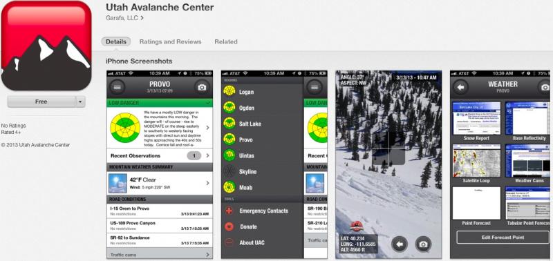
special announcement

iPhone & iPad users: With help from Backcountry.com & Garafa, LLC, we now have a free mobile app that combines the best of the UAC advisories, observations, and weather summaries with National Weather Service products & UDOT road updates. This puts the tools you need for planning your day and your run in one handy mobile package. Check it out, tell your friends, and let us know what you think. http://utahavalanchecenter.org/apps

current conditions

Well it's a sign of spring when there are more cars at the Gate Buttress for rock climbing in Little Cottonwood Canyon than at the backcountry trailheads. It's also a sign of spring when there are tons of surveys and blog entries from us at the UAC -

  • Slope Steepness Blog by Toby Weed, our forecaster in Logan
  • 3d Danger Rose Prototype by Brett Kobernik
  • Avalanche Route Ratings by Drew Hardesty
  • Twitter Updates for your mobile phone - DETAILS - become part of the real-time avalanche community by adding info to #utavy
  • Help the avalanche centers improve avalanche danger communication via mapping. A grad student from Western Washington University has a survey. Your input is vital! http://myweb.students.wwu.edu/~kaneb2/avy-survey/

Skies are clear to partly cloudy with similar overnight lows in the upper 20s to low 30s. Well noted are the well-above freezing temps (upper 30s to low 40s) below roughly 8500' in the Park City, Ogden, and Provo area mountains for the 3rd night in a row. Winds are generally light and westerly. The last vestiges of leftover dense powder can still be found on straight north above 10,000'; otherwise it's a collection of quasi-corn, breakable crust, mashed potatoes and isothermal snow.

recent activity

No significant activity reported yesterday except for some larger rollerballs and a few wet sluffs on steep slopes as they heated up. More glide cracks are appearing as well. There were not many people in the backcountry yesterday.

Avalanche Problem 1over the next 8 hours
type aspect/elevation characteristics
Above 9,500 ft.
8,000-9,500 ft.
Below 8,000 ft.
likelihood size
likely
unlikely
large
small
distribution trend
widespread
isolated
More Dangerous
Same
Less Dangerous
description

It's the 3rd night in a row of a poor refreeze in the Park City, Provo, and Ogden area mountains below about 8500'. To be sure, clear skies will foster a superficial refreeze due to long-wave radiational cooling, but it'll be a wolf-in-sheep's-clothing. Many areas are still transitioning from a winter to spring snowpack...and can tend to produce wet slides while the plumbing and piping sorts its self out in the snowpack to allow for the free water to work its way out and not pool along layers and interfaces.

A spike in water flow is forecasted for some streams by the Colorado River Basin Forecast Center. (They are co-located with us at the National Weather Service downtown.) Mark Saurer, part of the Park City Mountain Resort snow safety, put together one of the more interesting research papers in awhile and presented his findings last September in Anchorage. He was looking at the correlation between forecasted spikes in water flows along the creeks and drainages with wet avalanche activity in the mountains.

Avalanche Problem 2over the next 24 hours

type aspect/elevation characteristics
Above 9,500 ft.
8,000-9,500 ft.
Below 8,000 ft.
likelihood size
likely
unlikely
large
small
distribution trend
widespread
isolated
More Dangerous
Less Dangerous
description

Glide avalanches and cornice failure become increasingly likely in the spring. Notorious glide avalanche terrain includes Stairs Gulch, Broads Fork and Mill B South of Big Cottonwood Canyon and have resulted in a double fatality in - I believe - spring of '99 in Stairs Gulch and a significant accident and broken leg earlier this year (in Broads Fork). Check out Glide Avalanches in our Encyclopedia and watch the avalanche rip-out.

weather

Should be clear to partly cloudy today with less potential for convective showers. Temperatures should rise from freezing this morning to the mid 50s at the 8000 foot level and around 40 along the ridges again. Winds will be light from the west to northwest. A weak cutoff Low affects the area late Sunday through the first part of the week and may produce 3-7" of snow....

general annoucements

Go to http://www.backcountry.com/utah-avalanche-center to get EVEN MORE DISCOUNTED tickets from our partners at Beaver Mountain and Sundance. All proceeds benefit the Utah Avalanche Center.

If you trigger an avalanche in the backcountry - especially if you are adjacent to a ski area – please call the following teams to alert them to the slide and whether anyone is missing or not. Rescue teams can be exposed to significant hazard when responding to avalanches, and do not want to do so when unneeded. Thanks.

Salt Lake and Park City – Alta Central (801-742-2033), Canyons Resort Dispatch (435-615-3322)

Ogden – Snowbasin Patrol Dispatch (801-620-1017)

Powder Mountain Ski Patrol Dispatch (801-745-3772 ex 123)

Provo – Sundance Patrol Dispatch (801-223-4150)

Dawn Patrol Forecast Hotline, updated by 05:30: 888-999-4019 option 8.

Twitter Updates for your mobile phone - DETAILS

Daily observations are frequently posted by 10 pm each evening.

Subscribe to the daily avalanche advisory e-mail click HERE.

UDOT canyon closures UDOT at (801) 975-4838

Wasatch Powderbird Guides does daily updates about where they'll be operating on this blog http://powderbird.blogspot.com/ .

Remember your information can save lives. If you see anything we should know about, please participate in the creation of our own community avalanche advisory by submitting snow and avalanche conditions. You can also call us at 801-524-5304 or 800-662-4140, email by clicking HERE, or include #utavy in your tweet.

Donate to your favorite non-profit –The Friends of the Utah Avalanche Center. The UAC depends on contributions from users like you to support our work.

For a print version of this advisory click HERE.

This advisory is produced by the U.S. Forest Service, which is solely responsible for its content. It describes only general avalanche conditions and local variations always exist. Specific terrain and route finding decisions should always be based on skills learned in a field-based avalanche class.

Tweet

2242 West North Temple | Salt Lake City, UT 84116 | (801) 524-5304 | Advisory Hotline: (888) 999-4019 | Contact

Powered by Drupal