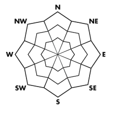


| Advisory: Salt Lake Area Mountains | Issued by Drew Hardesty for January 2, 2013 - 6:53am |
|---|


Above 9,500 ft.
8,000-9,500 ft.
Below 8,000 ft.
|
bottom line A MODERATE danger is centered upon existing and developing wind drifts along the highest terrain as well as the isolated and off chance of triggering a deeper persistent slab in steep, thinner snowpack areas. The 6-14" wind drifts will be relegated to the higher, exposed open terrain; the rogue 1-3' deep persistent slabs along the periphery of the Cottonwood canyons.
|
 |
special announcement Just a couple slots left for our Snowbird Freeride Avalanche Summit, an avalanche and alpine skills seminar focused on steep lines, remote locations, and filming. Jan 6-8 2013. Details at http://utahavalanchecenter.org/2013-snowbird-freeride-avalanche-summit. |
 |
current conditions Skies are clear. The northerly and northeasterly winds remain brisk, though confined to the highest elevations. They continue to blow 15-20mph with gusts to 35. Along the 11,000' level, however, they continue to average 30-35mph with gusts to 45. With the inversions settling in to their January easy chair, temps are 10 degrees up high, and near zero at the trailheads and basins. Wind and sun sheltered terrain still offer 5 star powder. |
 |
recent activity The winds provoked a couple shallow natural wind slabs 6-8" deep and 50' wide in the high terrain with aspects ranging from northeast to southeast to south. I imagine a few others with a westerly component went unnoticed... Also of note, perhaps running New Year's Eve were a couple full depth glide avalanches in their usual locations in upper Broads Fork of Big Cottonwood Canyon, roughly 10,000' and northeast facing. See Dave Kikkert's report here. |
| type | aspect/elevation | characteristics |
|---|
 |


Above 9,500 ft.
8,000-9,500 ft.
Below 8,000 ft.
|
|
|
description
The mountain topography easily channeled yesterday's northerly winds to erode some of the New Year's surface hoar and drift the low density snow onto a variety of lee slopes. Questions to ask with wind - "Is there any snow to blow around? and "What will the new drifts be loaded upon?" The answers here are "Yep, lots"; and "weak crystalline stellars (photo Todd Leeds) and surface hoar feathers" (photo - University of Calgary). The new drifts can easily overwhelm and collapse the large lattices of crystals (see photo below) and propagate avalanches...particularly when recently loaded by storm snow or wind. If loaded quickly enough, they can naturally avalanche (as a few did yesterday) and/or be sensitive to human provocation - as you'll find out today. (I suspect so.) Yellow represents most common terrain; green indicates less so...
|
| type | aspect/elevation | characteristics |
|---|
 |


Above 9,500 ft.
8,000-9,500 ft.
Below 8,000 ft.
|
|
|
description
Collapsing still noted in thinner weak snowpack areas. Snow tests offer variable results...some indicative of potential, some not. Thinner snowpack areas include Mt Aire, Lambs, Mill Creek, and areas of the Park City ridgeline...all areas with roughly less than 4' of snow on the ground...and roughly 8500'-10,000' are most suspect. |
| type | aspect/elevation | characteristics |
|---|
 |


Above 9,500 ft.
8,000-9,500 ft.
Below 8,000 ft.
|
|
|
description
Low density snow tends to sluff more readily...as well as transition into loose faceted snow that will start to lose cohesion, making it more prone to sluffing over the period of high pressure. Rose reflects current hazard, but worth a mention for the next several days. |
 |
weather Under clear skies, temps will rise into just the mid-teens at 10,000' and the low 20s at 8000'. Northerly to northeasterly winds will blow 15mph except at the highest elevations. There they'll continue to blow 25-35 with gusts into the 40s throughout the day. High pressure continues to build throughout the week and into the weekend. There was a glimmer of hope for storms late weekend, but the EC model fell in line with the GFS. Instead, the storm moves onshore and splits sharply to the south. Perhaps another mirage on the horizon for late next week? |
| general annoucements
Go to http://www.backcountry.com/utah-avalanche-center to get tickets from our partners at Beaver Mountain, Canyons, Sundance, and Wolf Mountain. All proceeds benefit the Utah Avalanche Center. If you trigger an avalanche in the backcountry - especially if you are adjacent to a ski area – please call the following teams to alert them to the slide and whether anyone is missing or not. Rescue teams can be exposed to significant hazard when responding to avalanches, and do not want to do so when unneeded. Thanks. Salt Lake and Park City – Alta Central (801-742-2033), Canyons Resort Dispatch (435-615-3322) Ogden – Snowbasin Patrol Dispatch (801-620-1017) Powder Mountain Ski Patrol Dispatch (801-745-3773 ex 123) Provo – Sundance Patrol Dispatch (801-223-4150) Dawn Patrol Forecast Hotline, updated by 05:30: 888-999-4019 option 8. Twitter Updates for your mobile phone - DETAILS Daily observations are frequently posted by 10 pm each evening. Subscribe to the daily avalanche advisory e-mail click HERE. UDOT canyon closures UDOT at (801) 975-4838 Wasatch Powderbird Guides does daily updates about where they'll be operating on this blog http://powderbird.blogspot.com/ . Remember your information can save lives. If you see anything we should know about, please participate in the creation of our own community avalanche advisory bysubmitting snow and avalanche conditions. You can also call us at 801-524-5304 or 800-662-4140, or email by clicking HERE Donate to your favorite non-profit –The Friends of the Utah Avalanche Center. The UAC depends on contributions from users like you to support our work. For a print version of this advisory click HERE. This advisory is produced by the U.S. Forest Service, which is solely responsible for its content. It describes only general avalanche conditions and local variations always exist. Specific terrain and route finding decisions should always be based on skills learned in a field-based avalanche class. |