Avalanche Advisory
| Advisory: Salt Lake Area Mountains | Issued by Brett Kobernik for December 21, 2012 - 6:59am |
|---|


Above 9,500 ft.
8,000-9,500 ft.
Below 8,000 ft.
|
bottom line CONSIDERABLE Avalanche Danger exists in shallow snow pack areas including the Park City ridgeline and Mill Creek Canyon, on all steep, mid and upper elevation northerly through easterly facing slopes. Slides can be triggered from a distance, and break into deeper weak layers, resulting in large, deadly slides. Deeper snowpack areas are safer but new windloading is a distinct concern today in these areas also.
|


 |
current conditions Temperatures are up and so are the winds. We have 25 to 30 degrees along the ridges and southwest winds a little stronger than yesterday during the day with moderate speed gusts along the mid elevations and gusts into the 50s and 60s along the more exposed terrain. Upper elevation snow surface conditions have deteriorated but mid elevations remain excellent. |
 |
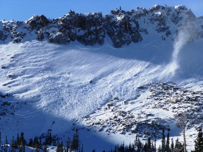
recent activity Two avalanches from Thursday highlight both our avalanche concerns for today. First, the wind drifted enough snow yesterday to create a natural new snow only soft slab avalanche in Maybird at near 10,000 feet on a northeast facing slope. DETAILS The second avalanche was reported from UDOT in Provo where a new wind load overloaded deeper buried weak layers. DETAILS Despite some predictions of doomsday, my outlook is more hopeful. I woke up at 3am this morning just like usual. Also, I feel we have slid into a fairly average winter. It is not uncommon for us to be dealing with some buried faceted snow at this time of the year. It is also not uncommon for the deeper areas to stabilize first. A look at some Snotel charts in our central region (blue=average, green=this season, red=last season) paint quite and average picture, which is a good sign for our snowpack.
Avalanche Problem 2over the next 24 hours
| |||||||||||||||||||||||||||||||||||||||||