25th Annual Black Diamond Fall Fundraising Party
Thursday, September 13; 6:00-10:00 PM; Black Diamond Parking Lot
25th Annual Black Diamond Fall Fundraising Party
Thursday, September 13; 6:00-10:00 PM; Black Diamond Parking Lot
| Advisory: Provo Area Mountains | Issued by Drew Hardesty for Sunday - February 4, 2018 - 7:23am |
|---|


|
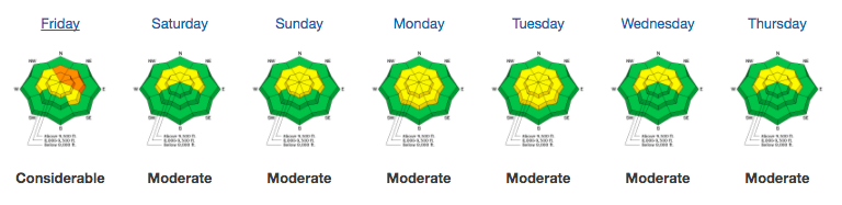
bottom line Most terrain has a LOW avalanche danger. Isolated areas of MODERATE danger, however, exist on northwest to east facing slopes above about 9000'. In this terrain, human triggered avalanches 1-3' deep are possible. Additionally, shallow pockets of soft and hard wind slab are littered across the landscape, but most problematic in high consequence terrain. Lastly, damp push-alanches are possible in steep low to mid-elevation sheltered slopes that have remained warm for the past several days.
|
 |
special announcement The latest UAC podcast - "Recreating Like a Pro - A Conversation with IFMGA guide Anna Keeling" is live. This podcast will be ideal for anyone looking to pick up some tips and tricks from a professional mountain guide for recreating in the winter backcountry environment. |
 |
current conditions Skies are mostly cloudy. Mountain temps are in the mid to upper 30s. Winds are westerly, blowing 15mph with gusts to 25. 11,000' winds are blowing 35-45mph. Snow totals are 20-30" in the high country but barely enough coverage on the southerly aspects for much recreation. Although Salt Lake-centric, be sure to read our latest Week in Review for avalanche activity and significant mountain weather events from this past week.
|
 |
recent activity None. Recent observations of snow and weather below. |
| type | aspect/elevation | characteristics |
|---|

|

|
LIKELIHOOD
 LIKELY
UNLIKELY
SIZE
 LARGE
SMALL
TREND
 INCREASING DANGER
SAME
DECREASING DANGER
|
|
description
I was able to collapse and crack out a small test slope Friday on a north facing piece of terrain at 9200'. It cracked out about 1' deep and 20' across. It wasn't particularly representative of most of our terrain and yet there it was: poor structure, additional wind loading, trigger. Collapse. The moderate to strong winds will add just a bit of extra stress to areas of poor structure. Our lingering persistent slab avalanche problem exists at elevations 9000' and above, on slopes facing northwest through east (with a particular emphasis on north through northeast.) Thinner snowpack areas are particularly suspect. |
 |
weather We should start to see some light precipitation this early evening under the northwest flow. An initial rain/snow line may start as high as 8000', then drop to the valleys by Tuesday. Decent upper level support adds what it can to a generally weak system, but trace-2" seems reasonable with higher confidence for amounts north of I-80. Temps for today will be in the upper twenties along the upper ridgelines with northwest winds continuing to blow 30-35mph...increasing to 40mph tonight and tomrrow. |
| general announcements CLICK HERE FOR MORE GENERAL INFO AND FAQ The UAC has new support programs with Outdoor Research and Darn Tough. Support the UAC through your daily shopping. When you shop at Smith's, or online at Outdoor Research, REI, Backcountry.com, Darn Tough, Patagonia, NRS, Amazon, eBay a portion of your purchase will be donated to the FUAC. See our Donate Page for more details on how you can support the UAC when you shop. Benefit the Utah Avalanche Center when you buy or sell on eBay - set the Utah Avalanche Center as a favorite non-profit in your eBay account here and click on eBay gives when you buy or sell. You can choose to have your seller fees donated to the UAC, which doesn't cost you a penny This information does not apply to developed ski areas or highways where avalanche control is normally done. This advisory is from the U.S.D.A. Forest Service, which is solely responsible for its content. This advisory describes general avalanche conditions and local variations always occur. |