| During the month of April, Mark Miller will donate $75 to the charity of your choice (5 to chose from, including the Utah Avalanche Center!) Mark Miller Subaru has raised over $300k in the previous 6 Do Good Feel Good events. More Info here |  |
| During the month of April, Mark Miller will donate $75 to the charity of your choice (5 to chose from, including the Utah Avalanche Center!) Mark Miller Subaru has raised over $300k in the previous 6 Do Good Feel Good events. More Info here | |
| Advisory: Ogden Area Mountains | Issued by Drew Hardesty for Thursday - February 26, 2015 - 7:01am |
|---|

|
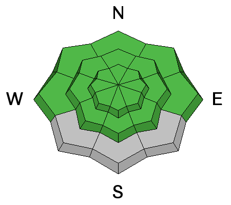
bottom line We have an overall LOW avalanche danger in the backcountry. Very isolated pockets of lingering wind slab may crack out in the highest alpine terrain. Similarly, if we see more snow than expected, loose snow avalanches may run with provocation in the steeper upper elevation terrain.
|
 |
special announcement The 2015 Wasatch Splitfest kicks off tonight at 7 PM, with a Presentation/Raffle night at Brewvies Cinema Pub. Come join us for a social evening of food, drinks, presentations of splitboarding adventures from around the world, and a chance to win gear from Chimera, Voile, Arc'teryx, Patagonia, and many others. All proceeds from the raffle go directly to support the Utah Avalanche Center. For more info on other SplitFest events through the weekend - http://www.facebook.com/WasatchSplitfest for all the details. Companion Rescue Workshop - Last one scheduled for the year! - tomorrow/Friday afternoon/eve at Brighton 530pm - Join the Utah Avalanche Center and avalanche professionals to hone your partner rescue skills, covering scene assessment, beacon searching, probing, strategic digging, and packaging and transporting an injured partner. For more info - |
 |
current conditions Clouds are streaming into Utah ahead of the first in a series of waves and storms that will predominantly affect southern and central Utah. Mountain temps are in the upper teens; west to northwesterly winds are generally less than 15mph but for the highest ridges where the anemometers spin at 25mph with gusts to 35. Riding and touring conditions remain quite good out of the sun and wind affected terrain. |
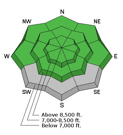
| type | aspect/elevation | characteristics |
|---|

|
|
LIKELIHOOD
 LIKELY
UNLIKELY
SIZE
 LARGE
SMALL
TREND
 INCREASING DANGER
SAME
DECREASING DANGER
|
|
description
A couple thoughts for today - Most terrain has a low avalanche danger. Lingering, isolated wind pockets in steep unsupported terrain may crack out in the high alpine terrain. As you might expect, radical terrain magnifies the consequences of any mistake or the smallest otherwise harmless avalanche. Storm snow avalanches are most pronounced during periods of high snowfall rates. IF we see more snow than expected, one can expect to see minor loose snow avalanches running in the steeper terrain.
|
 |
weather Greybird. We'll see a few flurries and perhaps a trace to an optimistic 2-4" over the next 24 hours or so. Mountain temps will be in the upper teens and low 20s. Winds will be from the northwest and generally less than 15-20mph. The next storm moves in from the northwest on Saturday and promptly closes off over Nevada, with moisture moving in over southern, central and perhaps far eastern Utah (to include the south slope of the Uintas). The north may see 2-4". Another, similar outfit moves in early in Tuesday that may hold more promise. |
| general announcements
Remember your information can save lives. If you see anything we should know about, please participate in the creation of our own community avalanche advisory by submitting snow and avalanche conditions. You can also call us at 801-524-5304, email by clicking HERE, or include #utavy in your tweet or Instagram. If you trigger an avalanche in the backcountry - especially if you are adjacent to a ski area – please call the following teams to alert them to the slide and whether anyone is missing or not. Rescue teams can be exposed to significant hazard when responding to avalanches, and do not want to do so when unneeded. Thanks. Salt Lake and Park City – Alta Central (801-742-2033), Canyons Resort Dispatch (435-615-3322) Snowbasin Resort Dispatch (801-620-1017), Powder Mountain Dispatch (801-745-3772 x 123). Sundance Dispatch (801-223-4150) EMAIL ADVISORY If you would like to get the daily advisory by email you will need to subscribe here. DAWN PATROL Hotline updated daily by 5-530am - 888-999-4019 option 8. Twitter Updates for your mobile phone - DETAILS UDOT canyon closures: LINK TO UDOT, or on Twitter, follow @UDOTavy, @CanyonAlerts or @AltaCentral Utah Avalanche Center mobile app - Get your advisory on your iPhone along with great navigation and rescue tools. Wasatch Powderbird Guides Blog/Itinerary for the Day. Lost or Found something in the backcountry? - http://nolofo.com/ Discount lift tickets are now available at Backcountry.com. Thanks to Ski Utah and the Utah Resorts. All proceeds go towards paying for Utah Avalanche Center avalanche and mountain weather advisories. To those skinning uphill at resorts: it is your responsibility to know the resort policy on uphill travel. You can see the uphill travel policy for each resort here. IMPORTANT: Before skinning or hiking at a resort under new snow conditions, check in with Ski Patrol. Resorts can restrict or cut off access if incompatible with control and grooming operations. Benefit the Utah Avalanche Center when you shop from Backcountry.com or REI: Click this link for Backcountry.com or this link to REI, shop, and they will donate a percent of your purchase price to the UAC. Both offer free shipping (with some conditions) so this costs you nothing! Benefit the Utah Avalanche Center when you buy or sell on ebay - set the Utah Avalanche Center as a favorite non-profit in your ebay account here and click on ebay gives when you buy or sell. You can choose to have your seller fees donated to the UAC, which doesn't cost you a penny. This information does not apply to developed ski areas or highways where avalanche control is normally done. This advisory is from the U.S.D.A. Forest Service, which is solely responsible for its content. This advisory describes general avalanche conditions and local variations always exist. |


_4.jpg)