
| During the month of April, Mark Miller will donate $75 to the charity of your choice (5 to chose from, including the Utah Avalanche Center!) Mark Miller Subaru has raised over $300k in the previous 6 Do Good Feel Good events. More Info here |  |
| During the month of April, Mark Miller will donate $75 to the charity of your choice (5 to chose from, including the Utah Avalanche Center!) Mark Miller Subaru has raised over $300k in the previous 6 Do Good Feel Good events. More Info here | |
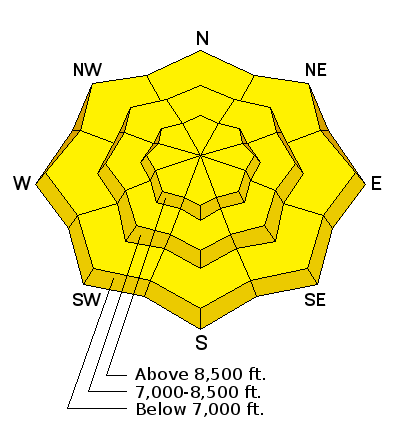
| Advisory: Ogden Area Mountains | Issued by Drew Hardesty for Saturday - February 7, 2015 - 7:09am |
|---|

|
bottom line A MODERATE danger exists for wind slabs and wet avalanches. A great deal of uncertainty exists for today's advisory...and when I feel a great deal of uncertainty I tend to take a step back from the edge. Until the wind stops and temps cool off, it's best to take a conservative approach for steep mountain travel even in the mid and lower elevations.
|
 |
current conditions At 5am, it's 59 degrees here at our office at the National Weather Service downtown. A quick look at the numbers shows these to be rough overnight lows for June or July. Record after record has fallen with warm temperatures over the past couple weeks. Water-wise, the image below from the National Climatic Data Center of NOAA shows how the west is shaping up this winter. Note how - yet again - UAC forecaster Toby Weed's Logan area mountains squeaks just north of the dividing line for drought. He's calling Tony Grove (in Logan Canyon) the new Alta. Here's a retread blog post from December - Beyond the 100th Meridian. But I digress. Skies are overcast, mountain temps are in the mid-30s to low 40s; winds are moderate to strong out of the west-southwest. Most ridgeline anemometers had averages of 25-30mph with gusts to 40...though they've calmed a touch in the last couple hours. Wind and sun has punished the snow surface conditions of late but we're only a couple days past one of my best days of the year.
|
 |
recent activity None. This is not the case in the Logan area mountains. Be sure to check their advisory if headed that way. |
| type | aspect/elevation | characteristics |
|---|

|

|
LIKELIHOOD
 LIKELY
UNLIKELY
SIZE
 LARGE
SMALL
TREND
 INCREASING DANGER
SAME
DECREASING DANGER
|
|
description
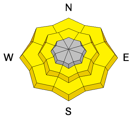
Scattered pockets of soft and hard wind slabs may be found at the mid and upper elevations and not necessarily confined to the ridgelines. Most of these should be stubborn and fairly well welded in as time and warm temps assist in stabilization. Still, this warrants some caution and a conservative approach if heading into wind affected avalanche terrain. Collapsing and shooting cracks are sure-fire indicators of instability; however, for many hard slabs, signs of instability are not as present and may pull out after you've committed to a slope. The teeming fury of the winds has produced drifts in unusual places and - sad to say - one can't dig a single pit or look at a single pitch on the slope and make a generalization. Take a moment and click on the 'i' next to the Wind Slab graphic for more info. |
| type | aspect/elevation | characteristics |
|---|

|
|
LIKELIHOOD
 LIKELY
UNLIKELY
SIZE
LARGE
SMALL
TREND
 INCREASING DANGER
SAME
DECREASING DANGER
|
|
description
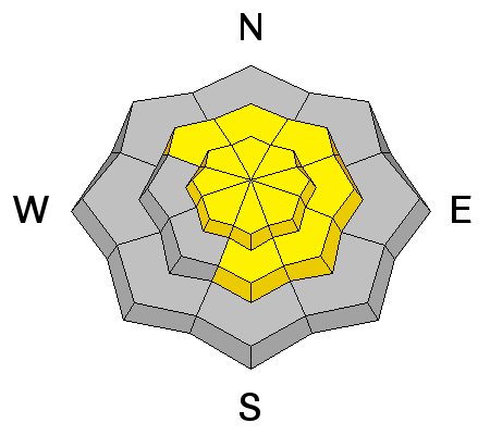
I have to say there is a great deal of uncertainty here with forecasting wet avalanches in February with record temps. Many areas have struggled to get below freezing as far back as Feb 2 or 3...leading one to imagine some degree of free water draining within the isothermal snowpack. It's not good. So - it'll be possible to get some and perhaps a great deal of wet unconsolidated snow to move under your feet or sled today, particularly in the mid and low elevation west to north to east facing terrain. If you can push your inverted ski pole or similar very very easily through the snowpack to the ground, consider this to be a yellow flag. Collapsing too is a red flag. These are unusual conditions, best to approach steeper terrain with caution and avoid being in or above terrain traps/gullies. |
| type | aspect/elevation | characteristics |
|---|

|
|
LIKELIHOOD
 LIKELY
UNLIKELY
SIZE
LARGE
SMALL
TREND
INCREASING DANGER
SAME
DECREASING DANGER
|
|
description
Mid and upper elevation ridgelines harbor cornices that will be prone to failure today. These may release on approach and break back well beyond the apex of the ridgeline. A spotter positioned to the side who can see the entirety of the ridge and cornice may be helpful. |
 |
weather We'll have a couple weak pulses of precipitation today with some clearing perhaps for tomorrow ahead of a slightly more vigorous and colder wave for Mon/Tues. Temps today will reach into the upper 30s and 40s; winds will continue to be moderate to strong out of the west and southwest. High pressure returns for mid-week. The long range models depict a progressive storm pattern two weeks out. |
| general announcements
Remember your information can save lives. If you see anything we should know about, please participate in the creation of our own community avalanche advisory by submitting snow and avalanche conditions. You can also call us at 801-524-5304, email by clicking HERE, or include #utavy in your tweet or Instagram. If you trigger an avalanche in the backcountry - especially if you are adjacent to a ski area – please call the following teams to alert them to the slide and whether anyone is missing or not. Rescue teams can be exposed to significant hazard when responding to avalanches, and do not want to do so when unneeded. Thanks. Salt Lake and Park City – Alta Central (801-742-2033), Canyons Resort Dispatch (435-615-3322) Snowbasin Resort Dispatch (801-620-1017), Powder Mountain Dispatch (801-745-3772 x 123). Sundance Dispatch (801-223-4150) EMAIL ADVISORY If you would like to get the daily advisory by email you will need to subscribe here. DAWN PATROL Hotline updated daily by 5-530am - 888-999-4019 option 8. Twitter Updates for your mobile phone - DETAILS UDOT canyon closures: LINK TO UDOT, or on Twitter, follow @UDOTavy, @CanyonAlerts or @AltaCentral Utah Avalanche Center mobile app - Get your advisory on your iPhone along with great navigation and rescue tools. Wasatch Powderbird Guides Blog/Itinerary for the Day. Lost or Found something in the backcountry? - http://nolofo.com/ Discount lift tickets are now available at Backcountry.com. Thanks to Ski Utah and the Utah Resorts. All proceeds go towards paying for Utah Avalanche Center avalanche and mountain weather advisories. To those skinning uphill at resorts: it is your responsibility to know the resort policy on uphill travel. You can see the uphill travel policy for each resort here. IMPORTANT: Before skinning or hiking at a resort under new snow conditions, check in with Ski Patrol. Resorts can restrict or cut off access if incompatible with control and grooming operations. Benefit the Utah Avalanche Center when you shop from Backcountry.com or REI: Click this link for Backcountry.com or this link to REI, shop, and they will donate a percent of your purchase price to the UAC. Both offer free shipping (with some conditions) so this costs you nothing! Benefit the Utah Avalanche Center when you buy or sell on ebay - set the Utah Avalanche Center as a favorite non-profit in your ebay account here and click on ebay gives when you buy or sell. You can choose to have your seller fees donated to the UAC, which doesn't cost you a penny. This information does not apply to developed ski areas or highways where avalanche control is normally done. This advisory is from the U.S.D.A. Forest Service, which is solely responsible for its content. This advisory describes general avalanche conditions and local variations always exist. |


_4.jpg)

