| During the month of April, Mark Miller will donate $75 to the charity of your choice (5 to chose from, including the Utah Avalanche Center!) Mark Miller Subaru has raised over $300k in the previous 6 Do Good Feel Good events. More Info here |  |
| During the month of April, Mark Miller will donate $75 to the charity of your choice (5 to chose from, including the Utah Avalanche Center!) Mark Miller Subaru has raised over $300k in the previous 6 Do Good Feel Good events. More Info here | |
| Advisory: Ogden Area Mountains | Issued by Evelyn Lees for Thursday - February 5, 2015 - 7:23am |
|---|


|
bottom line The avalanche danger will rise to MODERATE with day time heating, and it will become easy to trigger long running wet loose sluffs, especially on steep, sunny slopes. Once the snow becomes damp or soggy, avoid steep terrain. Isolated cornices and wind drifts can be triggered along the higher ridgelines.
|
 |
special announcement Tonight, Scott Markewitz will be at the Wildflower Lounge at Snowbird at 6:00pm. Scott will be sharing his photos of skiing and action sports in the Wasatch. There will be a raffle to benefit the Utah Avalanche Center. Must be 21+ to attend. |
 |
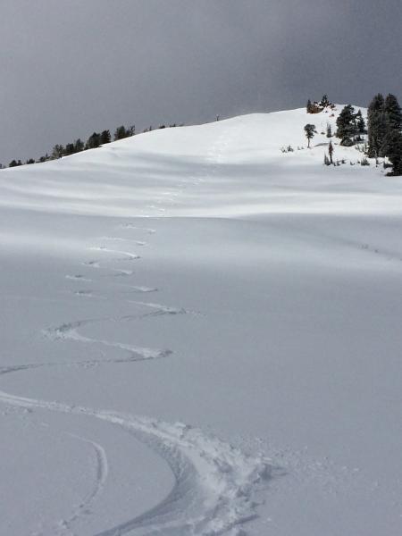
current conditions Under partly cloudy skies, temperatures only cooled decently along the higher ridge lines. Many mid-elevation stations are stubbornly in the upper 30s to even 40 in the Provo and Ogden area mountains. The westerly winds are in the 10 to 15 mph range, with just a few of the highest peaks averaging to 30 mph. The multiday (Sunday through Tuesday) snow totals were only a few inches at the upper elevations, but this dense snow is providing much improved turning and riding on high northerly facing slopes, for at least one more morning before heat and sun start taking their toll. Sunny slopes and all low to mid elevations will be crusty early, and very wet and sloppy later. Long forgotten soft snow turns. Low elevation access has been hit hard by rain and warm temperatures.
|
 |
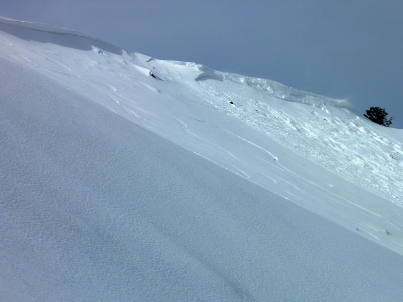
recent activity Yesterday’s avalanche activity was all new snow, and included:
Small cornice released new snow slide on West Monitor (Mark White Photo)
|
| type | aspect/elevation | characteristics |
|---|

|
|
LIKELIHOOD
 LIKELY
UNLIKELY
SIZE
 LARGE
SMALL
TREND
 INCREASING DANGER
SAME
DECREASING DANGER
|
|
description
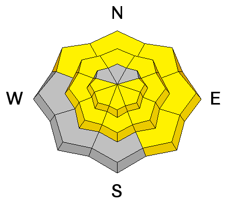
Very warm temperatures and periods of direct sun will make it easy to trigger wet loose sluffs in steep terrain today. On east through south through west facing slopes, these wet sluffs have the potential to run long distances on the icy crusts beneath them.
|
| type | aspect/elevation | characteristics |
|---|

|
|
LIKELIHOOD
 LIKELY
UNLIKELY
SIZE
 LARGE
SMALL
TREND
 INCREASING DANGER
SAME
DECREASING DANGER
|
|
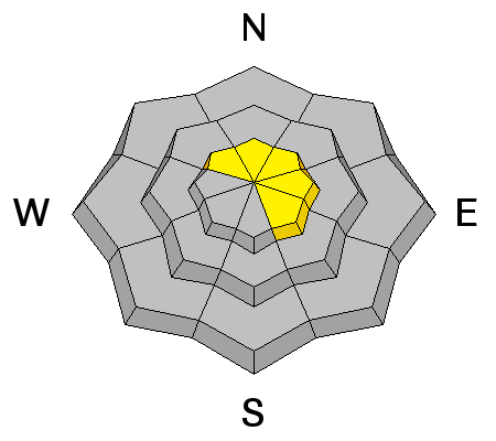
description
While most winds slabs rapidly stabilized yesterday, I’d still expect a few sensitive wind drifts could be triggered. These are mostly confined to upper elevation east and northeasterly facing slopes. In addition, cornices are still sensitive, and could break back further than expected or even on approach. |
 |
weather The next heat wave has arrived - 8,000’ temperatures will soar to near 50 today, and along the high ridge lines, will reach the mid-30s. The southwesterly winds will remain consistent along the highest ridgelines – in the 25 to 35 mph range. Elsewhere, however, winds speeds won’t average more than 10 to 15 mph. We’ll have variable high thin clouds this morning, which will thicken this afternoon. A repeat tomorrow, with a weak system bringing a chance of light rain and snow Saturday into Sunday. |
| general announcements Remember your information can save lives. If you see anything we should know about, please participate in the creation of our own community avalanche advisory by submitting snow and avalanche conditions. You can also call us at 801-524-5304, email by clicking HERE, or include #utavy in your tweet or Instagram. If you trigger an avalanche in the backcountry - especially if you are adjacent to a ski area – please call the following teams to alert them to the slide and whether anyone is missing or not. Rescue teams can be exposed to significant hazard when responding to avalanches, and do not want to do so when unneeded. Thanks. Salt Lake and Park City – Alta Central (801-742-2033), Canyons Resort Dispatch (435-615-3322) Snowbasin Resort Dispatch (801-620-1017), Powder Mountain Dispatch (801-745-3772 x 123). Sundance Dispatch (801-223-4150) EMAIL ADVISORY If you would like to get the daily advisory by email you will need to subscribe here. DAWN PATROL Hotline updated daily by 5-530am - 888-999-4019 option 8. Twitter Updates for your mobile phone - DETAILS UDOT canyon closures: LINK TO UDOT, or on Twitter, follow @UDOTavy, @CanyonAlerts or @AltaCentral Utah Avalanche Center mobile app - Get your advisory on your iPhone along with great navigation and rescue tools. Wasatch Powderbird Guides Blog/Itinerary for the Day. Lost or Found something in the backcountry? - http://nolofo.com/ Discount lift tickets are now available at Backcountry.com. Thanks to Ski Utah and the Utah Resorts. All proceeds go towards paying for Utah Avalanche Center avalanche and mountain weather advisories. To those skinning uphill at resorts: it is your responsibility to know the resort policy on uphill travel. You can see the uphill travel policy for each resort here. IMPORTANT: Before skinning or hiking at a resort under new snow conditions, check in with Ski Patrol. Resorts can restrict or cut off access if incompatible with control and grooming operations. Benefit the Utah Avalanche Center when you shop from Backcountry.com or REI: Click this link for Backcountry.com or this link to REI, shop, and they will donate a percent of your purchase price to the UAC. Both offer free shipping (with some conditions) so this costs you nothing! Benefit the Utah Avalanche Center when you buy or sell on ebay - set the Utah Avalanche Center as a favorite non-profit in your ebay account here and click on ebay gives when you buy or sell. You can choose to have your seller fees donated to the UAC, which doesn't cost you a penny. This information does not apply to developed ski areas or highways where avalanche control is normally done. This advisory is from the U.S.D.A. Forest Service, which is solely responsible for its content. This advisory describes general avalanche conditions and local variations always exist. |


_4.jpg)