| During the month of April, Mark Miller will donate $75 to the charity of your choice (5 to chose from, including the Utah Avalanche Center!) Mark Miller Subaru has raised over $300k in the previous 6 Do Good Feel Good events. More Info here |  |
| During the month of April, Mark Miller will donate $75 to the charity of your choice (5 to chose from, including the Utah Avalanche Center!) Mark Miller Subaru has raised over $300k in the previous 6 Do Good Feel Good events. More Info here | |
| Advisory: Ogden Area Mountains | Issued by Drew Hardesty for Saturday - January 11, 2014 - 7:25am |
|---|

|
bottom line A STRONG CONSIDERABLE DANGER WILL AGAIN RISE TO HIGH BY THE AFTERNOON INTO TOMORROW. Tree and bone snapping natural, natural cornice fall, and human triggered avalanches are likely on steep terrain and can be triggered from the flats below. These are dangerous conditions that will ramp up even higher with this next storm. Avoid being on or beneath steep terrain. Expert route finding essential. Choose low angled terrain with nothing steeper above or adjacent to you. Best to enjoy the new snow at our world class mountain resorts - I expect the next dramatic avalanche cycle to begin overnight into tomorrow.
|
 |
avalanche warning THIS AVALANCHE WARNING IS FOR THE MOUNTAINS OF NORTHERN AND CENTRAL UTAH, TO INCLUDE THE WESTERN UINTA MOUNTAINS. VERY DANGEROUS AVALANCHE CONDITIONS EXIST THROUGH THE WEEKEND...AVOID BEING ON OR BENEATH STEEP MOUNTAIN SLOPES...AS AVALANCHES MAY BE TRIGGERED LOW ON THE SLOPE AS WELL.
|
 |
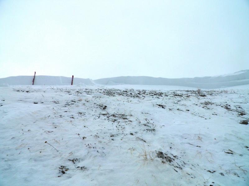
current conditions Be careful what you ask for. WINDS: The west to northwest winds wreaked havoc yesterday, blowing 30mph with gusts to 50 with the highest anemometers blowing 40-50mph with higher gusts. The winds swirled, even wraith-like, into the mid-elevations and canyon bottoms, leaving almost no stone unturned. Currently they're 25-35mph. TEMPS: Temperatures, starting in, if not near, the single digits yesterday, warmed throughout the day and are now in the mid 20s to near 30. Rapid warming? Check - temps have risen nearly 15 degrees in 24 hours... SNOW: It snowed maybe an inch yesterday, but due to the winds, the avalanche paths felt like it was heavy snowfall. Storm totals since Thursday -
In our line of business, we call this avalanche weather. Skies are partly cloudy. Riding conditions are now punchy and inverted, with many areas scoured or drifted; icing on the cake is a reported freezing rain/rime crust up to 8000', noted in the Cottonwood canyons, though may be patch and scattered elsewhere. |
 |
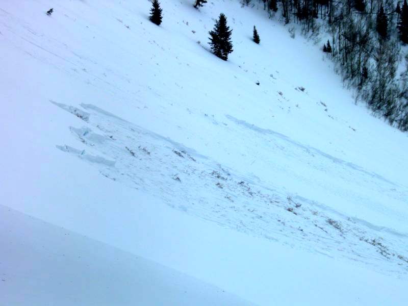
recent activity No slides observed from the backcountry though I expect better visibility today will show some significant activity. Avalanche teams at the mountain resorts found conditions to be stubborn and reluctant to move; however some control work in the upper elevations pulled out some slides 2-3' deep with explosives. In the central Wasatch - Large natural, cornice triggered, and human triggered avalanches ripped out across northern and central Utah. While the first line of naturals began Thursday night, they only became larger and more dangerous with yesterday's winds...
|
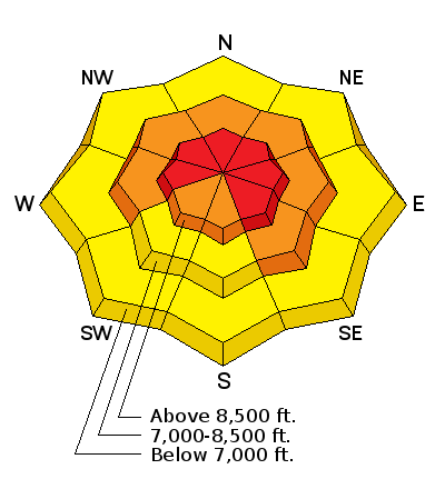
| type | aspect/elevation | characteristics |
|---|

|
|
LIKELIHOOD
 LIKELY
UNLIKELY
SIZE
 LARGE
SMALL
TREND
 INCREASING DANGER
SAME
DECREASING DANGER
|
|
description
Heavy snowfall, strong wind, rapid warming - all on the house of cards snowpack that we've "built" through the winter. Many of these avalanches will continue to rip out to the ground 2-4' deep and a couple hundred feet wide. These can be triggered at a distance and from below. Cracking and collapsing are signs of instability but may not be present. Doesn't matter. These are dangerous conditions. Long-time Ogden observer Brian Smith noted - "This is one of the weakest low elevation snow packs that I have seen in 25 years of skiing the same slopes in this area." Rapid warming and sun may be enough to initiate natural activity and accentuate the potential for human triggered slides on the steep sunlit slopes... I do expect "repeater" avalanches. With so much weak faceted snow near the ground and in the mid-pack, avalanches will have a hard time "cleaning out all the junk" in the closet...instead they'll reload...and then pull out again on the remaining weak faceted sugary snow. |
| type | aspect/elevation | characteristics |
|---|

|

|
LIKELIHOOD
LIKELY
UNLIKELY
SIZE
 LARGE
SMALL
TREND
 INCREASING DANGER
SAME
DECREASING DANGER
|
|
description
Wind drifts up to - easily - a couple feet deep may be triggered in many steep slopes on a variety of aspects and elevations. Due to the sheer wind speeds, they may also be triggered well off the ridgelines and then have the potential to step down into older faceted snow to the ground. Don't be fooled if these drifts may initially feel stiff and stubborn - cornice drops may reveal little and ski and slope cuts are downright dangerous. Any direct sun coupled with the rapidly warming temperatures will increase the likelihood of triggering these avalanches. ALSO - LARGE CORNICES MAY BE TRIGGERED AT A DISTANCE AND ARE LIKELY TO PULL FURTHER BACK ALONG THE RIDGELINE THAN EXPECTED....Don't go over with one of these boxcars - you and the cornice chunk are likely to trigger a slide on the slope below -
|
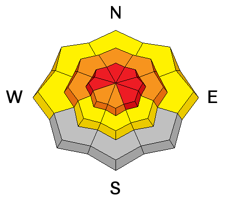
| type | aspect/elevation | characteristics |
|---|

|

|
LIKELIHOOD
 LIKELY
UNLIKELY
SIZE
LARGE
SMALL
TREND
INCREASING DANGER
SAME
DECREASING DANGER
|
|
description
A bit of an outlier...but it's often the outlier that catches the unaware. Two concerns with this -
|
 |
weather Skies will clear to mostly to partly cloudy today ahead of the next powerful storm system slated to arrive by the afternoon and early evening. 8000' and 10,000' highs will reach near 40 and the mid 30s, respectively. Winds will be west to northwest at 15-20mph then ramp up to 35-45mph by late evening. Gusts are expected in the 60s+. Cloud cover and initial rain to perhaps 8000' is expected by late afternoon/early evening before the cold front arrives. Storm total estimates are 12-18" by Monday with periods of intense snowfall. High pressure and warming follows for mid-week. |
| general announcements
This information does not apply to developed ski areas or highways where avalanche control is normally done. This advisory is from the U.S.D.A. Forest Service, which is solely responsible for its content. This advisory describes general avalanche conditions and local variations always occur. If you trigger an avalanche in the backcountry - especially if you are adjacent to a ski area – please call the following teams to alert them to the slide and whether anyone is missing or not. Rescue teams can be exposed to significant hazard when responding to avalanches, and do not want to do so when unneeded. Thanks. Salt Lake and Park City – Alta Central (801-742-2033), Canyons Resort Dispatch (435-615-3322) Snowbasin Resort Dispatch (801-620-1017), Powder Mountain Dispatch (801-745-3772 x 123). Sundance Dispatch (801-231-4150) EMAIL ADVISORY Get the Salt Lake avalanche advisory emailed to you every morning. CLICK HERE FOR DETAILS DAWN PATROL Hotline updated daily by 5-530am - 888-999-4019 option 8. Twitter Updates for your mobile phone - DETAILS UDOT canyon closures: LINK TO UDOT Utah Avalanche Center mobile app - Get your advisory on your iPhone along with great navigation and rescue tools.uned. Wasatch Powderbird Guides Blog/Itinerary for the Day. They'll be up and running later this winter - Lost or Found something in the backcountry? - http://nolofo.com/ Discount lift tickets are now available at Backcountry.com - Thanks to Ski Utah and the Utah Resorts. All proceeds go towards paying for Utah Avalanche Center avalanche and mountain weather advisories. To those skinning uphill at resorts: it is your responsibility to know the resort policy on uphill travel. Some allow uphill travel and have guidelines, some don't. Contact the Ski Patrol at each resort for details. IMPORTANT: Before skinning at a resort under new snow conditions, check in with Ski Patrol. Resorts can restrict or cut off access if incompatible with control and grooming operations. Benefit the Utah Avalanche Center when you shop from Backcountry.com or REI: Click this link for Backcountry.com or this link to REI, shop, and they will donate a percent of your purchase price to the UAC. Both offer free shipping (with some conditions) so this costs you nothing! Benefit the Utah Avalanche Center when you buy or sell on ebay - set the Utah Avalanche Center as a favorite non-profit in your ebay account here and click on ebay gives when you buy or sell. You can choose to have your seller fees donated to the UAC, which doesn't cost you a penny. Remember your information can save lives. If you see anything we should know about, please participate in the creation of our own community avalanche advisory by submitting snow and avalanche conditions. You can also call us at 801-524-5304 or 800-662-4140, email by clicking HERE, or include #utavy in your tweet or Instagram. Ski Utah mobile snow updates: |


_4.jpg)