| During the month of April, Mark Miller will donate $75 to the charity of your choice (5 to chose from, including the Utah Avalanche Center!) Mark Miller Subaru has raised over $300k in the previous 6 Do Good Feel Good events. More Info here |  |
| During the month of April, Mark Miller will donate $75 to the charity of your choice (5 to chose from, including the Utah Avalanche Center!) Mark Miller Subaru has raised over $300k in the previous 6 Do Good Feel Good events. More Info here | |
| Advisory: Ogden Area Mountains | Issued by Drew Hardesty for Monday - December 2, 2013 - 7:22am |
|---|

|
bottom line We have a mostly LOW danger. Low danger doesn't mean no danger. Avoid any recent drift of wind blown snow if traveling along the ridgelines. The danger will be on the rise over the next several days -
|
 |
special announcement
Extra Caution Advised for this week! - It's been mostly LOW danger for the past week. Now with a storm on the doorstep, don't let powder fever cloud your judgement - let the avalanche conditions settle out before jumping into the steep terrain. Remember that consequences are greater with a thin snowpack as a catch and carry results in the victim getting dragged through thinly veiled stumps and rocks
|
 |
current conditions Not exactly the calm before the storm. West to southwesterly winds are blowing - make that cranking - 30-40mph with high elevation gusts into the 50s. Temps continue their pre-frontal upward march with overnight "lows" near 30 up high, near 40 down low. Skies are mostly cloudy. Riding conditions are fair in soft settled powder in the more wind and sun sheltered terrain. The open bowls and snow in the alpine is a mix of wind and sun damage. |
 |
recent activity None. |
| type | aspect/elevation | characteristics |
|---|

|
|
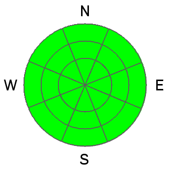
LIKELIHOOD
 LIKELY
UNLIKELY
SIZE
 LARGE
SMALL
TREND
 INCREASING DANGER
SAME
DECREASING DANGER
|
|
description
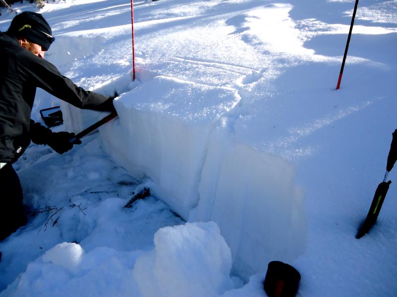
Doing the work - plenty of pre-storm obs have come in from a few of our pro observers. Reports from them (and you) make us the envy of all the other avalanche forecast centers. It's the Wisdom of the Crowds. (photo below - K. Robbins) Here's a few from the central Wasatch -
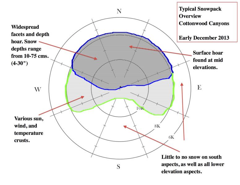
The snowpack and snow surface conditions are WIDELY VARIABLE slope to slope, even on the same slope due to the early season conditions and last weekend's fierce easterly wind event. Bottom Line is that any new snow and wind should bond poorly to the slick wind crusts and loose grains of recrystallized snow and smattering of surface hoar. I expect sensitive and touchy avalanche conditions with enough snow and wind. It's a different game now. Greg Gagne has an excellent overview of snow surface conditions on an aspect/elevation diagram, below.
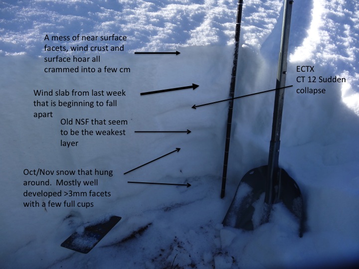
Profile - below Jake Hutchinson - indeed a "mess of surface facets, wind crust, and surface hoar" - not a good set up for this week's storm
|
| type | aspect/elevation | characteristics |
|---|

|
|
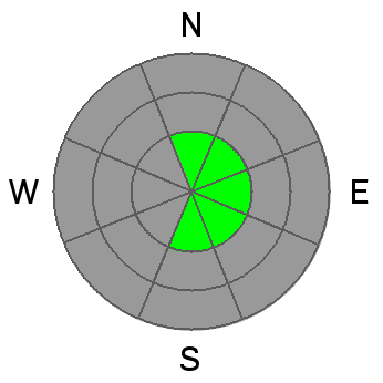
LIKELIHOOD
 LIKELY
UNLIKELY
SIZE
 LARGE
SMALL
TREND
 INCREASING DANGER
SAME
DECREASING DANGER
|
|
description
There's not a great deal of snow available for transport, yet the stronger westerlies will likely find what's left and create a few shallow wind drifts in the higher elevations today. |
 |
weather A long awaited Pacific storm is on our doorstep with the cold front expected in the early hours tomorrow morning. Pre-frontal winds will blow 30-40mph from the west and southwest with temps in the upper 20s expected at 10,000', and the mid to upper 30s at 8000'. Very cold air comes crashing into the state and we'll see mountain temps drop to below zero by Wednesday....and perhaps well below zero by the weekend. Snowfall amounts look to favor the Manti-Skyline plateau, though northern Utah may see upwards of 12-16" of very low density snow. Winds look to be light to moderate out of the northwest after the front...though cannot rule out perhaps another narrow window of an easterly wind event late Tues/early Wednesday. |
| general announcements
If you trigger an avalanche in the backcountry - especially if you are adjacent to a ski area – please call the following teams to alert them to the slide and whether anyone is missing or not. Rescue teams can be exposed to significant hazard when responding to avalanches, and do not want to do so when unneeded. Thanks. Salt Lake and Park City – Alta Central (801-742-2033), Canyons Resort Dispatch (435-615-3322) Twitter Updates for your mobile phone - DETAILS UDOT canyon closures UDOT at (801) 975-4838 Get your advisory on your iPhone with the Utah Avalanche Center mobile app, along with great navigation and rescue tools. Wasatch Powderbird Guides Blog/Itinerary for the Day. They'll be up and running later this winter - Thanks to Ski Utah and the Utah Resorts, discount lift tickets are now available at Backcountry.com. All proceeds go towards paying for Utah Avalanche Center avalanche and mountain weather advisories. To those skinning uphill at resorts: it is your responsibility to know the resort policy on uphill travel. Some allow uphill travel and have guidelines, some don't. Contact the Ski Patrol at each resort for details. IMPORTANT: Before skinning at a resort under new snow conditions, check in with Ski Patrol. Resorts can restrict or cut off access if incompatible with control and grooming operations. Benefit the Utah Avalanche Center when you shop from Backcountry.com or REI: Click this link for Backcountry.com or this link to REI, shop, and they will donate a percent of your purchase price to the UAC. Both offer free shipping (with some conditions) so this costs you nothing! Benefit the Utah Avalanche Center when you buy or sell on ebay - set the Utah Avalanche Center as a favorite non-profit in your ebay account here and click on ebay gives when you buy or sell. You can choose to have your seller fees donated to the UAC, which doesn't cost you a penny. Remember your information can save lives. If you see anything we should know about, please participate in the creation of our own community avalanche advisory by submitting snow and avalanche conditions. You can also call us at 801-524-5304 or 800-662-4140, email by clicking HERE, or include #utavy in your tweet or Instagram.
|


_4.jpg)