

Avalanche Advisory
| Advisory: Ogden Area Mountains | Issued by Drew Hardesty for April 10, 2013 - 7:13am |
|---|


Above 8,500 ft.
7,000-8,500 ft.
Below 7,000 ft.
|
bottom line Pockets of MODERATE danger exists for human triggered slides 8-16"'deep on many steep wind drifted slopes. These may be most pronounced - but certainly not limited to - the steep southeast through southwest facing slopes at the mid and upper elevations with pockets littered across the slope in unusual locations. Safer and more enjoyable snow conditions can be found in the mid elevation sheltered terrain on slopes less steep than 35 degrees.
|

 |
current conditions While an east wind blows Friend looks cancer in the eye Magnolia tree blooms
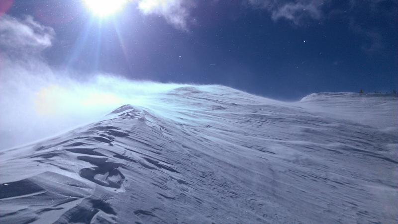
I often like to say that nothing good comes of an east wind...but sometimes there are good things that are coincident with it. Just ask the old man in Basho's haiku. Or the Park City and Western Uinta mountains. Storm totals for the previously described "tragic" closed Low are below: Park City and Western Uinta mountains: 16-20" LCC/BCC: 12-14" Ogden and Provo mountains: 5-7" Temps are in the mid teens this morning with northerly winds in the 15-20mph range, a bit off from the 25-35mph averages with gusts into the 40s and 50s. Riding conditions are quite good in the mid-elevation sheltered terrain and best with the a moderate slope angle to avoid "bottom feeding". Still, wind scouring and drifting were general and commonplace and defied categorization and pattern...and it was noted that "The winds seemed to be coming from all directions." Many southerly and westerly aspects saw just enough sun late in the day and will hold a thin breakable crust this morning. Photos by Rice, Brackelsberg, White
Aeolian processes at work - Mark White photo - could just as easily be Navajo sandstone in the desert southwest... |

 |
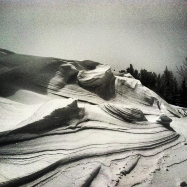
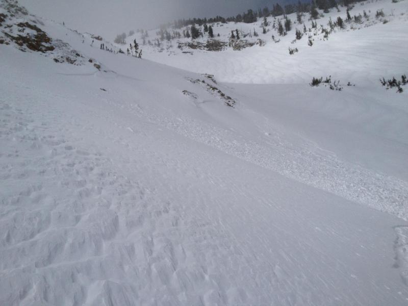
recent activity One might think - Snow, wind...garden variety wind drifts. Not so. Unusual loading patterns led to tricky conditions, with one person taking a short ride in southeast facing Toledo Bowl above Little Cottonwood Canyon. What makes this one interesting is not just the aspect (southeast), but that it was mid-slope...and caught an experienced b/c skier. (Typically when these conditions exist, best to take another step back.) Falk photo below (note scalloping wind effect). And below - cracking (Andy Rich) and activity (Englehard). we heard of no avalanching in the Provo mountains yesterday, but likely wind slabs were commonplace up high....photos below from the central Wasatch.
Most out yesterday reported plenty of cracking (some up to 60' wide propagation) and wind slab development. Classic red flag. (Andy Rich photo below)
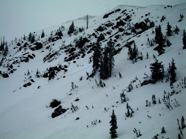
Pic below off Clayton Peak into Lackawaxen (Englehard)
|

Avalanche Problem 1over the next 24 hours
| type | aspect/elevation | characteristics |
|---|---|
 |
Above 8,500 ft.
7,000-8,500 ft.
Below 7,000 ft.
|
|
|
description
ALL ASPECTS ARE SUSPECT: Reported aspects for avalanche activity included northeast, east, southeast, south, and southwest...though if headed out today, I'd assume all aspects to be guilty until proven otherwise. HIGH ON THE SLOPE AND MID-SLOPE ARE EQUALLY SUSPECT - The strong winds were able to load areas both just off the ridgeline...and well off the ridgeline. This is due to both strength of wind as well as its ability to side or cross-load into the lee of sub-ridges, roll-overs, or any other spot that acts as a deceleration zone. Regardless, they should be less sensitive than yesterday but still identifiable as smooth, rounded, or otherwise wind affected.
Avalanche Problem 3over the next 24 hours
|


