

Avalanche Advisory
| Advisory: Ogden Area Mountains | Issued by Drew Hardesty for March 25, 2013 - 7:07am |
|---|


Above 8,500 ft.
7,000-8,500 ft.
Below 7,000 ft.
|
bottom line A mostly LOW danger this morning will rise to MODERATE with daytime warming and periods of sun. Human triggered slides in the lingering storm snow remain unlikely, but possible in very isolated terrain. 2nd Disclaimer in as many days - IF the mountains see more sun and warmth than forecasted (in other words, if I blow the weather forecast) the danger of wet activity will rise to CONSIDERABLE on all steep sun exposed slopes.
|

 |
current conditions We're mostly clear...though we'll have moisture streaming in from the west by the time this goes to press. Winds are generally light with some' ridgelines clocking speeds of 15-20mph with an occasional gust to 30. Temps are in the teens. Many southeast to south to westerly facing slopes will have a superficial crust this morning that should soften with daytime warming. Same for northerly terrain up to 7-7500'. A couple thoughts before heading out into that state of powder euphoria -
|
 |
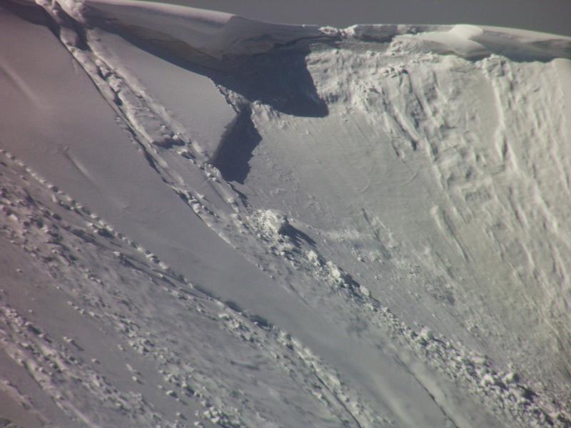
recent activity Enough breeze, cold temps and clouds kept the wet activity at bay yesterday and activity was limited to a few pockets of lingering storm snow avalanches as reported in Mineral Fork, Snake Creek, West Monitor, and Silver Fork. (pics - Kobernik, White). These were generally north through southeast facing at 9-10,000' and up to 15" deep, 100' wide. In the Ogden mountains, we heard about a few minor sluffs and garden variety soft slabs...all manageable conditions...
|

Avalanche Problem 1over the next 24 hours
| type | aspect/elevation | characteristics |
|---|
 |
Above 8,500 ft.
7,000-8,500 ft.
Below 7,000 ft.
|
|
|
description
Temps will be a few degrees warmer today than they were yesterday, though the more dramatic warming is slated for tomorrow. 10,000' highs should hit the mid-teens today, near 30 tomorrow. Cloud cover is again the wild card...and it is freeing to say I don't know exactly how the cloud cover is going to play out today. I suspect that there will be enough building clouds and cool temps so the wet snow won't get out of hand. You'll just need to remain flexible and watch for yourself how things play out. Greenhousing - that is, with thin layers of clouds trapping in the heat may exacerbate the warming, particularly on the mid to low elevation northerly slopes...but it, too, is a wild card. Enough of the heat and sun may trigger wet activity that gouges down to the sun crusts buried on the 20th...and produce significant debris piles. If it were me, I'd already write off the southerlies and stick to the mid to upper elevation shady terrain. Otherwise, if you see natural and/or human triggered wet pinwheels and rollerballs...gradually turning into wet sluffs, hit the road. Ever notice how more writing means more uncertainty? |

Avalanche Problem 2over the next 24 hours
| type | aspect/elevation | characteristics |
|---|
 |


Above 8,500 ft.
7,000-8,500 ft.
Below 7,000 ft.
|
|
|
description
Gradual warming should help settle out the lingering wind drifts and storm snow instabilities and the overall danger is mostly Low. Dramatic warming and sun? Not so much. Set yourself up for success by skiing/riding one at at time, execute proper ski/slope cuts moving across the convexity from area of safety to area of safety and get out of the way at the bottom. Cornices will become increasingly sensitive with the warming trend and may be enough of a thump to trigger a slab on the lee side of the ridgeline. |

 |
weather We'll have partly to mostly cloudy skies today with light westerly winds and temps reaching toward 30 at 8000; the mid to upper teens at 10,000'. More significant warming takes place tomorrow at ridgetop temps reach freezing. A weak system dissolves as it moves through later tomorrow..with periods of cloudiness moving through the low amplitude ridge through the rest of the week. A cut-off Low should start to affect Utah by April Fools Day. |
| general annoucements Go to http://www.backcountry.com/utah-avalanche-center to get tickets from our partners at Beaver Mountain, Canyons, Sundance, and Wolf Mountain. All proceeds benefit the Utah Avalanche Center. If you trigger an avalanche in the backcountry - especially if you are adjacent to a ski area – please call the following teams to alert them to the slide and whether anyone is missing or not. Rescue teams can be exposed to significant hazard when responding to avalanches, and do not want to do so when unneeded. Thanks. Salt Lake and Park City – Alta Central (801-742-2033), Canyons Resort Dispatch (435-615-3322) Ogden – Snowbasin Patrol Dispatch (801-620-1017) Powder Mountain Ski Patrol Dispatch (801-745-3772 ex 123) Provo – Sundance Patrol Dispatch (801-223-4150) Dawn Patrol Forecast Hotline, updated by 05:30: 888-999-4019 option 8. Twitter Updates for your mobile phone - DETAILS Daily observations are frequently posted by 10 pm each evening. Subscribe to the daily avalanche advisory e-mail click HERE. UDOT canyon closures UDOT at (801) 975-4838 Wasatch Powderbird Guides does daily updates about where they'll be operating on this blog http://powderbird.blogspot.com/ . Remember your information can save lives. If you see anything we should know about, please participate in the creation of our own community avalanche advisory by submitting snow and avalanche conditions. You can also call us at 801-524-5304 or 800-662-4140, email by clicking HERE, or include #utavy in your tweet. Donate to your favorite non-profit –The Friends of the Utah Avalanche Center. The UAC depends on contributions from users like you to support our work. For a print version of this advisory click HERE. This advisory is produced by the U.S. Forest Service, which is solely responsible for its content. It describes only general avalanche conditions and local variations always exist. Specific terrain and route finding decisions should always be based on skills learned in a field-based avalanche class. |