

Avalanche Advisory
| Advisory: Ogden Area Mountains | Issued by Drew Hardesty for March 24, 2013 - 7:18am |
|---|


Above 8,500 ft.
7,000-8,500 ft.
Below 7,000 ft.
|
bottom line Pockets of MODERATE remain for lingering instabilities within the week's storm snow, though these are now isolated and manageable. The danger of wet snow avalanches on the sunny aspects will rise to MODERATE with periods of direct sun and daytime warming. If I'm wrong with the weather forecast and the mountains see direct sun all day, all bets are off...and the danger of wet avalanches may rise toward CONSIDERABLE with both human and natural avalanches likely.
|

 |
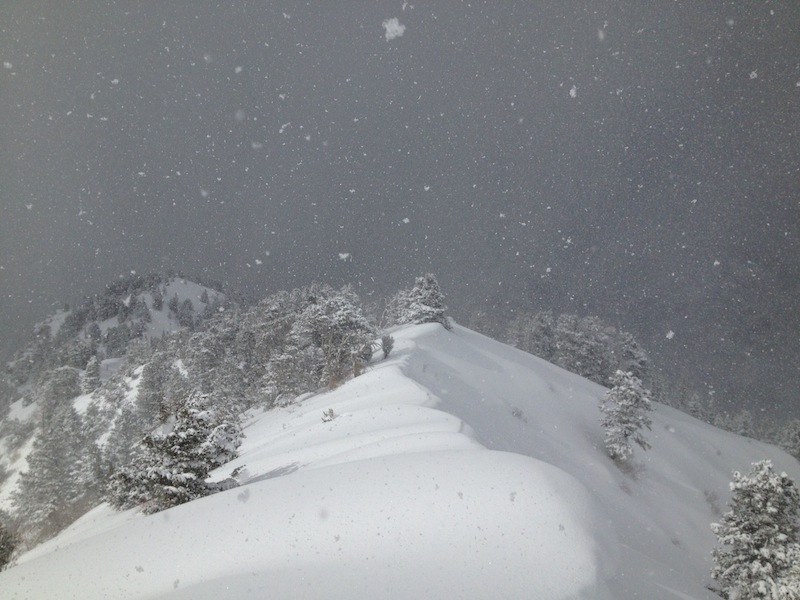
current conditions It's still 5 star out there boys and girls...and below are the storm totals for the week. (Add another inch or two for yesterday's instability showers on top - Greg Gagne's photo below)
It is simply amazing how quickly the snow turns with just a glance of the spring sun in the Wasatch...affecting both the snow quality and the avalanche conditions. Fortunately there was just enough lingering moisture and instability to keep much of the solar radiation at bay but for some slopes - that's all it takes. So...some east, south and westerly slopes will have a touch of crust this morning...and you'll be rolling the dice. Stick to the mid to high northerly slopes and your crust and major avalanche concerns will be minimized. Skies are (currently) clear, temps remain in the below - to just above zero - icebox, and the northwesterly winds are generally less than 15mph. What's not to like? Did I mention how good the skiing and riding is? |
 |
recent activity Yesterday's human triggered activity can be summed up in 4 parts -
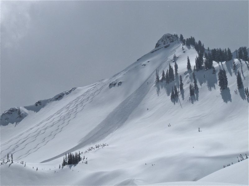
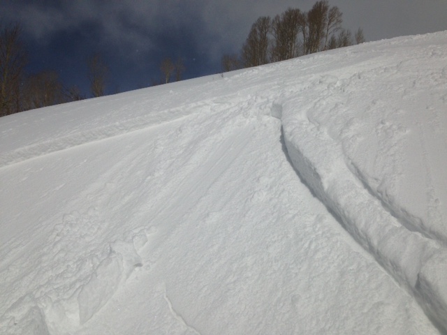
The wide eyed and wildly grinning backcountry crowd swarmed over all of the low-hanging fruit and found a smattering of lingering storm snow slabs up to 6-8" deep, though rarely more than 40' wide. (1st photo Brett Kobernik of another party's slide on Little Superior). As the sun poke through, it provided just enough of a change to make localized sun pockets sensitive as well (2nd photo Paige Pagnucco in upper Snake Creek). 3rd photo of sizable pocket in the Catcher's Mitt (photo Trent Meisenheimer of another party's slide).
Very good snow observations came in yesterday (you can see them all under Detailed Info in the Menu above), with notable reports by Greg Gagne and Chris Cawley in the central Wasatch and Bill Hunt in the Snowbasin backcountry. |
Avalanche Problem 1over the next 24 hours
| type | aspect/elevation | characteristics |
|---|
 |
Above 8,500 ft.
7,000-8,500 ft.
Below 7,000 ft.
|
|
|
description
It all depends on the cloud cover. It is partly cloudy now with some more clearing expected initially...then more convective cloud buildup with an instability shower or two expected during the day. Even though it's still quite cold, any direct solar radiation for an minimum amount of time dramatically changes the mechanics of the snow and human triggered avalanches will become increasingly likely. Longer duration of direct sun and natural loose wet sluffs and an occasional wet slab may be produced. My sense is that it probably won't get too out of hand today; though here's the key - Get off and out of any sunny aspect before the sun has a chance to alter it and make it unstable.
|

Avalanche Problem 2over the next 24 hours
| type | aspect/elevation | characteristics |
|---|
 |


Above 8,500 ft.
7,000-8,500 ft.
Below 7,000 ft.
|
|
|
description
A long time observer in Big Cottonwood called it the best day of the year yesterday b/c of the blower powder AND the avalanche conditions were manageable. In other words, there were no monsters in the basement to worry about anymore. Simple cornice drops and ski and slope cuts and good terrain management can help keep you "right side up". The minor concerns for today -
|

 |
weather We're likely to see periods of cloud cover and spring convective squalls (see pic above by Gagne) through the day. Winds will be less than 15mph at all but the highest elevations. Temps will rise to the upper single digits/low teens at 10,000' and the low 20s at 8000'. We can expect a slow warm-up over the next couple days...with another storm system perhaps a week out. |
| general annoucements Go to http://www.backcountry.com/utah-avalanche-center to get tickets from our partners at Beaver Mountain, Canyons, Sundance, and Wolf Mountain. All proceeds benefit the Utah Avalanche Center. If you trigger an avalanche in the backcountry - especially if you are adjacent to a ski area – please call the following teams to alert them to the slide and whether anyone is missing or not. Rescue teams can be exposed to significant hazard when responding to avalanches, and do not want to do so when unneeded. Thanks. Salt Lake and Park City – Alta Central (801-742-2033), Canyons Resort Dispatch (435-615-3322) Ogden – Snowbasin Patrol Dispatch (801-620-1017) Powder Mountain Ski Patrol Dispatch (801-745-3772 ex 123) Provo – Sundance Patrol Dispatch (801-223-4150) Dawn Patrol Forecast Hotline, updated by 05:30: 888-999-4019 option 8. Twitter Updates for your mobile phone - DETAILS Daily observations are frequently posted by 10 pm each evening. Subscribe to the daily avalanche advisory e-mail click HERE. UDOT canyon closures UDOT at (801) 975-4838Wasatch Powderbird Guides does daily updates about where they'll be operating on this bloghttp://powderbird.blogspot.com/ .Remember your information can save lives. If you see anything we should know about, please participate in the creation of our own community avalanche advisory by submitting snow and avalanche conditions. You can also call us at 801-524-5304 or 800-662-4140, email by clicking HERE, or include #utavy in your tweet. Donate to your favorite non-profit –The Friends of the Utah Avalanche Center. The UAC depends on contributions from users like you to support our work. For a print version of this advisory click HERE. This advisory is produced by the U.S. Forest Service, which is solely responsible for its content. It describes only general avalanche conditions and local variations always exist. Specific terrain and route finding decisions should always be based on skills learned in a field-based avalanche class. |