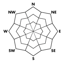


| Advisory: Ogden Area Mountains | Issued by Drew Hardesty for March 20, 2013 - 7:04am |
|---|


Above 8,500 ft.
7,000-8,500 ft.
Below 7,000 ft.
|
bottom line We'll have a mostly LOW danger again in the backcountry. If we see more rain and snow than expected, both wet and dry sluffs as well as shallow wind slab will become more prevalent.
|
 |
special announcement
|
 |
current conditions The 1st day of Spring...though between me and you...and the snowpack, last Thursday/Friday's heat wave marked the transition between one season to the next. Don't abandon the winter gear yet - we have more storms on the way - as today's increasing clouds and southwesterly winds usher in the first of two systems. Skies are already partly to mostly cloudy, temps have increased through the night (mid to upper 20s) and winds are southwesterly blowing 15-20mph with gusts into the 30s. |
 |
recent activity None...though there was a close call in the Moffit Peak area of the Uintas yesterday - check the Uinta advisory for more details.... More photos continue to filter in from last week's wet avalanche cycle. Brett started a collection here. |
| type | aspect/elevation | characteristics |
|---|
 |


Above 8,500 ft.
7,000-8,500 ft.
Below 7,000 ft.
|
|
|
description
Even with a LOW avalanche danger, there are a few places where a person could trigger a small slide. In extreme terrain or on very steep slopes, there could be serious consequences if you go for a fast icy ride, are pushed off a cliff or into trees. Watch out for:
|
 |
weather The first storm arrives today, accompanied by a subtropical moisture tap. It doesn't look like this will translate to a lot of precipitation for the Wasatch, but at least we'll have a high rain/snow line (8-8500'). Temps will nudge near freezing at 10,000' and the mid 30s at 8000'. Winds will be on uptick from the southwest, blowing 30-35mph by the afternoon and perhaps into the 40s along the most exposed ridgelines. I suspect we'll see 2-4" of dense snow by early evening. A cold front arrives tomorrow, ushering in a new round of snow with snowfall crashing to the valleys. Mountain temps plummet to the mid-teens with mountain snowfall amounts in the 6-10" range expected by late Thurs/early Friday. Quite a bit of instability noted with tomorrow's storm...lightning, lake effect bands possible...and periods of convective snowfall will lead to widely variable snow amounts even from drainage to drainage. Mountain temps continue to plummet to the single digits by Friday. We stay unsettled through Saturday. |
| general annoucements Go to http://www.backcountry.com/utah-avalanche-center to get tickets from our partners at Beaver Mountain, Canyons, Sundance, and Wolf Mountain. All proceeds benefit the Utah Avalanche Center. If you trigger an avalanche in the backcountry - especially if you are adjacent to a ski area – please call the following teams to alert them to the slide and whether anyone is missing or not. Rescue teams can be exposed to significant hazard when responding to avalanches, and do not want to do so when unneeded. Thanks. Salt Lake and Park City – Alta Central (801-742-2033), Canyons Resort Dispatch (435-615-3322) Ogden – Snowbasin Patrol Dispatch (801-620-1017) Powder Mountain Ski Patrol Dispatch (801-745-3772 ex 123) Provo – Sundance Patrol Dispatch (801-223-4150) Dawn Patrol Forecast Hotline, updated by 05:30: 888-999-4019 option 8. Twitter Updates for your mobile phone - DETAILS Daily observations are frequently posted by 10 pm each evening. Subscribe to the daily avalanche advisory e-mail click HERE. UDOT canyon closures UDOT at (801) 975-4838Wasatch Powderbird Guides does daily updates about where they'll be operating on this bloghttp://powderbird.blogspot.com/ .Remember your information can save lives. If you see anything we should know about, please participate in the creation of our own community avalanche advisory by submitting snow and avalanche conditions. You can also call us at 801-524-5304 or 800-662-4140, email by clicking HERE, or include #utavy in your tweet. Donate to your favorite non-profit –The Friends of the Utah Avalanche Center. The UAC depends on contributions from users like you to support our work. For a print version of this advisory click HERE. This advisory is produced by the U.S. Forest Service, which is solely responsible for its content. It describes only general avalanche conditions and local variations always exist. Specific terrain and route finding decisions should always be based on skills learned in a field-based avalanche class. |