

| Advisory: Ogden Area Mountains | Issued by Brett Kobernik for December 31, 2012 - 7:03am |
|---|


Above 8,500 ft.
7,000-8,500 ft.
Below 7,000 ft.
|
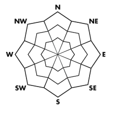
bottom line A MODERATE avalanche danger exists on northwest through north through east facing slopes in areas that have an overall snow depth of less than about 3 feet. This means human triggered avalanches are possible that could break into older weak snow. There is also a chance for a person to trigger a newer wind slab along the upper easterly facing ridgelines.
|
 |
special announcement Thanks so much to all those who have donate to the UAC this year! Most of our funding comes from donations and events and your support keeps the forecasts and education going. If you have not yet made a 2012 contribution, you have a few more days... There is still space available for the Snowbird Freeride Avalanche Summit, an avalanche skills class aimed at Big Mtn Freeriders, aimed at addressing safety issues related to steep lines, remote locations, and filming. Jan 6-8 2012. Details at http://utahavalanchecenter.org/2013-snowbird-freeride-avalanche-summit. |
 |
current conditions What a great way to end the year. Riding conditions have been spectacular and we're dealing with an overall fairly stable snowpack. A trace of snow fell during the day on Sunday. We have partly cloudy skies and temperatures in the single digits. Winds are light from a northerly direction. With a period of cold clear weather ahead, we will be intently watching the snow surface for near surface faceting and surface hoar formation which could play a role when we start seeing storms again. In the mean time, better get out an enjoy it. |
 |
recent activity No avalanche activity was reported from the Ogden area mountains but one small hard slab was reported from Sunday from the Central Wasatch where a skier triggered a 1 foot deep by 50 foot wide wind pillow from the ridge above, no one was caught. This involved newer snow only. |
| type | aspect/elevation | characteristics |
|---|
 |


Above 8,500 ft.
7,000-8,500 ft.
Below 7,000 ft.
|
|
|
description
The most dangerous type of avalanche today would be the unlikely chance of triggering one that breaks deep into weak layers from late November and early December. You would need to be poking around in areas with a thin overall snow depth (about 3 feet or less) between 8000 and 9800 feet in elevation. |
| type | aspect/elevation | characteristics |
|---|
 |


Above 8,500 ft.
7,000-8,500 ft.
Below 7,000 ft.
|
|
|
description
Yesterday's skier triggered pocket demonstrates that there are actually a few newer wind pillows that may crack under the weight of a person. You'll find these to be mostly confined to the easterly sides of the ridges and will need a very steep slope. |
 |
weather I'm expecting a somewhat similar day today as yesterday with a minor disturbance moving through which should produce clouds and maybe some light snow with really no accumulation. Temperatures should get into the mid teens and northwest winds should remain light. A ridge of high pressure will build in for the remainder of the week with no significant storms in sight. |
| general annoucements Go to http://www.backcountry.com/utah-avalanche-center to get tickets from our partners at Beaver Mountain, Canyons, Sundance, and Wolf Mountain. All proceeds benefit the Utah Avalanche Center. If you trigger an avalanche in the backcountry - especially if you are adjacent to a ski area – please call the following teams to alert them to the slide and whether anyone is missing or not. Rescue teams can be exposed to significant hazard when responding to avalanches, and do not want to do so when unneeded. Thanks. Salt Lake and Park City – Alta Central (801-742-2033), Canyons Resort Dispatch (435-615-3322) Ogden – Snowbasin Patrol Dispatch (801-620-1017) Powder Mountain Ski Patrol Dispatch (801-745-3773 ex 123) Provo – Sundance Patrol Dispatch (801-223-4150) Dawn Patrol Forecast Hotline, updated by 05:30: 888-999-4019 option 8. Twitter Updates for your mobile phone - DETAILS Daily observations are frequently posted by 10 pm each evening. Subscribe to the daily avalanche advisory e-mail click HERE. UDOT canyon closures UDOT at (801) 975-4838 Wasatch Powderbird Guides does daily updates about where they'll be operating on this blog http://powderbird.blogspot.com/ . Remember your information can save lives. If you see anything we should know about, please participate in the creation of our own community avalanche advisory bysubmitting snow and avalanche conditions. You can also call us at 801-524-5304 or 800-662-4140, or email by clicking HERE Donate to your favorite non-profit –The Friends of the Utah Avalanche Center. The UAC depends on contributions from users like you to support our work. For a print version of this advisory click HERE. This advisory is produced by the U.S. Forest Service, which is solely responsible for its content. It describes only general avalanche conditions and local variations always exist. Specific terrain and route finding decisions should always be based on skills learned in a field-based avalanche class. |