

| Advisory: Ogden Area Mountains | Issued by Brett Kobernik for December 2, 2012 - 7:12am |
|---|


Above 8,500 ft.
7,000-8,500 ft.
Below 7,000 ft.
|
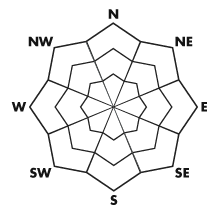
bottom line Overall, the avalanche danger starts out LOW this morning but will be on the rise and could reach MODERATE by this afternoon with enough wind and the onset of snow. Fresh drifts along the northerly lee sides of ridges are the problem areas. The danger will continue to rise into Monday.
|
 |
current conditions Temperatures are slightly warmer than 24 hours ago and all of the Ogden area stations are well above freezing. Southwest winds are increasing but generally are in the moderate speed range along the mid elevation ridges with strong gusts at the more exposed locations. |
 |
recent activity It was a quiet day out in the hills on Saturday with stubborn wind slabs and no activity noted. Two of our higher end and most secretive observers both noted a thin rain crust that formed prior to the minor snow event Friday night. It's presence was noted up to 9500 feet and perhaps even higher. This is something that should be looked at closely as rain crusts can cause and or enhance a layer of faceted snow making it more dangerous than it would be without the crust. If you're getting out today, try to sniff this out and let us know if you're finding it. Often, you will need to take your glove off and feel for it with your bare hand. The weak snow that formed since November 20 has been well documented in observations and will be the major player in any instability that results from tonights storm. The question is, will we receive enough weight to overload it and produce a widespread avalanche cycle? I suspect we'll see some activity. DON'T TRUST IT OUT THERE ON MONDAY. It would be foolish to dive right into any big terrain without thorough analysis.
|
| type | aspect/elevation | characteristics |
|---|
 |


Above 8,500 ft.
7,000-8,500 ft.
Below 7,000 ft.
|
|
|
description
You will want to pay attention to what the wind does today. Things were stubborn on Saturday and there doesn't seem like there will be a whole lot of snow available for transport during the day today, however, pay attention on the high lee northerly aspects. You're looking for fresh pillows. Provoke them in safe locations whenever possible to get a feel if they are reactive. |
 |
weather We'll see very mild temperatures today with highs in the upper 30s at 8000 feet and around freezing along the ridgetops. Southwest winds will continue to increase as the day goes on. Snow is expected to start late this afternoon/evening with 6 to 12 inch totals and around an inch of water weight. Strong southwest winds will continue during this system. Snow should be done by Monday morning and winds will lighten up and shift more westerly. |
| general annoucements If you trigger an avalanche in the backcountry - especially if you are adjacent to a ski area – please call the following teams to alert them to the slide and whether anyone is missing or not. Rescue teams can be exposed to significant hazard when responding to avalanches, and do not want to do so when unneeded. Thanks. Salt Lake and Park City – Alta Central (801-742-2033) Ogden – Snowbasin Patrol Dispatch (801-620-1017) Provo – Sundance Patrol Dispatch (801-223-4150) Dawn Patrol Forecast Hotline, updated by 05:30: 888-999-4019 option 8. Twitter Updates for your mobile phone Daily observations are frequently posted by 10 pm each evening. Subscribe to the daily avalanche advisory e-mail click HERE. UDOT canyon closures UDOT at (801) 975-4838 Wasatch Powderbird Guides does daily updates about where they'll be operating on this blog http://powderbird.blogspot.com/ . Remember your information can save lives. If you see anything we should know about, please participate in the creation of our own community avalanche advisory by submitting snow and avalanche conditions. You can also call us at 801-524-5304 or 800-662-4140, or email by clicking HERE Donate to your favorite non-profit –The Friends of the Utah Avalanche Center. The UAC depends on contributions from users like you to support our work. This advisory is produced by the U.S. Forest Service, which is solely responsible for its content. It describes only general avalanche conditions and local variations always exist. Specific terrain and route finding decisions should always be based on skills learned in a field-based avalanche class.
|