

| Advisory: Ogden Area Mountains | Issued by Drew Hardesty for November 29, 2012 - 6:57am |
|---|


Above 8,500 ft.
7,000-8,500 ft.
Below 7,000 ft.
|
bottom line LOW
|
 |
current conditions Skies are clear to partly cloudy. A little 'wave' went through overnight that brought little more than a bump in southerly winds. Preceding the "front", southerly winds averaged 30-40mph with a couple gusts into the 60s. They've since diminished, currently blowing from the southwest in the 15-20mph range. Temps are in the upper 20s to low 30s. Riding conditions are grim, but it's times like these that make philosophers of us all. It's no coincidence that history's greatest philosophers and spiritual icons spent time wandering vast expanses of desert. We continue to add more and more content to the website - we have featured videos (detailed info) and archived advisories. |
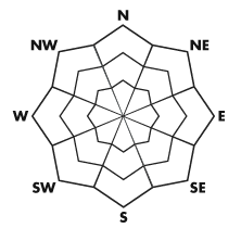
| type | aspect/elevation | characteristics |
|---|
 |


Above 8,500 ft.
7,000-8,500 ft.
Below 7,000 ft.
|
|
|
description
The weak surface snow, aka "recrystallized powder", weakening by the day, is becoming weak enough to sluff with some provocation. Not enough to be an avalanche concern today, but I suspect it'll be a player with the next storm. There's little to blow around, but I guess you could find a shallow new wind drift in the extreme terrain. |
 |
weather The storm spinning off the coast will bring another wave through on Friday before ejecting inland and providing northern Utah with a decent shot of snow late Sunday into Monday. In the meantime, we'll have clear to partly cloudy skies, southwesterly winds at 10-15mph, and highs today in the mid to upper 30s. Friday's disturbance may offer a few meager inches of white rain. Pre-frontal winds Sunday are expected to ramp into the 45-55mph range. Temps drop to the mid-teens by Monday and a foot of snow shouldn't be out of the question. (Models don't look as good as yesterday...) Elsewhere - check out the subtropical moisture tap. The Sierra should see feet and feet of snow with this system. Plenty of food on the table, but none for us.
|
| general annoucements If you trigger an avalanche in the backcountry - especially if you are adjacent to a ski area – please call the following teams to alert them to the slide and whether anyone is missing or not. Rescue teams can be exposed to significant hazard when responding to avalanches, and do not want to do so when unneeded. Thanks. Salt Lake and Park City – Alta Central (801-742-2033) Ogden – Snowbasin Patrol Dispatch (801-620-1017) Provo – Sundance Patrol Dispatch (801-223-4150) Dawn Patrol Forecast Hotline, updated by 05:30: 888-999-4019 option 8. Twitter Updates for your mobile phone Daily observations are frequently posted by 10 pm each evening. Subscribe to the daily avalanche advisory e-mail click HERE. UDOT canyon closures UDOT at (801) 975-4838 Wasatch Powderbird Guides does daily updates about where they'll be operating on this blog http://powderbird.blogspot.com/ . Remember your information can save lives. If you see anything we should know about, please participate in the creation of our own community avalanche advisory by submitting snow and avalanche conditions. You can also call us at 801-524-5304 or 800-662-4140, or email by clicking HERE Donate to your favorite non-profit –The Friends of the Utah Avalanche Center. The UAC depends on contributions from users like you to support our work. This advisory is produced by the U.S. Forest Service, which is solely responsible for its content. It describes only general avalanche conditions and local variations always exist. Specific terrain and route finding decisions should always be based on skills learned in a field-based avalanche class. Evelyn will update this forecast tomorrow. Thanks for calling. |