

| Advisory: Ogden Area Mountains | Issued by Evelyn Lees for November 11, 2012 - 7:21am |
|---|


Above 8,500 ft.
7,000-8,500 ft.
Below 7,000 ft.
|
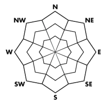
bottom line The avalanche danger is CONSIDERABLE on steep, upper elevation north, northwest and northeasterly facing slopes where old October snow is beneath all the new powder. Slides can be triggered from a distance, narrow but up to 3’ deep, and will take you on a rough, rocky ride, and possibly bury you. The avalanche danger is MODERATE on steep mid elevation slopes and all slopes facing southeast, south and west. New snow soft slabs, sluffs and a few wind drifts along the highest ridgelines can be triggered by people on steep slopes.
|
 |
special announcement Alta and Snowbird Mountain Resorts will be closed to Uphill Traffic today in preparation for their scheduled opening date. Please observe all closure signs at all resorts. Welcome to the new look of the avalanche advisory. This past summer we had a series of meetings and negotiated a unified look-and-feel of the avalanche advisories and web pages for other avalanche centers in this region including Jackson, Wyoming, Sun Valley and the Sierra Avalanche Center. Eventually all these sites should look very similar and the plan is for Colorado to join the look next winter. In another week or two we expect to have two viewing choices for the advisory page--this basic view and the "advanced" view most are familiar with from last season with colored danger ratings in the aspect-elevation diagram. We are still in the process of transferring the pages and content from our old website to the new site, so be patient. We are also tweaking the look and design so you may notice some changes. When everything is finished, it should all be pretty cool. |
 |
current conditions Instant winter! Snow continues to fall in the Ogden, Park City and Salt Lake mountains, which picked up another 2 to 5” overnight. A narrow lake affect band directed into Little Cottonwood, allowed Alta to pick up another 11 inches, and still counting. Storm totals are now approximately 9 to 11” in the Provo area mountains, up to 19” in the Ogden area mountains, 2 feet on the Park City side, and 2 to 3 feet in the Cottonwoods. Temperatures are in the single digits to low teens this morning. The northwesterly winds are generally averaging less than 15 mph, but have starting picking up along the higher ridges the past 2 hours. Along a few high, exposed ridges, winds speeds are edging up into the 20 to 30 mph range, with gusts to 40. |
 |
recent activity Two small slides were triggered yesterday on north facing slopes , above 9700', in upper Big Cottonwood. One was remotely triggered from about 75' away, by the 2nd person on the slope. Both failed on a shallow layer of 1-2mm facets on the ground. Check out the details in “All The Good Stuff” . There were also the more predictable natural and human triggered new snow soft slabs and sluffs, mostly triggered in upper Little Cottonwood during the periods of very heavy snowfall. |
| type | aspect/elevation | characteristics |
|---|
 |


Above 8,500 ft.
7,000-8,500 ft.
Below 7,000 ft.
|
|
|
description
That thin layer of sugary facets on or near the ground is the weak layer most likely to surprise backcountry travelers today. It is snow left over from the late October storm, remaining in patches on upper elevation north, northeasterly and northwesterly facing slopes, above about 9500’. While this weak layer is shallow and localized, it has all the hallmark characteristics of a tricky facets – slides can be triggered remotely from a distance or by the third person on a slope, and will take out the entire snowpack to the ground. |
| type | aspect/elevation | characteristics |
|---|
 |


Above 8,500 ft.
7,000-8,500 ft.
Below 7,000 ft.
|
|
|
description
Wind speeds of 15 mph or greater move snow into sensitive wind drifts. Just a few upper elevation, ridgeline stations are flirting with these speeds this morning, but be aware through out the day that if wind speeds increase where you are or above you, the avalanche danger can increase in a matter of minutes. Generally, the higher the elevation, the greater wind speeds today, and sensitive wind drifts will be most widespread along the high ridgelines. |
| type | aspect/elevation | characteristics |
|---|
 |


Above 8,500 ft.
7,000-8,500 ft.
Below 7,000 ft.
|
|
|
description
A “right side up” storm - dense snow first followed by increasingly light feathery snow – encourages new snow stability. However, just the shear volume of all that new snow with little time to settle, means that today it will still be possible to trigger new snow soft slabs and sluffs on steep slopes. Be especially wary during periods of intense precipitation – approaching 2 inches or more an hour – when the new snow will be super sensitive. |
 |
weather The storm system that has ushered in winter will exit northern Utah this afternoon. Snow showers will linger into the early afternoon, with an additional 2-4” of low density powder snow possible. Upper Little Cottonwood could remain under a focused band of lake effect snow, and pick up 4 to 8” of additional snow. The northwesterly winds are forecast to remain light today and tonight, averaging less than 15 mph, except along the highest, most exposed ridges, where speeds of 20 to 30 mph are already occurring. Temperatures today will warm only into the low to mid teens, before dropping back to near zero tonight. Unsettled weather Monday as a weak disturbance moves through, followed by high pressure for mid week. |
| general annoucements Alta and Snowbird Mountain Resorts will be closed to Uphill Traffic today in preparation for their scheduled opening date. Please observe all closure signs at all resorts. Welcome to the new look of the avalanche advisory. This past summer we had a series of meetings and negotiated a unified look-and-feel of the avalanche advisories and web pages for other avalanche centers in this region including Jackson, Wyoming, Sun Valley and the Sierra Avalanche Center. Eventually all these sites should look very similar and the plan is for Colorado to join the look next winter. In another week or two we expect to have two viewing choices for the advisory page--this basic view and the "advanced" view most are familiar with from last season with colored danger ratings in the aspect-elevation diagram. We are still in the process of transferring the pages and content from our old website to the new site, so be patient. We are also tweaking the look and design so you may notice some changes. When everything is finished, it should all be pretty cool. |