

| Advisory: Ogden Area Mountains | Issued by Drew Hardesty for November 9, 2012 - 11:19am |
|---|


Above 8,500 ft.
7,000-8,500 ft.
Below 7,000 ft.
|
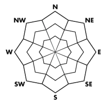
bottom line The danger is MODERATE this morning and may rise with additional snow and wind into the afternoon. The danger will be most pronounced on the mid and upper elevation northwest through north through northeast facing terrain that hold slick crusts and weaker snow below. Remember that traumatic injury from getting caught and carried in an avalanche is most severe early season with the thin snowpack. This advisory will be updated tomorrow morning by 7:30.
|
 |
special announcement Welcome to the new look of the avalanche advisory. This past summer we had a series of meetings and negotiated a unified look-and-feel of the avalanche advisories and web pages for other avalanche centers in this region including Jackson, Wyoming, Sun Valley and the Sierra Avalanche Center. Eventually all these sites should look very similar and the plan is for Colorado to join the look next winter. In another week or two we expect to have two viewing choices for the advisory page--this basic view and the "advanced" view most are familiar with from last season with colored danger ratings in the aspect-elevation diagram. We are still in the process of transferring the pages and content from our old website to the new site, so be patient. We are also tweaking the look and design so you may notice some changes. When everything is finished, it should all be pretty cool. |
 |
current conditions Winter is in full force across the Wasatch with astronomical water numbers over the past 6 hours. Precipitation, beginning as rain, and transitioning to 4-6" of heavy dense snow and graupel, has fallen across the range. These initial densities, roughly measured at 15-20%, are just what we need to build a good foundation and help to cover up the rocks, stumps, and deadfall. Temperatures are currently in the mid 20s though falling fast and models suggest the high alpine temps dropping to the low single digits by Saturday night into Sunday. Winds, of course, are howling - south and southwesterlies blowing 30-40mph with some gusts at 11,000' into the 80s. |
 |
recent activity None. This, of course, won't last long. Click on Detailed Info above and All the Good Stuff to keep up to speed on Observations coming in.... |
| type | aspect/elevation | characteristics |
|---|
 |


Above 8,500 ft.
7,000-8,500 ft.
Below 7,000 ft.
|
|
|
description
New wind drifts will becoming increasingly sensitive and widespread with the onslaught of the new snow and wind. Test slopes will offer a good indication of the sensitivity of the new drifts...though they may become more stubborn and spatially variable with the strong winds. |
| type | aspect/elevation | characteristics |
|---|
 |


Above 8,500 ft.
7,000-8,500 ft.
Below 7,000 ft.
|
|
|
description
While coming in warm, any graupel and new snow is likely to bond poorly to the melt freeze crusts capping the old snow from late October. It may be possible for enough accumulation to catastrophically collapse the pre-existing crusts and release larger, wider avalanches. |
 |
weather Snow and wind should continue in earnest through the day and into the early evening and we may see another foot of heavier snow at this time. The flow shifts to the west and then northwest and becomes light by the late evening after the passage of the cold front. Temps are expected to dive into the high, then low single digits by tomorrow night into Sunday. The cold unstable flow will keep periods of much lower density snow falling through Sunday. Totals are expected in the 2'+ range in favored areas. |