
| During the month of April, Mark Miller will donate $75 to the charity of your choice (5 to chose from, including the Utah Avalanche Center!) Mark Miller Subaru has raised over $300k in the previous 6 Do Good Feel Good events. More Info here |  |
| During the month of April, Mark Miller will donate $75 to the charity of your choice (5 to chose from, including the Utah Avalanche Center!) Mark Miller Subaru has raised over $300k in the previous 6 Do Good Feel Good events. More Info here | |
| Advisory: Moab Area Mountains | Issued by Eric Trenbeath for Thursday - February 20, 2014 - 7:30am |
|---|

|
bottom line There remains a CONSIDERABLE avalanche danger in areas that have recent deposits of wind drifted snow, and in areas where it is possible to trigger a buried, persistent slab. These dangers are primarily found on mid to upper elevation slopes, steeper than 34 degrees, that have a NW-E-SE aspect. At mid elevations, these dangers are more MODERATE or localized, but it is not the time to push slope angles by venturing into steep terrain. At lower elevations, the avalanche danger is generally LOW.
|
 |
special avalanche bulletin
|
 |
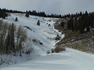
current conditions La Sal Mountains Sensors are reporting that a couple inches of new snow fell before midnight last night. This dusting will likely not improve things much except in areas that still held dry snow, primarily on mid and upper elevation shady aspects. Northwesterly winds overnight averaged 22 mph with gusting in 30's on ridge tops. It is a frigid 2 degrees at 10,000'. Winds and temperature on Pre-Laurel Peak (11,705') Temperature and new snow totals in Gold Basin (10,050') Total snow depth and temperature near Geyser Pass Trailhead (9850') Abajo Mountains Buckboard Flat is reporting 2" of new snow, but low snow conditions still remain in the Abajo Mountains. The snow pack depth averages between 18" and 36", but some sun and wind exposed slopes are showing bare ground. Westerly winds averaged in the teens overnight with gusts to 40 on Abajo Peak. It is 13 degrees at 9000'
Winds and temperature on Abajo Peak (11,330') Snow totals at Camp Jackson (8968') |
| type | aspect/elevation | characteristics |
|---|

|
|
LIKELIHOOD
 LIKELY
UNLIKELY
SIZE
 LARGE
SMALL
TREND
 INCREASING DANGER
SAME
DECREASING DANGER
|
|
description
Steady, westerly winds have continued to deposited wind slabs on upper elevation, leeward slopes. Winds have shifted between SW and NW even swinging to due N at times so be alert to cross loading at upper elevations. Recent deposits are likely on southeasterly aspects. Older slabs have gained strength and will be more difficult to trigger, however, triggering one would be extremely dangerous. They also wield the potential to step down into a buried persistent slab causing a large, and possibly un-survivable avalanche. This danger is most prevalent on upper elevation slopes. steeper than 34 degrees that have a N-E-SE aspect.
|
| type | aspect/elevation | characteristics |
|---|

|

|
LIKELIHOOD
 LIKELY
UNLIKELY
SIZE
 LARGE
SMALL
TREND
 INCREASING DANGER
SAME
DECREASING DANGER
|
|
description
We are in a tenuous balance out there. The underlying snow pack is very weak. Significant amounts of snow fell early in the month, and persistent winds have continued to re-distribute the snow adding straw to the proverbial camel's back. The possibility of triggering a deep, persistent slab is a very real and present danger, and steep, N-E-SE facing terrain at upper mid-upper elevations should still be avoided.
|
 |
weather Remaining mountain clouds this morning will quickly dissipate, and today we will see mostly sunny skies with winter like temperatures. Highs at 10,000' will be in the low to mid 20's. Friday looks to be sunny with a slight warming trend ahead of a weak disturbance slated for Friday night and Saturday. |
| general announcements OBSERVATIONS: If you are out and about in the mountains, I'd love to know what you are seeing so please SUBMIT OBSERVATIONS You can read current OBSERVATIONS HERE. LUNA GROOMING INFORMATION: Grooming equipment is down for repair. ROAD CONDITIONS: Expect to find a dusting of snow on the road. UAC MOBILE APP: Get your advisory on your iphone with this app
|


_2.jpg)

 .
.