| During the month of April, Mark Miller will donate $75 to the charity of your choice (5 to chose from, including the Utah Avalanche Center!) Mark Miller Subaru has raised over $300k in the previous 6 Do Good Feel Good events. More Info here |  |
| During the month of April, Mark Miller will donate $75 to the charity of your choice (5 to chose from, including the Utah Avalanche Center!) Mark Miller Subaru has raised over $300k in the previous 6 Do Good Feel Good events. More Info here | |
| Advisory: Logan Area Mountains | Issued by Toby Weed for Thursday - March 26, 2015 - 7:02am |
|---|


|
bottom line MODERATE (Level 2): Heightened avalanche conditions exist at upper elevations in the backcountry. Rapid solar warming of the fresh snow may cause dangerous conditions, and a Level 3 danger could develop on steep sunny slopes, with natural avalanches entraining significant piles of heavy wet snow possible.
|
 |
special announcement Special thanks to Buttar's of Tremonton and ArcticCat for hooking us up with the light and powerful M8000,
|
 |
current conditions Powder conditions were pretty good at upper elevations yesterday, but heating from the powerful high angled sun damaged the higher density powder on many slopes. The Tony Grove Snotel reported around 18 inches of dense new snow with the Monday/Tuesday storm, containing close to 3 inches of water. There's now 68 inches of total snow containing 81% of average water for the date, and it's currently 28 degrees at the 8400' site. It's 26 degrees at the UDOT Hwy 89 Summit weather station, with diminishing and fairly light northwest wind this morning after moderate northwest winds yesterday and overnight.
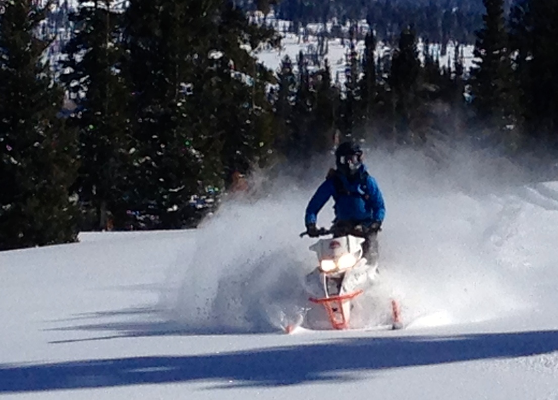
Folks found fairly good powder riding and pow surf conditions at upper elevations in the Bear River Range yesterday. (J Jensen,3-25-2015)
|
 |
recent activity
****Check out our crowd-sourced avalanche information and recent backcountry observations from across the state.........HERE
|
| type | aspect/elevation | characteristics |
|---|

|

|
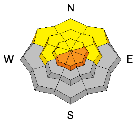
LIKELIHOOD
 LIKELY
UNLIKELY
SIZE
 LARGE
SMALL
TREND
 INCREASING DANGER
SAME
DECREASING DANGER
|
|
description
We found fairly good stability yesterday in the Franklin Basin Area, with the heavy new snow well bonded to the crusty old snow surface. Although rather unlikely, triggered wind slabs 1 to 2 feet deep are possible in some steep drifted terrain. Continue to avoid deposits of drifted snow on slopes steeper than about 30 degrees, and steer clear of the rebuilt ridge-top cornices, which might break further back than expected, and could trigger avalanches on slopes below.
|
| type | aspect/elevation | characteristics |
|---|

|
|
LIKELIHOOD
LIKELY
UNLIKELY
SIZE
LARGE
SMALL
TREND
 INCREASING DANGER
SAME
DECREASING DANGER
|
|
description
The sun will be out in full force today, and it will quickly warm the fresh snow.
|
 |
weather Expect mostly sunny conditions today, with mountain high temperatures in the mid forties at upper elevations and a moderate northwest breeze. Temperatures should drop just below freezing overnight. Looks like another warming trend as we head into the weekend, with some showers becoming possible on Saturday.
|
| general announcements ***Advisories by email for the Logan Zone. Go here for details. Discount lift tickets are now available at Backcountry.com. Thanks to Ski Utah and the Utah Resorts. All proceeds go towards paying for Utah Avalanche Center avalanche and mountain weather advisories. Benefit the Utah Avalanche Center when you shop from Backcountry.com or REI: Click this link for Backcountry.com or this link to REI, shop, and they will donate a percent of your purchase price to the UAC. Both offer free shipping (with some conditions) so this costs you nothing! ***Please submit snow and avalanche observations from your ventures in the backcountry HERE. You can call us at 801-524-5304 or email HERE, or include #utavy in your Instagram or Tweet us @UAClogan. To report avalanche activity in the Logan Area or to contact the local avalanche forecaster call me, Toby, at 435-757-7578. As we're rapidly heading into spring, we'll post these advisories intermittently and as conditions change in the backcountry. This advisory is produced by the U.S.D.A. Forest Service, which is solely responsible for its content. It describes only general avalanche conditions and local variations always exist. |


_1.jpg)