| During the month of April, Mark Miller will donate $75 to the charity of your choice (5 to chose from, including the Utah Avalanche Center!) Mark Miller Subaru has raised over $300k in the previous 6 Do Good Feel Good events. More Info here |  |
| During the month of April, Mark Miller will donate $75 to the charity of your choice (5 to chose from, including the Utah Avalanche Center!) Mark Miller Subaru has raised over $300k in the previous 6 Do Good Feel Good events. More Info here | |
| Advisory: Logan Area Mountains | Issued by Toby Weed for Wednesday - March 4, 2015 - 6:50am |
|---|

|
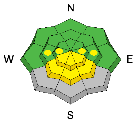
bottom line Heightened avalanche conditions exist in the backcountry, and there's a MODERATE (level 2) danger. Triggered wind slab avalanches are possible on drifted upper and mid-elevation slopes steeper than about 30 degrees. Heightened wet avalanche conditions will develop in sunny terrain with daytime solar warming.
|
 |
special announcement ****Special thanks to Buttar's of Tremonton and ArcticCat for hooking us up with the light and powerful M8000, which is featured in UAC Logan's Practicing Companion Rescue video........HERE
|
 |
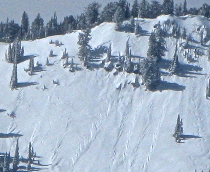
current conditions You'll find nice shallow powder riding conditions across the zone, with deeper new snow up high and on north and east facing slopes. Heightened avalanche conditions exist on drifted slopes and will develop in sunny terrain today. The Tony Grove Snotel picked up about a foot of new snow and 0.9" of water in the last 48 hours. There's 80 inches of total snow containing 95% of average water for the date, and it's 12 degrees at 8400 feet. It's 14 degrees at the UDOT Hwy 89 Logan Summit weather station, with a constant northwest breeze and wind speeds in the teens, with gusts in the twenties overnight.
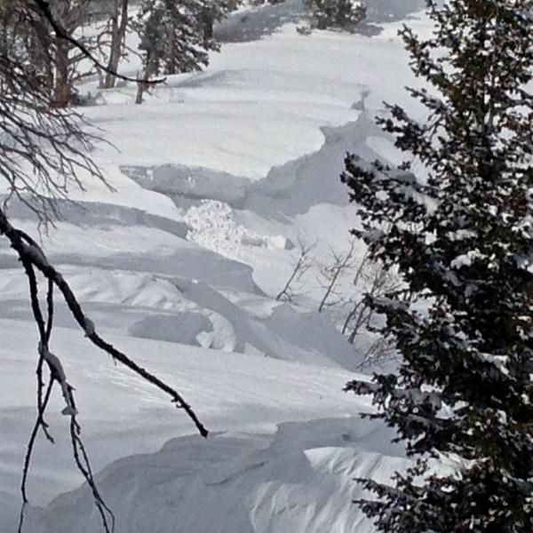
Significant drifting occurred in some areas ,like the Beaver Mountain saddle where I found 3' deep drifts of fresh snow. 3-3-2015
|
 |
recent activity Natural storm snow avalanches were common at upper elevations in the backcountry during a period of heavy snowfall yesterday morning, but no one reported triggering anything. Fresh shallow storm slab releases visible from a distance in Hells Kitchen from across Franklin Basin. 3-3-2015 ***Visit our Backcountry Observations Page for more local information and from across the state.
|
| type | aspect/elevation | characteristics |
|---|

|
|
LIKELIHOOD
 LIKELY
UNLIKELY
SIZE
 LARGE
SMALL
TREND
 INCREASING DANGER
SAME
DECREASING DANGER
|
|
description
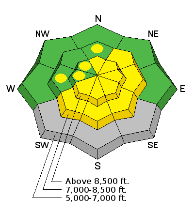
Triggered wind slab avalanches 1 to 2 feet deep are possible in drifted upper and mid-elevation terrain today. Avoid freshly built cornices and wind deposited snow on the lee side of ridges, in and around terrain features like gullies and cliff bands, and areas where snow is vertically cross-loaded near sub-ridges, roll-overs, or scoops lower on the slope.
|
| type | aspect/elevation | characteristics |
|---|

|
|
LIKELIHOOD
LIKELY
UNLIKELY
SIZE
LARGE
SMALL
TREND
 INCREASING DANGER
SAME
DECREASING DANGER
|
|
description
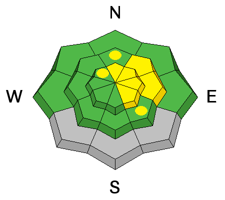
Even though air temperatures should stay fairly cold, solar warming may be intense in some areas. Sun-warmed fresh snow is likely to become active, with loose avalanches entraining significant moist snow possible on many steep sunny slopes. Avoid midday travel on or below steep sunny slopes, and keep in mind that roller balls and/or observed natural loose avalanches indicate significant potential for further avalanching while the snow is still initially warm.
|
 |
weather There's a chance for some continuing snow showers this morning, but it'll be mostly sunny with a high temperature at 8500' around 21 degrees and a continuing northwest breeze. It'll be mostly clear tonight with a low temperature around 11 degrees and moderate west winds. Looks like fair weather tomorrow, with high temperatures around 31 degrees and a westerly breeze. Looks like a ridge of high pressure will dominate the weather pattern for a while, with warming temperatures and fair weather expected in the mountains heading into and through the weekend. ***Check out our one-stop weather page........HERE
|
| general announcements ***Advisories by email for the Logan Zone. Go here for details. *** Utah Avalanche Center mobile app Discount lift tickets are now available at Backcountry.com. Thanks to Ski Utah and the Utah Resorts. All proceeds go towards paying for Utah Avalanche Center avalanche and mountain weather advisories. Benefit the Utah Avalanche Center when you shop from Backcountry.com or REI: Click this link for Backcountry.com or this link to REI, shop, and they will donate a percent of your purchase price to the UAC. Both offer free shipping (with some conditions) so this costs you nothing! ***Please submit snow and avalanche observations from your ventures in the backcountry HERE. You can call us at 801-524-5304 or email HERE, or include #utavy in your Instagram or Tweet us @UAClogan. To report avalanche activity in the Logan Area or to contact the local avalanche forecaster call me, Toby, at 435-757-7578. I'll regularly update this advisory on Monday, Wednesday, Friday, and Saturday mornings by about 7:30. This advisory is produced by the U.S.D.A. Forest Service, which is solely responsible for its content. It describes only general avalanche conditions and local variations always exist. |


_1.jpg)