| During the month of April, Mark Miller will donate $75 to the charity of your choice (5 to chose from, including the Utah Avalanche Center!) Mark Miller Subaru has raised over $300k in the previous 6 Do Good Feel Good events. More Info here |  |
| During the month of April, Mark Miller will donate $75 to the charity of your choice (5 to chose from, including the Utah Avalanche Center!) Mark Miller Subaru has raised over $300k in the previous 6 Do Good Feel Good events. More Info here | |
| Advisory: Logan Area Mountains | Issued by Toby Weed for Monday - March 2, 2015 - 6:58am |
|---|


|
bottom line You'll find generally stable snow conditions, and a LOW (Level 1) avalanche danger in the backcountry. Pockets of heightened wind slab avalanche conditions linger on some drifted upper elevation slopes. Accumulating snow could cause a rising danger of storm snow avalanches overnight and tomorrow.
|
 |
special announcement ****Special thanks to Buttar's of Tremonton and ArcticCat for hooking us up with the light and powerful M8000, which is featured in UAC Logan's Practicing Companion Rescue video........HERE
|
 |
current conditions The Tony Grove Snotel reports 68 inches of total snow containing 92% of average water for the date. It's 22 degrees at the UDOT Hwy 89 Logan Summit weather station, with gradually increasing south-southeast winds overnight. There's some nice shallow powder in sheltered north facing terrain, but it's still more like dust-on-crust in most places. Under a skiff of re-crystallized powder, the snow is rock hard and slick at lower elevations and also on many wind scoured or sunny slopes. I recommend crampons and an ice ax for mountaineering objectives these days, and backcountry riders risk sliding falls and loss of control in some areas given the current hard snow conditions.
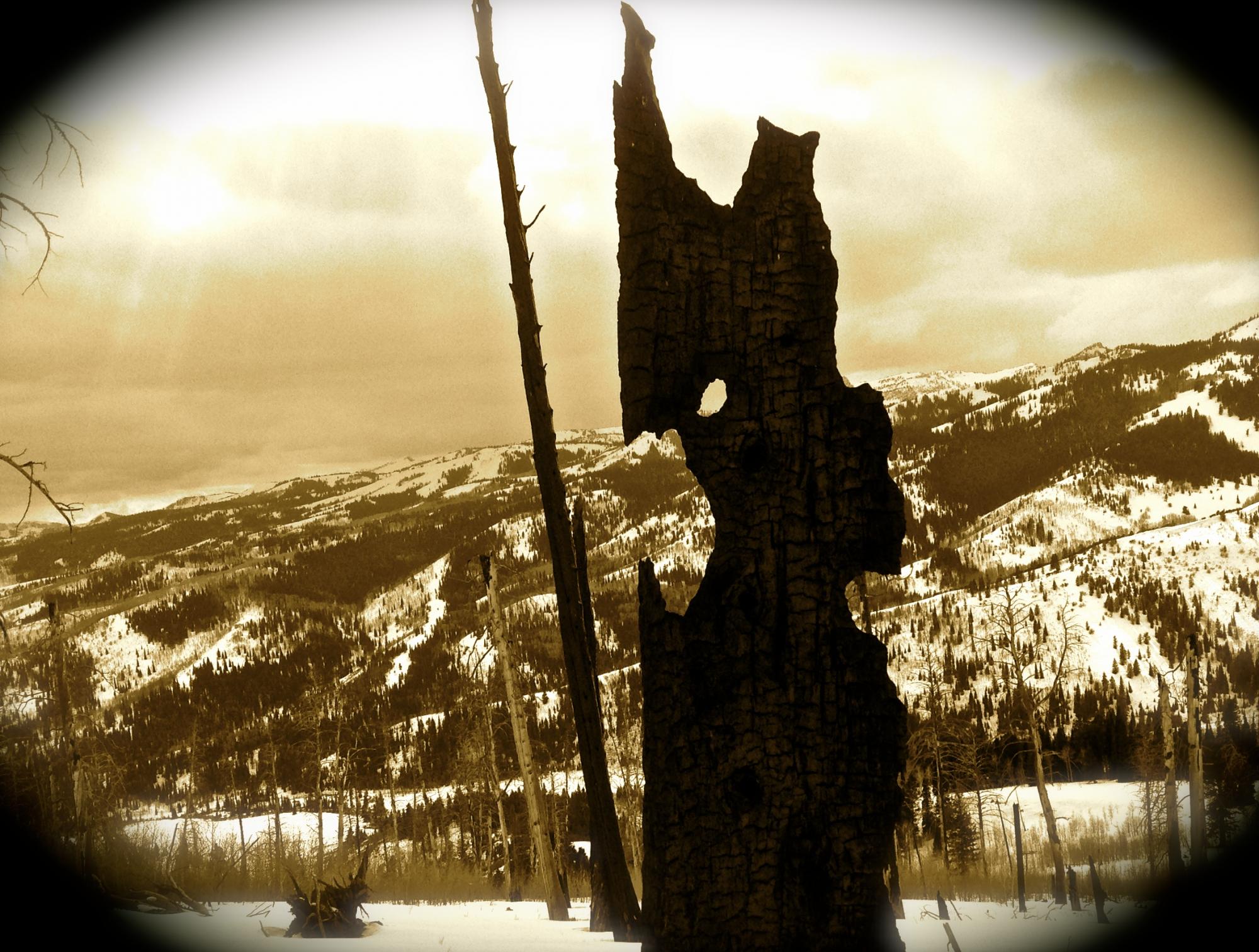
A gargoyle of drought, a remnant stump of the 1994 Beaver Fire leering over the Bear River Range. 3-1-2015
|
 |
recent activity No avalanches were reported locally since the first week of February, but I've noticed some small natural wind slab releases in obviously drifted areas.
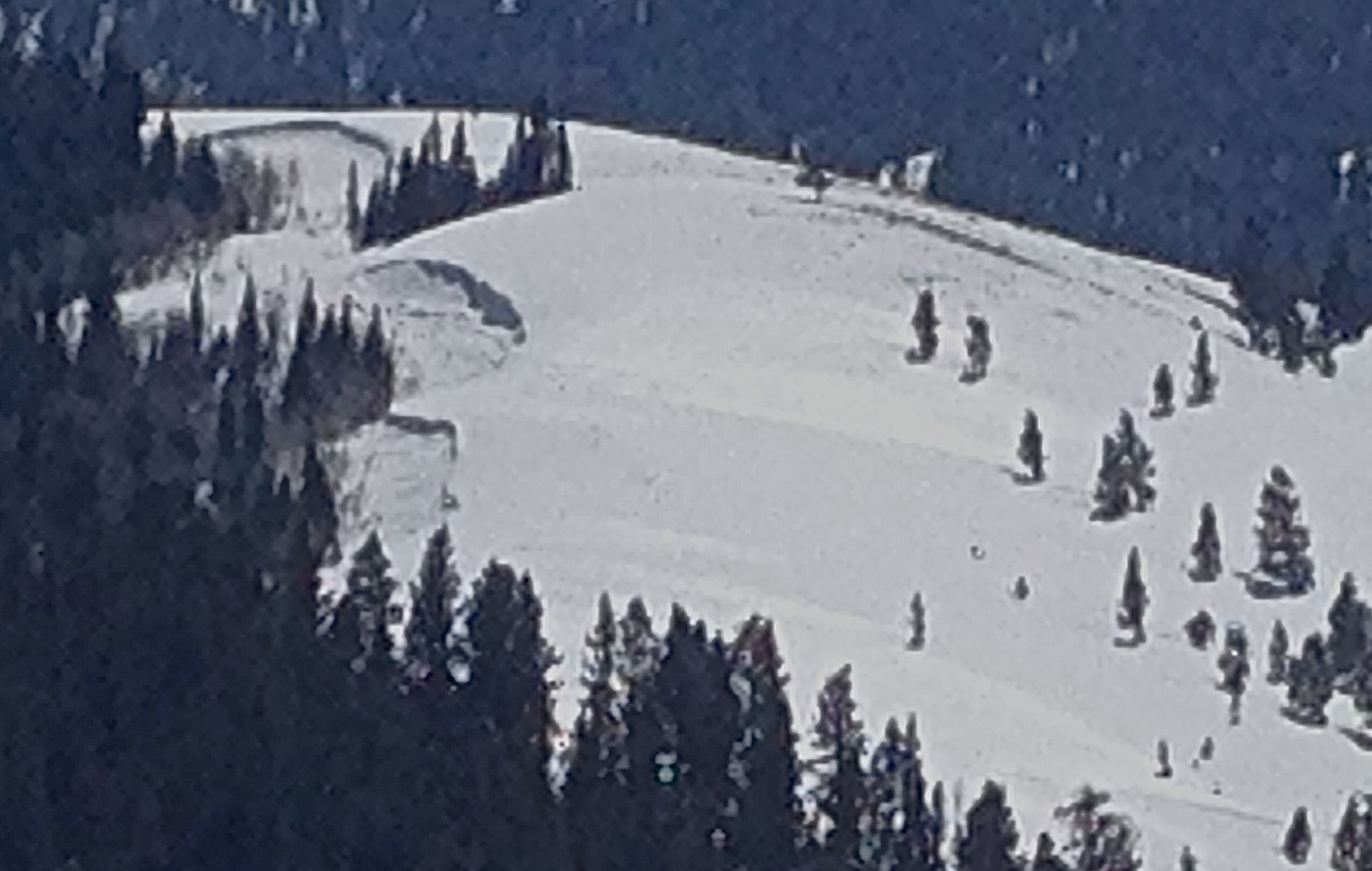
Small wind slab release visible from a distance on an obviously drifted slope in Amazon Basin. 3-1-2015 ***Visit our Backcountry Observations Page for more local information and from across the state.
|
| type | aspect/elevation | characteristics |
|---|

|
|
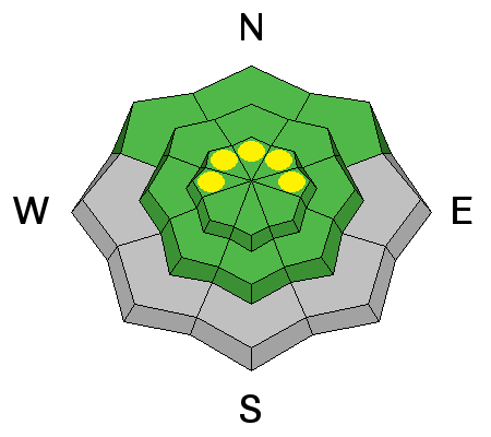
LIKELIHOOD
 LIKELY
UNLIKELY
SIZE
 LARGE
SMALL
TREND
 INCREASING DANGER
SAME
DECREASING DANGER
|
|
description
Shallow triggered wind slab avalanches are possible on some drifted upper elevation slopes. Avoid wind deposited snow on the lee side of ridges, in and around terrain features like gullies and cliff bands, and areas where snow is vertically cross-loaded near sub-ridges, roll-overs, or scoops lower on the slope.
|
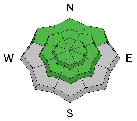
| type | aspect/elevation | characteristics |
|---|

|
|
LIKELIHOOD
 LIKELY
UNLIKELY
SIZE
LARGE
SMALL
TREND
INCREASING DANGER
SAME
DECREASING DANGER
|
description
|
 |
weather It'll be mostly cloudy today, with gradually increasing southeast winds, a high around 27 degrees, and a good chance for a little snow, with 1 to 2 inches possible by evening. Snow is likely tonight, with low temperatures around 13 degrees, northwest wind, and 3 to 7 inches of accumulation possible. Snow showers should continue tomorrow, with a high of around 18 degrees, stronger and sustained northwest wind, and 3 to 7 inches possible. Expect clearing for the latter half of the week. ***Check out our one-stop weather page........HERE
|
| general announcements ***Advisories by email for the Logan Zone. Go here for details. *** Utah Avalanche Center mobile app Discount lift tickets are now available at Backcountry.com. Thanks to Ski Utah and the Utah Resorts. All proceeds go towards paying for Utah Avalanche Center avalanche and mountain weather advisories. Benefit the Utah Avalanche Center when you shop from Backcountry.com or REI: Click this link for Backcountry.com or this link to REI, shop, and they will donate a percent of your purchase price to the UAC. Both offer free shipping (with some conditions) so this costs you nothing! ***Please submit snow and avalanche observations from your ventures in the backcountry HERE. You can call us at 801-524-5304 or email HERE, or include #utavy in your Instagram or Tweet us @UAClogan. To report avalanche activity in the Logan Area or to contact the local avalanche forecaster call me, Toby, at 435-757-7578. I'll regularly update this advisory on Monday, Wednesday, Friday, and Saturday mornings by about 7:30. This advisory is produced by the U.S.D.A. Forest Service, which is solely responsible for its content. It describes only general avalanche conditions and local variations always exist. |


_1.jpg)