| During the month of April, Mark Miller will donate $75 to the charity of your choice (5 to chose from, including the Utah Avalanche Center!) Mark Miller Subaru has raised over $300k in the previous 6 Do Good Feel Good events. More Info here |  |
| During the month of April, Mark Miller will donate $75 to the charity of your choice (5 to chose from, including the Utah Avalanche Center!) Mark Miller Subaru has raised over $300k in the previous 6 Do Good Feel Good events. More Info here | |
| Advisory: Logan Area Mountains | Issued by Toby Weed for Saturday - February 28, 2015 - 6:59am |
|---|

|
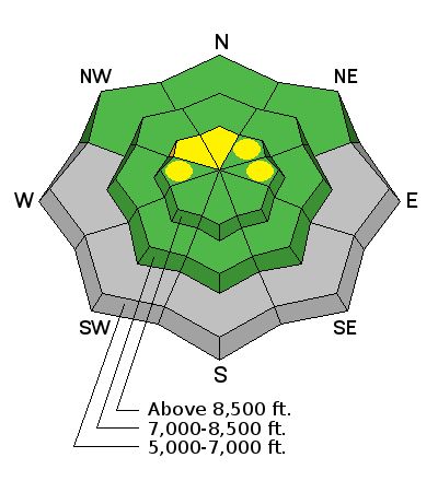
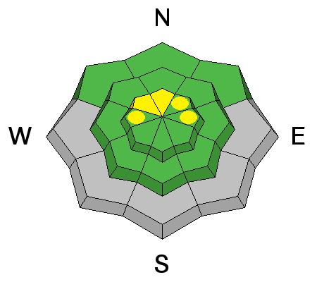
bottom line You'll find nice shallow powder, stable snow conditions, and a LOW (Level 1) avalanche danger in the backcountry this morning. Increasing east winds and drifting snow will create heightened avalanche conditions and a MODERATE (Level 2) danger on some drifted slopes at upper elevations later today.
|
 |
special announcement ****Special thanks to Buttar's of Tremonton and ArcticCat for hooking us up with the light and powerful M8000, which is featured in UAC Logan's Practicing Companion Rescue video........HERE
|
 |
current conditions The Tony Grove Snotel reports a couple more inches of very light new snow in the last 24 hours. There's 70 inches of total snow containing 94% of average water for the date, and it's 17 degrees at 8400'. The UDOT Hwy 89 Logan Summit weather station also reports a little light new snow, 19 degrees, and gradually increasing southeast winds overnight. There's some nice shallow powder in sheltered north facing terrain, but it's still more like dust-on-crust in most places. The snow is rock hard and slick at lower elevations and also on many slopes where last weekend's snow has been scoured off by winds. Don't be fooled by a couple inches of light powder up high, backcountry riders risk sliding falls and loss of control in these hard snow conditions.
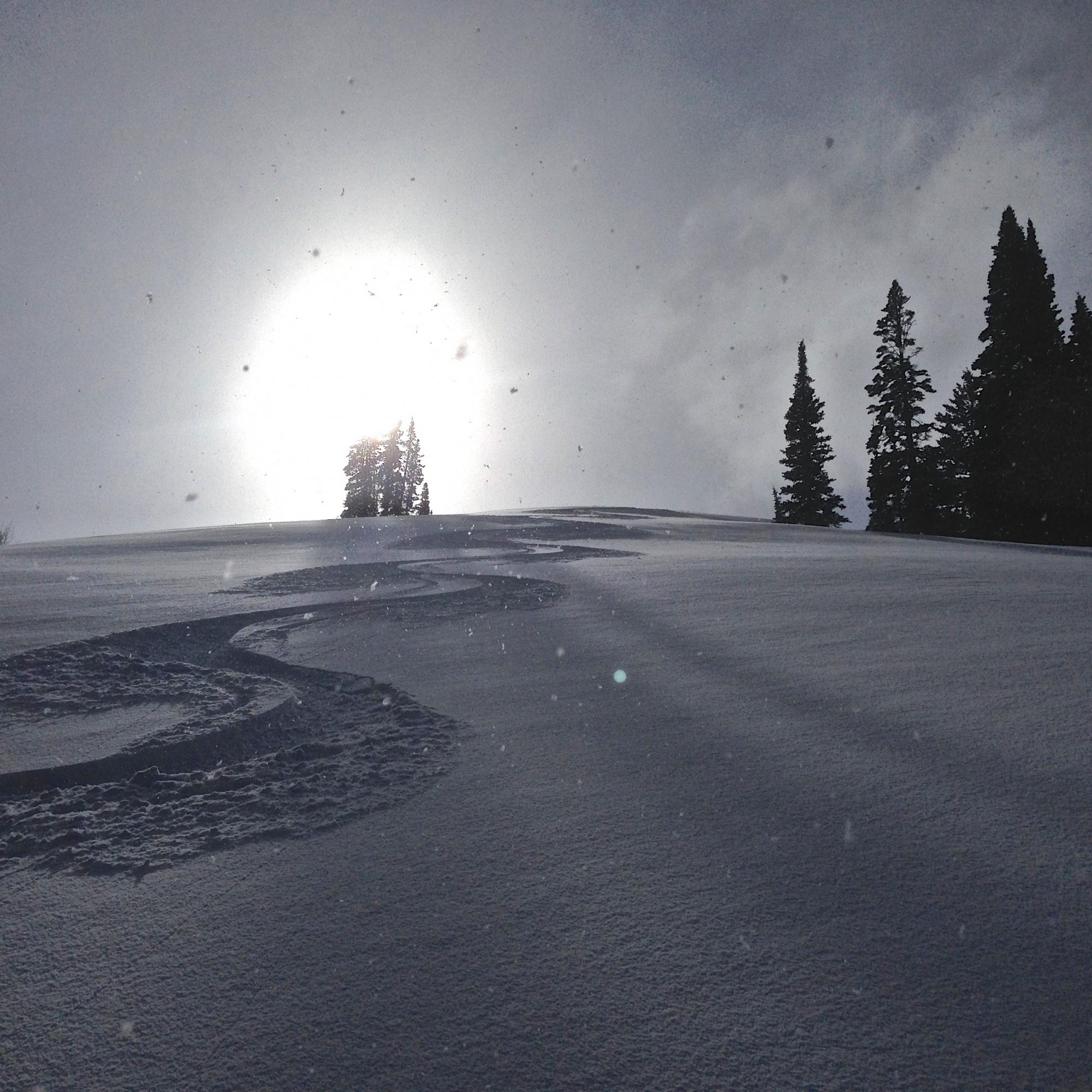
Even just a little bit of snow helps. Sun and snow made for fine shallow powder conditions in White Pine Canyon yesterday. 2-26-2015
|
 |
recent activity No avalanches were reported locally since the first week of February, but I've noticed some small natural wind slabs at upper elevations and wet sluffs on sunny slopes that are more recent. ***Visit our Backcountry Observations Page for more local information and from across the state.
|
| type | aspect/elevation | characteristics |
|---|

|
|
LIKELIHOOD
 LIKELY
UNLIKELY
SIZE
 LARGE
SMALL
TREND
 INCREASING DANGER
SAME
DECREASING DANGER
|
|
description
Increasing easterly winds during the day will find plenty of light snow on the surface to blow around, and heightened avalanche conditions will likely develop on steep slopes in drifted terrain. Shallow triggered wind slab avalanches will likely become possible later today on some upper elevation slopes. Avoid wind deposited snow on the lee side of ridges, in and around terrain features like gullies and cliff bands, and areas where snow is vertically cross-loaded near sub-ridges, roll-overs, or scoops lower on the slope.
|
| type | aspect/elevation | characteristics |
|---|

|
|
LIKELIHOOD
 LIKELY
UNLIKELY
SIZE
LARGE
SMALL
TREND
INCREASING DANGER
SAME
DECREASING DANGER
|
|
description
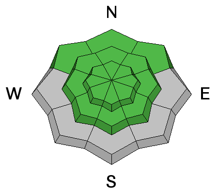
Perhaps of more concern than avalanches these days is the potential for sliding falls and loss of control on slick, rock-hard snow at lower elevations and underlying a dusting of light powder on many slopes up higher. Continue to stay in the habit of using safe travel protocols, and practice companion rescue techniques with your riding partners.
|
 |
weather It'll be mostly cloudy today, with moderate and gradually increasing east winds, a high around 25 degrees, and a 30% chance for a little snow. It'll be mostly cloudy tonight, with a chance for a little more snow, low temperatures around 8 degrees and sustained east winds, gusting near 40 mph. The weather pattern looks active through the weekend, but most of the energy looks to be heading south. Snow showers linger in the forecast through Tuesday, with a few inches of accumulation possible then... Looks like fair weather will develop over the region midweek. ***Check out our one-stop weather page........HERE
|
| general announcements ***Advisories by email for the Logan Zone. Go here for details. *** Utah Avalanche Center mobile app Discount lift tickets are now available at Backcountry.com. Thanks to Ski Utah and the Utah Resorts. All proceeds go towards paying for Utah Avalanche Center avalanche and mountain weather advisories. Benefit the Utah Avalanche Center when you shop from Backcountry.com or REI: Click this link for Backcountry.com or this link to REI, shop, and they will donate a percent of your purchase price to the UAC. Both offer free shipping (with some conditions) so this costs you nothing! ***Please submit snow and avalanche observations from your ventures in the backcountry HERE. You can call us at 801-524-5304 or email HERE, or include #utavy in your Instagram or Tweet us @UAClogan. To report avalanche activity in the Logan Area or to contact the local avalanche forecaster call me, Toby, at 435-757-7578. I'll regularly update this advisory on Monday, Wednesday, Friday, and Saturday mornings by about 7:30. This advisory is produced by the U.S.D.A. Forest Service, which is solely responsible for its content. It describes only general avalanche conditions and local variations always exist. |


_1.jpg)