| During the month of April, Mark Miller will donate $75 to the charity of your choice (5 to chose from, including the Utah Avalanche Center!) Mark Miller Subaru has raised over $300k in the previous 6 Do Good Feel Good events. More Info here |  |
| During the month of April, Mark Miller will donate $75 to the charity of your choice (5 to chose from, including the Utah Avalanche Center!) Mark Miller Subaru has raised over $300k in the previous 6 Do Good Feel Good events. More Info here | |
| Advisory: Logan Area Mountains | Issued by Toby Weed for Friday - January 16, 2015 - 6:33am |
|---|

|
bottom line Stable snow conditions exist on most slopes, and the overall danger is LOW (level 1). Increasing southwest wind today will create heightened conditions and a MODERATE (level 2) danger, with triggered wind slab avalanches possible on drifted upper elevation slopes.
|
 |
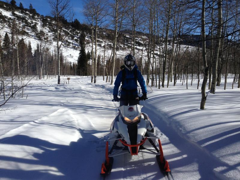
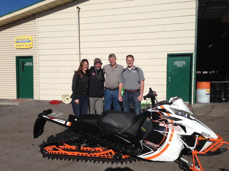
special announcement Special thanks to Buttar's and ArcticCat for hooking us up with the light and powerful M8000. This machine will make our field days more fun, safe, and productive and will significantly boost our outreach and education efforts.
We picked up and tried out the new sled last week. The sled in action included in our new Practicing Companion Rescue video.........HERE
|
 |
current conditions The 8400' Tony Grove Snotel reports 57 inches of total snow containing 116% of average water for the date, and its 26 degrees this morning. You can find pretty nice shallow settled powder and dust-on-crust riding conditions in the Central Bear River Range these days. The snow is supportable in most areas and you can ride anywhere without sinking in very deeply. A bit more snow fell in the front canyons earlier in the week, but If you're looking for deeper powder conditions, the Wasatch and Unitas picked up twice as much.
|
 |
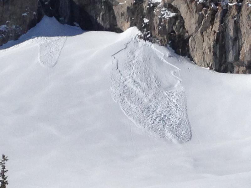
recent activity We noticed a couple fresh natural wind slabs and some fresh loose wet activity at upper elevations in the Tony Grove Area on Wednesday(1-14-15).
A fresh wind slab under the cliffs on the east side of Naomi Peak. (1-14-15) Visit our Backcountry Observations Page for more information.....
|
| type | aspect/elevation | characteristics |
|---|

|

|
LIKELIHOOD
 LIKELY
UNLIKELY
SIZE
 LARGE
SMALL
TREND
 INCREASING DANGER
SAME
DECREASING DANGER
|
|
description
Triggered wind slab avalanches are possible on drifted upper elevation slopes, and increasing southwest wind will build new drifts and wind slabs at upper elevations today. Watch for and avoid wind slabs in exposed terrain at high elevations in and around terrain features like gullies, sub-ridges, and cliff bands. Drifts and wind slabs should be fairly obvious, consisting of stiffer snow, rounded, chalky looking, and perhaps hollow sounding, but an inch or two of new snow today could make them a bit less easy to see. |
 |
weather It'll be mostly cloudy today, with west-southwest winds averaging in the mid teens, a high temperature at 8500' around 34 degrees, and an inch or two of accumulation the afternoon.. Overnight low temperatures are expected to be around 21 degrees. winds will be from the west-northwest, and a couple more inches of snow might fall. Looks like it'll be partly sunny and fairly warm in the mountains tomorrow. Check out our one-stop weather page........HERE
|
| general announcements You can now receive advisories by email for each region in the state including Logan. Go here for details. Get your advisory on your iPhone along with great navigation and rescue tools....... Utah Avalanche Center mobile app Please submit snow and avalanche observations from your ventures in the backcountry HERE. You can call us at 801-524-5304 or email HERE, or include #utavy in your Instagram or Tweet us @UAClogan. To report avalanche activity in the Logan Area or to contact the local avalanche forecaster call me, Toby, at 435-757-7578. I'll regularly update this advisory on Monday, Wednesday, Friday, and Saturday mornings by about 7:30. This advisory is produced by the U.S.D.A. Forest Service, which is solely responsible for its content. It describes only general avalanche conditions and local variations always exist. |


_1.jpg)