| During the month of April, Mark Miller will donate $75 to the charity of your choice (5 to chose from, including the Utah Avalanche Center!) Mark Miller Subaru has raised over $300k in the previous 6 Do Good Feel Good events. More Info here |  |
| During the month of April, Mark Miller will donate $75 to the charity of your choice (5 to chose from, including the Utah Avalanche Center!) Mark Miller Subaru has raised over $300k in the previous 6 Do Good Feel Good events. More Info here | |
| Advisory: Logan Area Mountains | Issued by Toby Weed for Tuesday - January 6, 2015 - 6:52am |
|---|

|
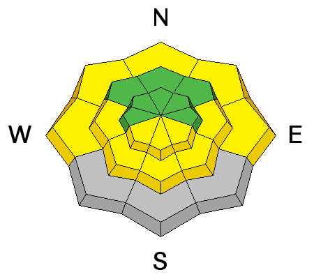
bottom line There's a MODERATE (level 2) danger in the backcountry. Heightened avalanche conditions exist on drifted slopes, and wind slab avalanches are possible. Warming temperatures will create a rising danger of wet avalanches on steep slopes with saturated snow.
|
 |
special announcement We will offer an Avalanche Awareness Class, for beginners and as a refresher for those already with some training, including a Field Day in the backcountry. Class begins on January 8 (evening) and all day Saturday January 10. Call Paige at 435-757-2794 for more information. |
 |
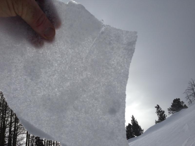
current conditions The 8400' Tony Grove Snotel indicates the occurrence of a rime event. We picked up 0.7" of water in the past 24 hours and maybe only 1 inch of snow. The station reports 58 inches of total snow containing 136% of average water for the date, and its already 30 degrees this morning. The wind sensor is still rimed at the CSI Logan Peak weather station, but it's 27 degrees at 9700'. The wind sensor on Mt. Ogden reports diminished winds from the west overnight, after recording high wind speeds in the 50 to 60 mph range all day yesterday. I found wind and warmth damaged snow, and a nice translucent zipper rime-crust up high in the White Pine-Steam Mill Area in very windy and mild weather yesterday.
I found a thin translucent zipper rime-crust on the snow surface at upper elevations yesterday. (1-5-2015) ****Observational and snowpit video from Burn Bowl on 1-5-2014....HERE
|
 |
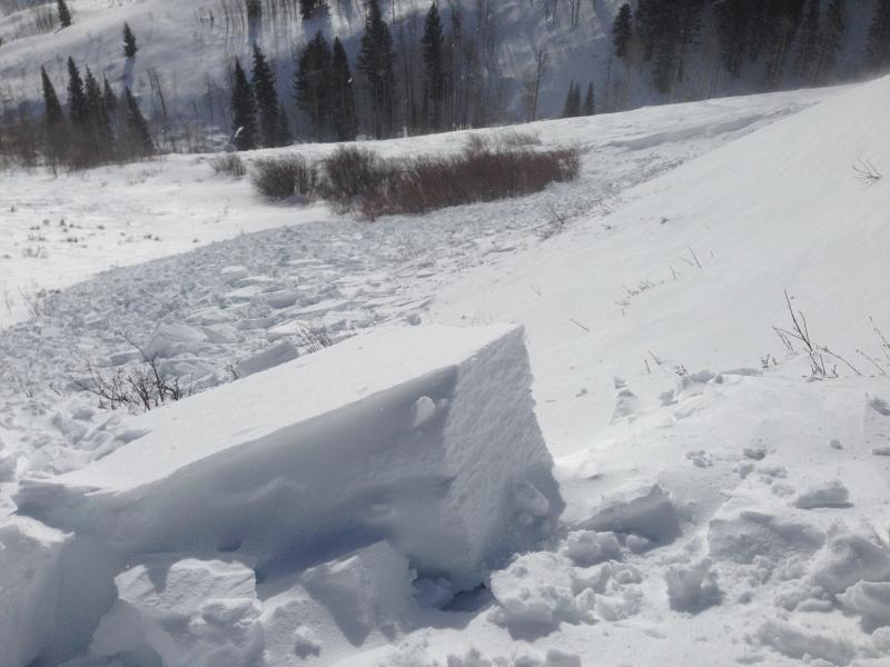
recent activity I ran across a fresh natural wind slab avalanche, which looked to have occurred in the morning (1-5-2015). The 1-foot deep and 100 feet wide avalanche occurred on a heavily drifted mid-elevation southeast facing slope. *****1-5-15 Wind Slab Avalanche Video Observation.......HERE
Visit our Backcountry Observations Page for more information.....
Chunky debris from a fresh natural wind slab at around 7400' on a southeast facing sub-ridge. (1-5-2015)
|
| type | aspect/elevation | characteristics |
|---|

|
|
LIKELIHOOD
 LIKELY
UNLIKELY
SIZE
 LARGE
SMALL
TREND
 INCREASING DANGER
SAME
DECREASING DANGER
|
|
description
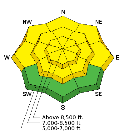
Watch for fresh wind slabs formed by recent sustained and strong west winds Wind slabs may be lurking on the lee side of ridge-lines and in and around terrain features like gullies, scoops, cliff-bands, and sub-ridges. The fresh drifts should still be fairly obvious. Wind deposits often appear rounded, patterned, chalky looking, and they may be hollow sounding. Dangerous persistent slab avalanches are rather unlikely, but they remain possible in outlying terrain facing the northern half of the compass, and on drifted slopes steeper than about 30 degrees. Steep rocky slopes at mid and upper elevations that had shallow snow cover in December and now with fresh wind deposits are the most suspect. Warming temperatures in the next couple days could soften the overlying slab in some cases allowing for easier triggering....
|
| type | aspect/elevation | characteristics |
|---|

|
|
LIKELIHOOD
LIKELY
UNLIKELY
SIZE
LARGE
SMALL
TREND
 INCREASING DANGER
SAME
DECREASING DANGER
|
|
description
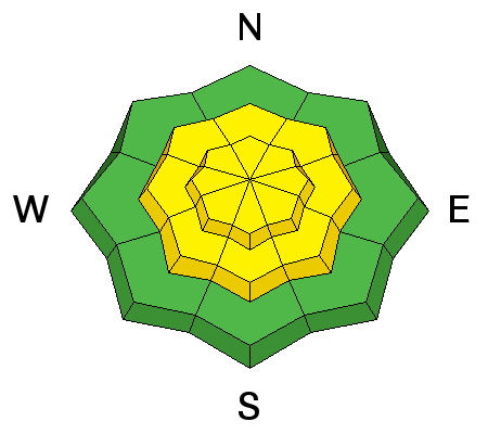
Warming temperatures will create heightened wet avalanche conditions on slopes with saturated surface snow. Loose wet avalanches will become more likely during the heat of midday, especially on sunny sheltered slopes.
|
 |
weather It'll be partly sunny and mild in the mountains today, with moderate west wind and 8500' high temperatures approaching 40 degrees. It'll be partly cloudy tonight, with moderate northwest winds, and a low around 26 degrees. We'll see further warming temperatures and mostly sunny skies tomorrow, with mountain temperatures well up in the mid 40's! Check out our one-stop weather page........HERE
|
| general announcements You can now receive advisories by email for each region in the state including Logan. Go here for details. Get your advisory on your iPhone along with great navigation and rescue tools....... Utah Avalanche Center mobile app Please submit snow and avalanche observations from your ventures in the backcountry HERE. You can call us at 801-524-5304 or email HERE, or include #utavy in your Instagram or Tweet us @UAClogan. To report avalanche activity in the Logan Area or to contact the local avalanche forecaster call me, Toby, at 435-757-7578. I'll regularly update this advisory on Monday, Wednesday, Friday, and Saturday mornings by about 7:30. This advisory is produced by the U.S.D.A. Forest Service, which is solely responsible for its content. It describes only general avalanche conditions and local variations always exist. |


_1.jpg)