| During the month of April, Mark Miller will donate $75 to the charity of your choice (5 to chose from, including the Utah Avalanche Center!) Mark Miller Subaru has raised over $300k in the previous 6 Do Good Feel Good events. More Info here |  |
| During the month of April, Mark Miller will donate $75 to the charity of your choice (5 to chose from, including the Utah Avalanche Center!) Mark Miller Subaru has raised over $300k in the previous 6 Do Good Feel Good events. More Info here | |
| Advisory: Logan Area Mountains | Issued by Toby Weed for Monday - January 5, 2015 - 7:25am |
|---|

|
bottom line There's a MODERATE (level 2) danger in the backcountry. Heightened avalanche conditions exist on drifted slopes, and triggered wind slab avalanches are possible.
|
 |
special announcement We will offer an Avalanche Awareness Class, for beginners and as a refresher for those already with some training, including a Field Day in the backcountry. Class begins on January 8 (evening) and all day Saturday January 10. Call Paige at 435-757-2794 for more information. |
 |
current conditions Looks like the 8400' Tony Grove Snotel picked up a little snow overnight. The station reports 58 inches of total snow containing 133% of average water for the date, and its 26 degrees this morning. The wind sensor is still rimed at the CSI Logan Peak weather station, but it's 20 degrees. The wind sensor on Mt. Ogden reports strong winds from the west this morning, and is recording wind speeds in excess of 50 mph. You can still find nice settled powder conditions in mid-elevation sheltered terrain, and it appears that there's less wind damage in the central part of the Bear River Range. West slope canyon were hammered pretty hard by last week's strong east wind.
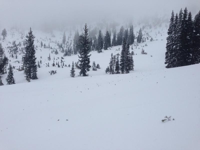
Fir tips and branches litter the snow in the Mount Naomi Wilderness after strong east winds last week. (1-3-2015) ****Watch Cold East Wind video observation from 12-30-2014............HERE
|
 |
recent activity Looks like there were a few natural avalanches with last week's strong east wind event. The wind slab avalanches occurred in areas impacted by significant drifting, and we could see evidence of recent activity on upper elevation slopes of different aspects. No larger or more notable avalanches were reported since the Solstice natural cycle and a sizable triggered avalanche in the Rodeo Grounds just before Christmas. Visit our Backcountry Observations Page for more information.....
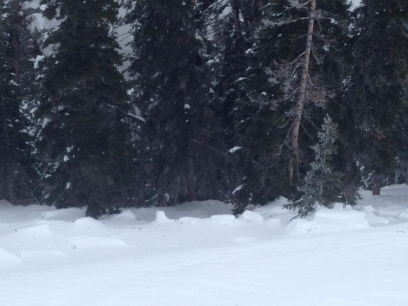
Chunky debris from a recent natural wind slab at around 8500' on a north facing sub-ridge. (1-3-2015)
|
| type | aspect/elevation | characteristics |
|---|

|
|
LIKELIHOOD
 LIKELY
UNLIKELY
SIZE
 LARGE
SMALL
TREND
 INCREASING DANGER
SAME
DECREASING DANGER
|
|
description
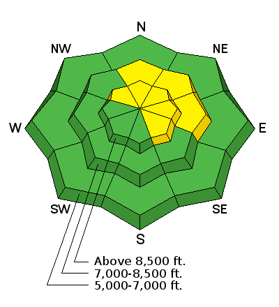
Watch for fresh wind slabs formed by recent sustained and strong west winds Wind slabs may be lurking on the lee side of ridge-lines and in and around terrain features like gullies, scoops, cliff-bands, and sub-ridges. A couple inches of fresh snow may be hiding some of the clues, but the drifts should still be fairly obvious. Wind deposits often appear rounded, patterned, chalky looking, and they may be hollow sounding.
|
| type | aspect/elevation | characteristics |
|---|

|
|
LIKELIHOOD
 LIKELY
UNLIKELY
SIZE
 LARGE
SMALL
TREND
 INCREASING DANGER
SAME
DECREASING DANGER
|
|
description
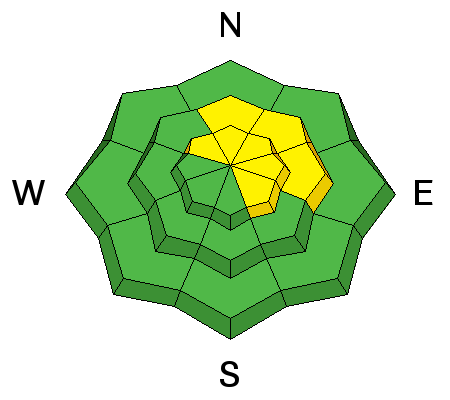
Dangerous persistent slab avalanches are rather unlikely, but they remain possible in outlying terrain facing the northern half of the compass, and on drifted slopes steeper than about 30 degrees. Steep rocky slopes at mid and upper elevations that had shallow snow cover in December and now with fresh wind deposits are the most suspect. *****Video observation from Franklin Basin in the Beaver Mountain Backcountry from 12-31-2014...........HERE
|
 |
weather It'll be cloudy and mild today, with some snowfall likely and 1 to 3 inches of additional accumulation possible. Temperatures at 8500' will climb above freezing, and we can expect breezy west winds on the ridges. It'll be mostly cloudy tonight, with diminishing southwest winds, a good chance for continued snow showers, and a low around 24 degrees. We'll see warming temperatures and partly sunny skies tomorrow, with mountain temperatures up in the 40's! Check out our one-stop weather page........HERE
|
| general announcements You can now receive advisories by email for each region in the state including Logan. Go here for details. Get your advisory on your iPhone along with great navigation and rescue tools....... Utah Avalanche Center mobile app Please submit snow and avalanche observations from your ventures in the backcountry HERE. You can call us at 801-524-5304 or email HERE, or include #utavy in your Instagram or Tweet us @UAClogan. To report avalanche activity in the Logan Area or to contact the local avalanche forecaster call me, Toby, at 435-757-7578. I'll regularly update this advisory on Monday, Wednesday, Friday, and Saturday mornings by about 7:30. This advisory is produced by the U.S.D.A. Forest Service, which is solely responsible for its content. It describes only general avalanche conditions and local variations always exist. |


_1.jpg)